Amazon Hollow Ski/Snowshoe, 28 January, 2018
Meeting at 10 a.m., 13 hikers came out for the Amazon Ski/Snowshoe activity. Teresa, Dave W., Dave P. and Laurel were on skis and Susan, Kathy, Clay, Wendy, Renee, Chris, Maggie, Jane and Dan, the leader, used snowshoes. The roads were good as we drove up Logan Canyon on US-89. Dave W. left his car at Amazon Hollow, our ending point. Everyone continued another mile to the UDOT sheds, arriving about 11 a.m. to warm and windy conditions.
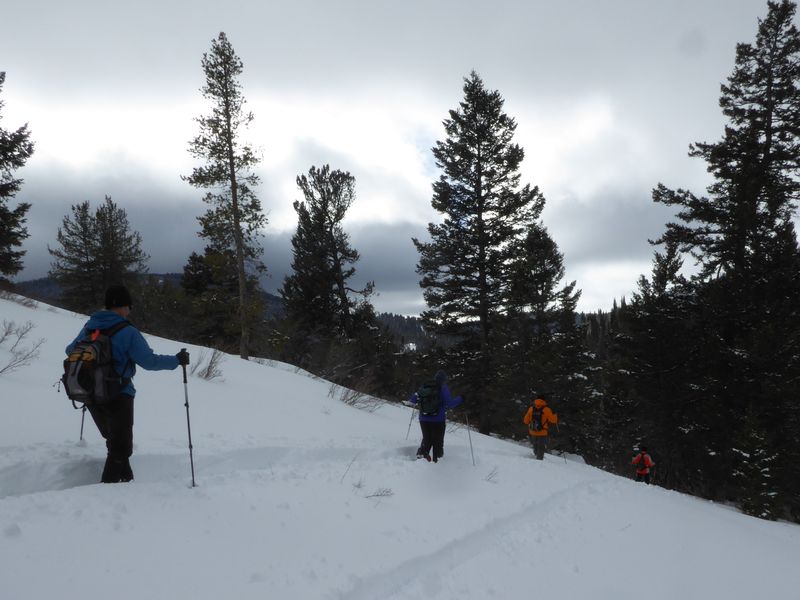
The group spread out as we made a difficulty climb up from the UDOT sheds through untracked snow. One of the participants experienced gear trouble part way up the hill. Laurel skied back down to our vehicles to retrieve a spare pair of snowshoes while others waited in the shelter of some trees, sipping coffee and taking a snack break.
About 12 noon everyone met on the windy ridge east of North Fork Amazon Hollow, just in time for a short sun break. We continued northward up the ridge, past the sinkhole to a sheltered lunch spot in the trees. We resumed our trek about 1:00 p.m., contouring toward the northwest before heading steeply down the heavy soft snow through open meadows and scattered trees to the bottom of the hollow.
Abandoning our original plan to climb the ridge to the northwest, we regrouped and turned south, following previously tracked snow along the bottom of the hollow until we reached our car on US-89. Most of the group waited here while the drivers went up to fetch the other cars. We drove down the canyon returning to Logan about 3:30 p.m.
Trip Summary:
- 13 participants: Teresa, Dave W., Dave P. and Laurel (skis) and Susan, Kathy, Clay, Wendy, Renee, Chris, Maggie, Jane and Dan, the leader (snowshoes)
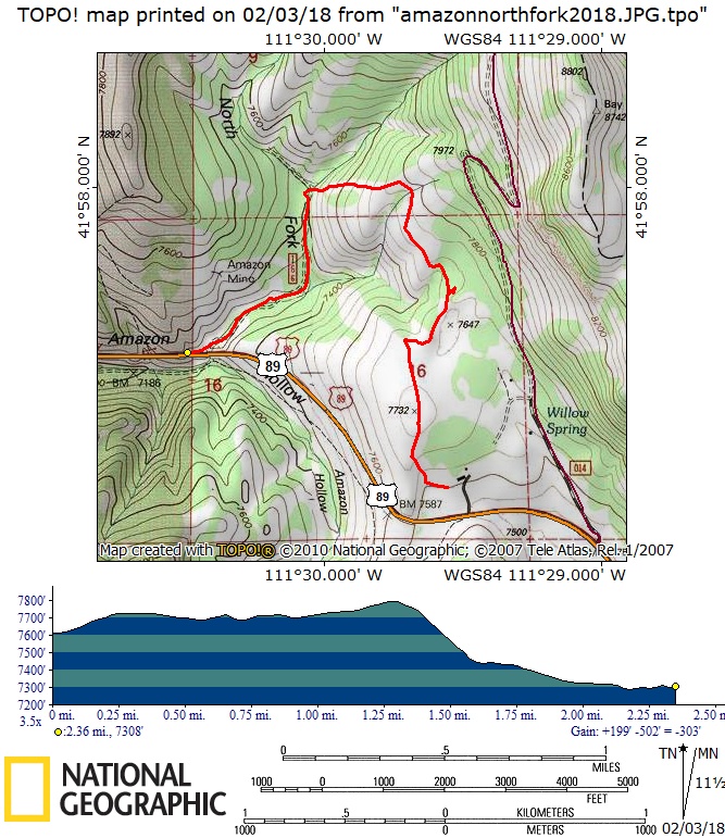
- Drove 31 miles up Logan Canyon to the UDOT sheds
- Started up the hill about 11:00, with lunch about 12:30 to 1:00
- Returned to the highway about 2:20, shuttled drivers to their vehicles at the UDOT sheds, then back to Amazon about 2:40 and Logan about 3:30.
- Overcast skies, warm temperatures and wind
- 2.4 miles with 200 feet of ascending and 500 feet
descending
Thanks to Dan for the narrative and GPS data and Dan, Dave W., Wendy and Clay for photos.
|
|
|
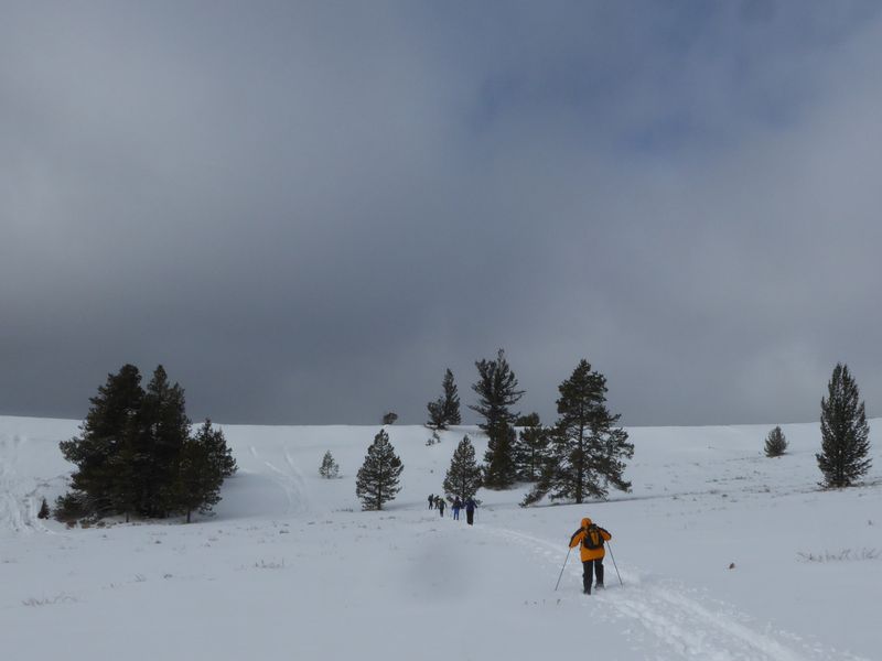
| Ascending the ridge above the UDOT sheds | |
 |
|
| Heading northward on the windy ridge | |
 |
|
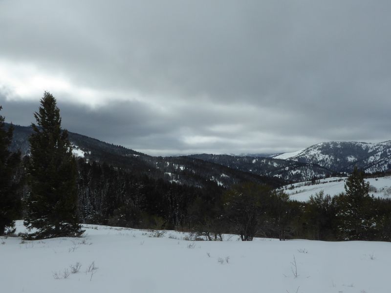
| Looking southwest, over North Fork Amazon Hollow and Logan Canyon | |
|
|
|
|
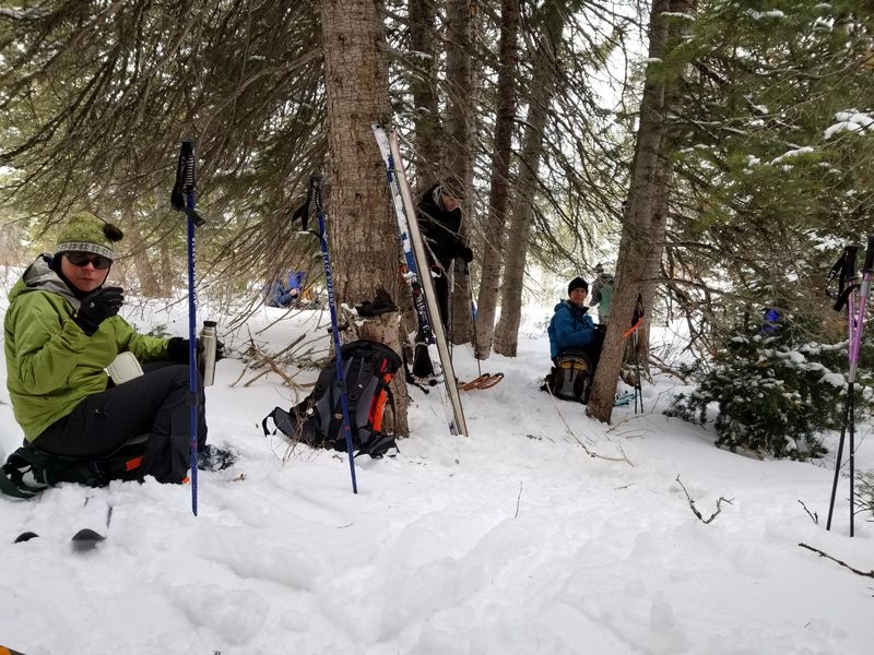
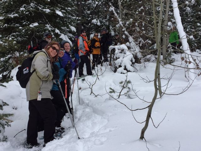
Sheltered among the trees for lunch |
|
 |
 |
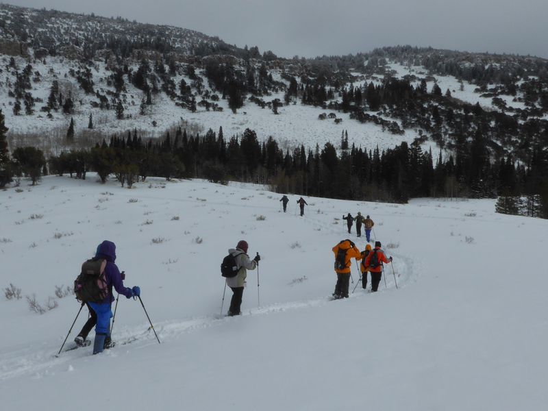
| Descending into North Fork Amazon Hollow | At the bottom of the hollow |
 |
|
| 2.4 miles with 200 feet of ascent and 500 feet of descent | |
|
You can look at our route using: Google Earth, the various map and aerial views of Google Maps or download our GPS file. |
|