Home
Bear Lake Overlook/Old Limber Pine, 11 March, 2023
Ten snowshoers and one skier met at
Smith's on Saturday morning for our last scheduled
winter outing. With the avalanche danger ranging from
considerable to high, we abandoned our plans for Logan
Dry Canyon. With several inches of new snow over the
last couple of days and a Bluebird Saturday morning, we
took advantage of the opportunity and headed for
the Bear Lake Overlook.
The Overlook parking area was almost
full with snowmobilers, many of whom were riding the Nordic,
non-motorized areas. We altered our route to go
farther south and avoid the "high marking gang". We left
the parking lot under a sunny sky and a light breeze.
Our path took us down through Sunrise Campground, then
on a southwest loop trail of our own creation. We
climbed back up to the Limber Pine for lunch and then
took a more direct route back to the cars.
Trip Summary:
- Eleven participants: Linda, Teresa, Dave P, Jane, Susan, Ophelia, Bev , Eva, Sydney, Brent (leader) on snowshoes, Dave W on skis
- Drove 34
miles up Logan Canyon to the Bear Lake Overlook
- Left the parking area at 11:00, lunch and photos at the Old Limber Pine 1:10 to 1:50, back at our vehicles at 2:50 and Smith's at 3:35
- Fresh snow,
blue sky,
temperature in the mid 20s and a light breeze
- Our track
shows about 2.6 miles with more than 300 feet of
ascent/descent
Thanks to Brent for the narrative and photos, Ophelia, Dave P, Dave W and Jane for photos, Teresa for GPS data, and Dave P and Dave W for route-finding.
 |
|||
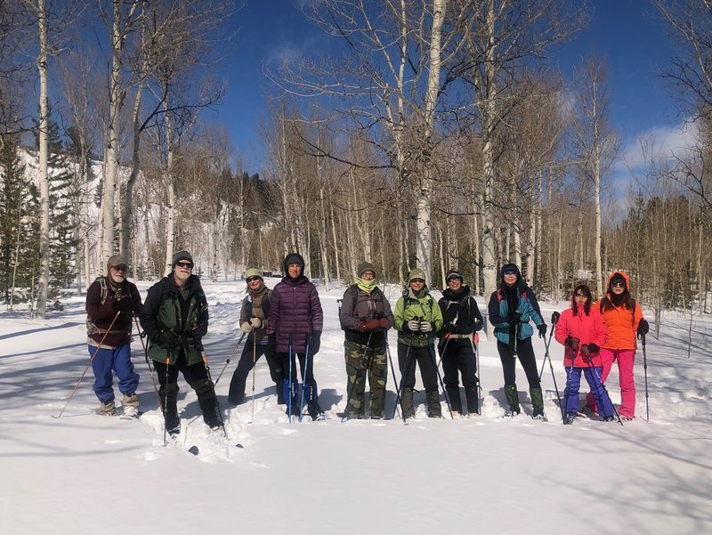
| Starting out,
near the Bear Lake Overlook |
|||
 |
|||
| Climbing a snowy hill with blue skies, fresh snow, calm winds and pleasant temperatures | |||
 |
|||
| We enjoyed
great views of Bear Lake |
|||
 |
|||
| Lunch near the
Old Limber Pine |
|||
 |
|||
| At the Old Limber Pine | |||
 |
 |
||
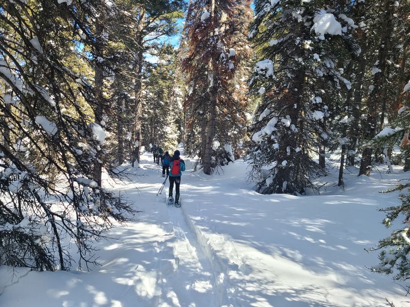
| Heading back from
the Old Limber PIne |
Traveling through the trees | ||
 |
|||
| Snowshoers
crossing snowmobile tracks as they descended (snowmobiles
had intruded into this non-motorized area) |
|||
 |
|||
| Skiing back down, with an icy Bear Lake in the distance | |||
 |
 |
||
| A grouse overhead in an aspen
tree |
|||
 |
|||
|
Our GPS track shows about 2.6 miles
and over 300 feet of ascent/descent.
You can look at our route using Google Earth
or download our GPS
file.
|
|||