Home
Bear Lake Overlook - Limber Pine, 22 February, 2026
Nine Cache Hikers drove up to the summit of Logan Canyon in hopes of good snow. Even in this poor snow year, at nearly 8000 feet, this trip from Bear Lake Overlook to Limber Pine had plenty of the white stuff. The temps were in the 30s on a sunny, windless day.
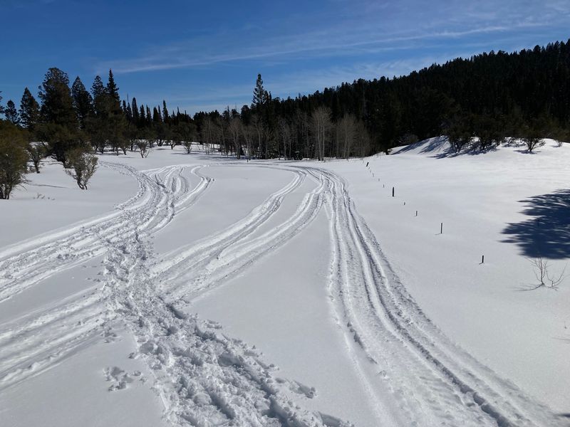
We distributed into three vehicles and drove 34 miles up Logan Canyon to the Bear Lake Overlook Rest Area. A classic track was set through the Sunrise campground. One skier elected to stay there and ski some enjoyable loops. The grooming is done by a volunteer from Garden City, but unlike the grooming reports provided by Nordic United, we do not know the situation until we get there. Today the track appeared to have been recently groomed, although a few spots had been trampled by snowshoers.
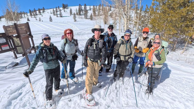
After stopping for a group photo at the west edge of the campground, the group set off over hill and dale toward Limber Pine. There is no official trail, so there were frequent stops to discuss and compare prior GPS tracks for the most efficient route. There were tracks from prior trekkers, but one has to guard against the lure of tracks that go where you do not want to go.
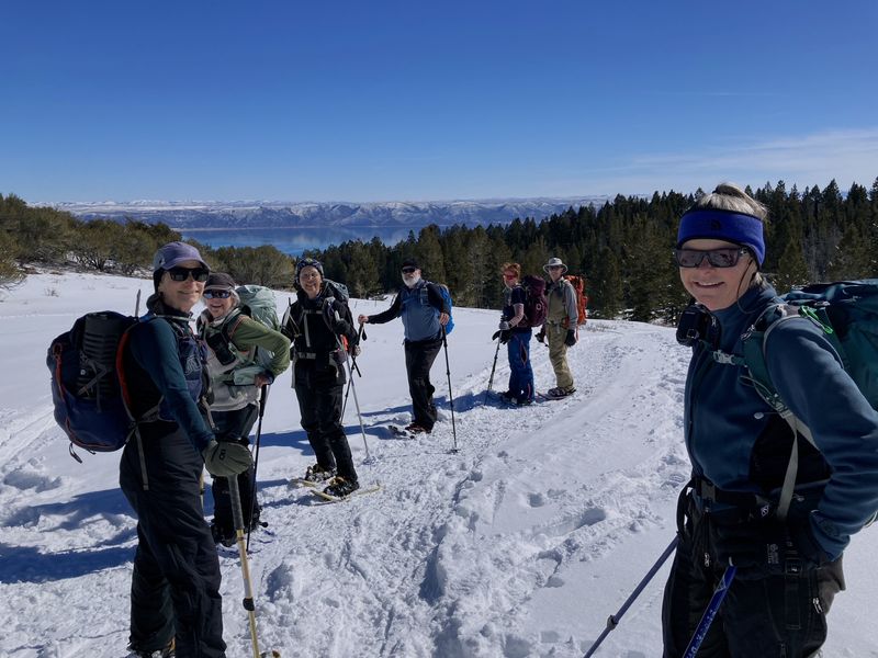
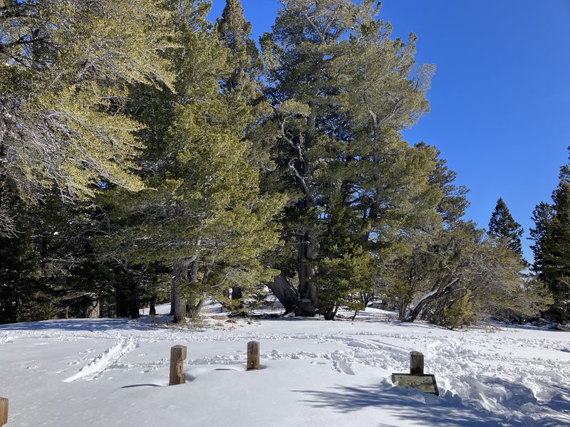
We climbed south through a large open slope. At the top, there is a great view of Bear Lake with its deep blue water (and no ice). We turned west to go along the side of a forested hill toward a low spot on the ridge. The fence line that cues us to the route in that section was very evident with the low snow. We ascended a short slope through small trees to Old Limber Pine. After admiring the venerable tree, we headed west to the main ridge and a view of Middle Sink. Lunch was in the shelter of some mountain mahogany trees near the top of the ridge.
The area east of Middle Sink is reserved for non-motorized winter recreation. Despite the Forest Service signage, there were some snowmobile tracks in the restricted area.
We returned to Limber Pine and followed the same contoured route back. The two skiers split from the main group to cut some turns on a winding slope back into the campground. The campground skier had done a couple of ambling circuits on the groomed track running through the campground before returning to the Overlook.
This was a pleasant trip, with outstanding views, pleasant weather, good snow, and fine company.
Trip Summary:
- Nine participants: Jane, Kathy, Susan, Dave P, Brent L, Michelle, David, Dave W, and Teresa (leader).
- Drove 34 miles to the Bear Lake Overlook
- Started out
from the Overlook about 11:10, all had returned by
2:30
- Enjoyed sunny blue skies, mild temperatures, and good snow conditions.
- Traveled
about 3 miles with about 350 feet of ascent
(snowshoers), 3.3 miles/400 feet (limber pine skiers)
and 1.8 miles/100 feet (campground skier)
Thanks
to Teresa for the narrative, photos and GPS data,
Jane, Dave P, Kathy, and Susan for photos,
and David and Dave W for photos and GPS data.
 |
|||
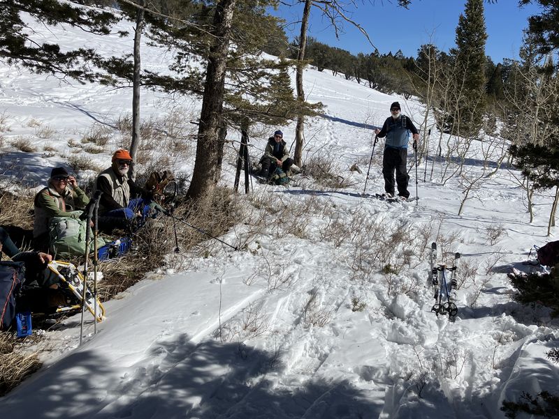
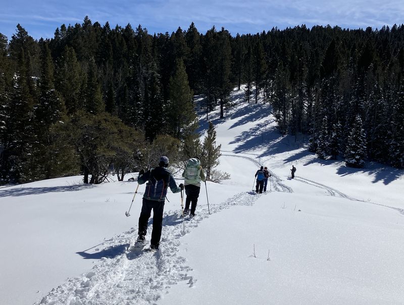
| Ready to head
up toward the Old Limber Pine from Sunrise
Campground |
|||
 |
|||
| Looking over Bear Lake on the ascent | |||
 |
|||
| The Old Limber Pine, as seen from the designated viewing area | |||
 |
|||
| Lunch on the ridge between Middle Sink and the Old Limber Pine | |||
 |
 |
||
| Snowmobiles have encroached from Middle Sink into the non-motorized area near the Old Limber Pine | |||
 |
 |
||
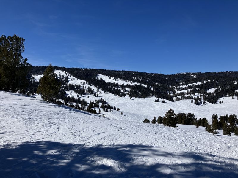
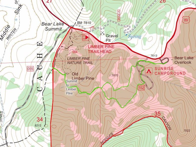
| Middle Sink, a major snowmobile area,
lies west of the Old Limber PIne |
Our path (green) was entirely within the designated non-motorized area (shaded red), see Nordic United map | ||
 |
 |
||
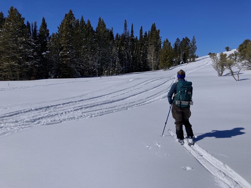
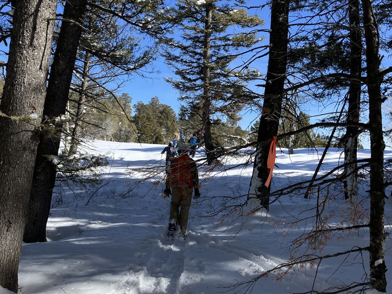
| Heading back after visiting the Old
Limber Pine |
Part of the route has been flagged |
||
 |
|||
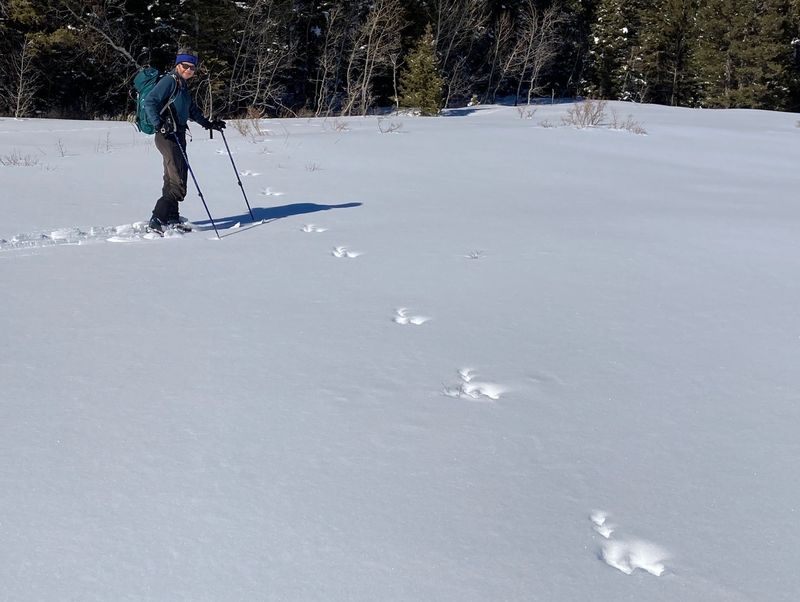
| This
snowshoe hare traveled 6-10 feet between each
jump |
|||
 |
|||
|
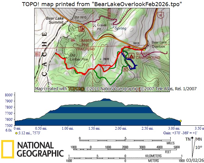
Our GPS track (red) shows about 3
miles and 350 feet of ascent, 3.3 miles with 400
feet for the limber pine skiers (green) and 1.8
miles with 100 feet for the campground skier
(blue). You can look at our route using Google
Earth or download our GPS
file.
|
|||