Beirdneau Peak, 10 July, 2016
Seven hikers started out: Dave P (leader), Dave W, Jane, Stephanie, Nick, Nikolai, and Jeremiah. We took a break at the upper spring that gushed good water from a metal pipe. Jane turned back after hiking 3 miles to the “new trail” junction, which turns to the north-west a few hundred yards above the spring. The new trail segment appeared to be rarely used, possibly because it drops down to cross the Green Canyon drainage before rejoining the regular trail. A few hundred yards above this junction was an old sign for Beirdneau and an old trail which only Dave W had been on. It turned out to be a good trail that led to a saddle on the ridge, and in fact it is marked on the “Trails Illustrated” Logan map as part of the Mt Naomi Peak Tr (#005).
We had lunch on the ridge that gave great views of Cottonwood Canyon and points east. We followed the ridge toward Beirdneau Peak, mostly on a seldom used trail, and soon we could look down into Wood Camp Hollow. Most wanted to climb Beirdneau, but Dave P opted to follow the trail around the south side. He ran into waist-high brush, lost the trail, and ended up climbing the peak too. On top we could see storm clouds approaching and started down the west side without delay. Dave P located the stone window or arch that some of us had previously seen from below. From there four of us headed down to intersect the trail. Dave W made a quick stop before stepping on a rattlesnake, and when Dave P climbed back to see it a second snake made its presence known with a loud buzz. These were the highest elevation rattlesnakes Dave P had ever seen (more than 8500 ft). As we continued west down the ridge to the junction with the Wind Caves Way we were hit with a bit of rain and hail, which was just enough to wet the bushes that then soaked our pants. We arrived at the Beirdneau (Preston Valley) trailhead at 6 pm.
This route had plenty of wildflowers and butterflies, although below about 7600 feet many plants were wilted from a few weeks of hot and dry weather. Some bushes were completely defoliated by black, fuzzy caterpillars.
Trip Summary:
- Drove 8.5 miles to the Green Canyon Trailhead, with one car at the Preston Valley Trailhead
- Started hiking at 9:00 a.m.
- Lunch on the Beirdneau Ridge, 12:15-12:45 p.m.
- Beirdneau Peak, 2:40 p.m.
- Arrived Preston Valley Trailhead about 6 p.m. and returned to Logan at 6:45 p.m.
- Sunny morning but afternoon clouds and rain showers
- 12 miles and 4200 feet of elevation gain
Thanks to Dave P. for the narrative and Dave W. for photos and GPS work.
 |
|||
Hiking the "old" trail, with Mt. Jardine in the background |
|||
 |
 |
||
| Old trail sign on the Green Canyon Trail | Old trail sign on the Beirdneau Ridge | ||
 |
|||
| Looking down Wood Camp Hollow from the Beirdneau Ridge | |||
 |
|||
| Hiking the Beirdneau Ridge | |||
 |
 |
||
| Fossils on the ridge | Plaque at Beirdneau Peak | ||
|
|||
On Beirdneau Peak |
|||
|
 |
||
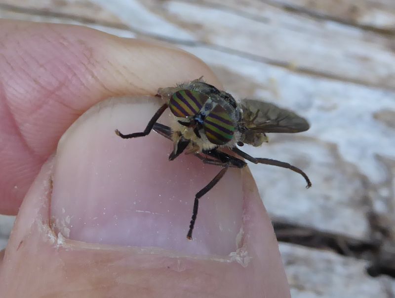
| This deer fly won't bite anyone now | A polyphemus moth on the ground | ||
|
 |
 |
 |
Monkey Flower |
Douglas pincushion | Lupine | Horsemint |
 |
 |
 |
 |
| Scarlet gilia | Hare figwort | Sego lily | Buckwheat |
 |
 |
 |
 |
| Owlsclover | Rubber boa | Enchanters nightshade | Illegal cache in the wilderness |
 |
 |
||
Storm clouds moving in |
We saw this rattlesnake in time to stop |
||
 |
 |
||
| Rock arch near Beirdneau Peak | Hiking through the wildflowers | ||
| Our GPS track showed about 12 miles and 4200 feet of elevation gain | |||
You can also look at our route using Google Earth, the various map and aerial views of Google Maps, or download our GPX file. |
|||


