Home
Beirdneau Trail, 27 July, 2025
We had a fantastic hike today. At Smith's we began with 12 participants: Sue, Bruce, Dave P, Kathy, Brent, Denis, Rebecca, Deb, Linda, Jim, Nancy, Richard (new to hiking with the group ). At the trailhead we added Ralph and a new hiker Milton (friend of Denis). As expected on the way up we had quite a bit of shade and a cooler temperature.
There has been regular and recent maintenance on the trail which made for a lovely hike up. We arrived at the ridge about 10:30. We made our way out to the overlook and took in the wonderful views.
Denis was thrilled to have people to hike with since he had not been up that trail before. There was a nice cool breeze. The group wanted to go back to the ridge intersection for lunch and we took a long break there. We ended up in two groups going down, fast and a bit slower, but we all successfully made it. A shorter day than typical but certainly a lot of vertical so none of us felt shorted.
Trip Summary:
- Fourteen hikers: Bruce, Dave P, Kathy, Brent, Denis, Rebecca, Deb, Linda, Jim, Nancy, Richard, Ralph, Milton, and Sue (leader)
- Drove 7 miles to the Preston Valley Trailhead in Green Canyon
- Started hiking about 8:30, "lunch" at the ridge about 11:00, back at the trailhead about 12:30.
- Comfortable temperatures, clear-to-partly cloudy skies and a pleasant breeze
- Hiked about
4.8 miles with 1900 feet of ascent/descent
Thanks
to Sue for photos and the narrative, Dave P for
photos, and Ralph for photos and GPS data.
 |
 |
||
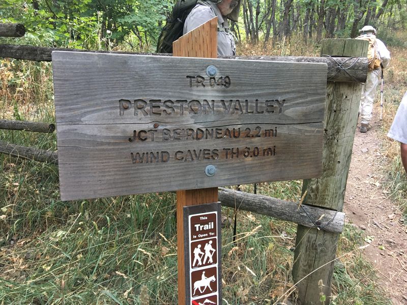
| This sign correctly names the trail |
This misleading sign has been removed
(2020 photo) |
||
 |
 |
||
| There is a new
"Carsonite" trail sign and an electronic counter
at the trailhead |
|||
2025.jpg) |
|||
| Cache Hikers at the trailhead | |||
 |
2025.jpg) |
||
| The trail
adopter has been maintaining the trail corridor,
including controlling trail
(or tread) creep (left) |
|||
 |
|||
| Hiking up the
trail |
|||
 |
|||
| Hyrum Dolomite
(left) and shale of the Beirdneau formation
(right) |
|||
 |
|||
| We had
occasional glimpses of Cache Valley as we ascended |
|||
2025.jpg) |
2025.jpg) |
||
| A new sign on the ridge marked the
Wilderness boundary |
Hiking west on the ridge to a viewpoint | ||
 |
|||
| Enjoying the
view from the ridge (point 7510 on the map) |
|||
2025.jpg) |
 |
||
| Looking west toward Cache Valley
(left) and east, up Logan Canyon (right) |
|||
 |
|||
| A shady spot
on the ridge for lunch |
|||
 |
 |
||
| Aster |
Fleabane daisy |
||
 |
 |
||
| Coneflower |
Showy goldeneye? |
||
 |
 |
||
| Paintbrush |
Rose |
||
 |
 |
||
| Fossils |
Lizard |
||
.JPG) |
|||
|
Our GPS track shows about 4.8 miles
and 1900 feet of ascent.
You can look at our route using
Google Earth or download our GPS
file.
|
|||