Home
Birch Canyon to Dry Canyon, 14 October, 2020
This was not a scheduled Cache Hiker event. Rather, Dave W. and Dave P. decided to make a mid-week hike from Birch Canyon to Dry Canyon before deer hunting season began and while the trails were still accessible (elk hunting season was in progress so they would wear "hunter orange" for safety).
We drove east on Canyon Road in Smithfield, then south on Birch Canyon Road (1000 East) over a rough and muddy road signed "Public Road Through Private Property" and through several unlocked gates to the Forest boundary in Birch Canyon, 12 miles from Logan. We started hiking about 8:20 a.m. on the Birch Canyon Trail (006). The first 2 1/4 miles are a cherry-stemmed road carved from the Mt. Naomi Wilderness Area to allow motorized access to a water system. An unauthorized single track trail that winds through the cherry stem is easy walking but a bit longer than the official trail/road (it was built by local mountain bikers and occasionally encroaches on the Wilderness).
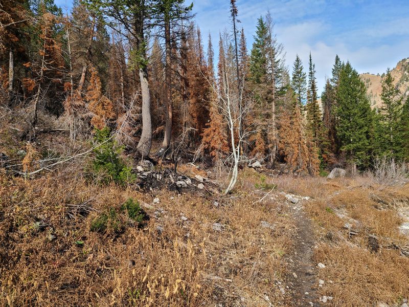
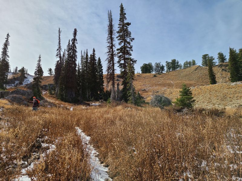
The Mt. Naomi Wilderness Area boundary is at the end of the cherry stem but there was no sign. The trail was paved with fallen leaves as it continued eastward along the stream. About 1.5 miles beyond the Wilderness boundary the canyon turned toward the south and about a half-mile farther the terrain became more open and the stream disappeared. We passed the remnant of an old (illegal) campsite on the east and the remains of a 2019 fire on the west (it was started by a burning campfire).
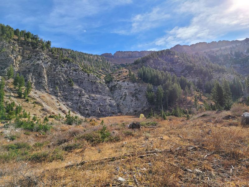
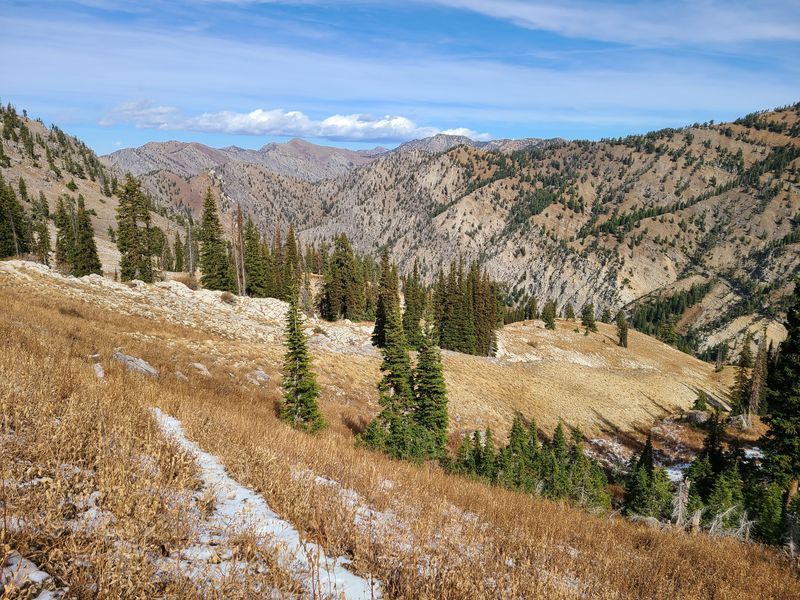
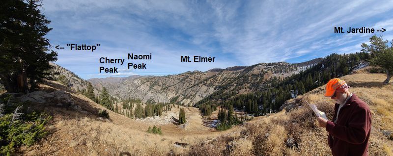
The canyon opened up into a cirque as the trail climbed. We took a short rest here, about 8000 foot elevation, and considered turning around. Instead, we decided to continue heading up as the trail turned to the southwest, providing great views of exposed geological strata, of Cherry Peak and Mt. Naomi to the north and Mt. Elmer to the east. The trail peaked at a pass on the ridge between Birch Canyon and Dry Canyon at an elevation of almost 9000 feet, 3600 feet above and nearly 6 miles from the start of the hike. Mt. Jardine was a mile to the south by trail and Flattop was 2/3 mile north by an off-trail route, but maybe we'll go to those destinations on a future trip. (The name "Flattop" is not found on government topographic maps, but that's what people call it. It's not actually flat on top but it looks that way when viewed from Cache Valley).
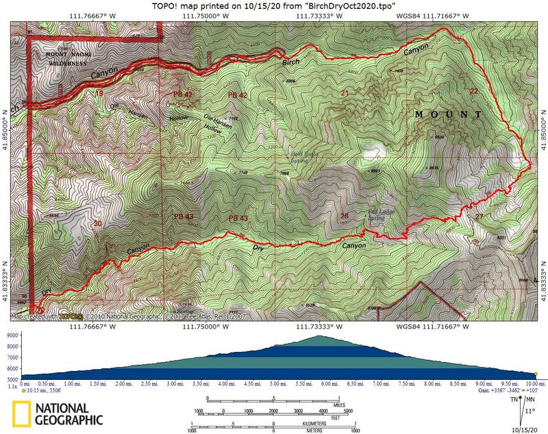
On the ridge we rested in a sheltered spot, ate lunch and called Jane to arrange a pick up at the trailhead (Cache Valley was in view so we had cell coverage). We started down the Smithfield Dry Trail (060) about 2:05 p.m. The trail was indistinct at first but it soon became easier to follow we descended the steep terrain. About a mile from the top we stopped briefly to enjoy the view from a prominent point, then walked steadily the rest of the way down the trail. We arrived at the Dry Canyon road about 4:50 after hiking 10 miles with 3600 feet ascending and 3500 feet descending, where Jane picked us up for a ride back to Birch Canyon and our vehicle.
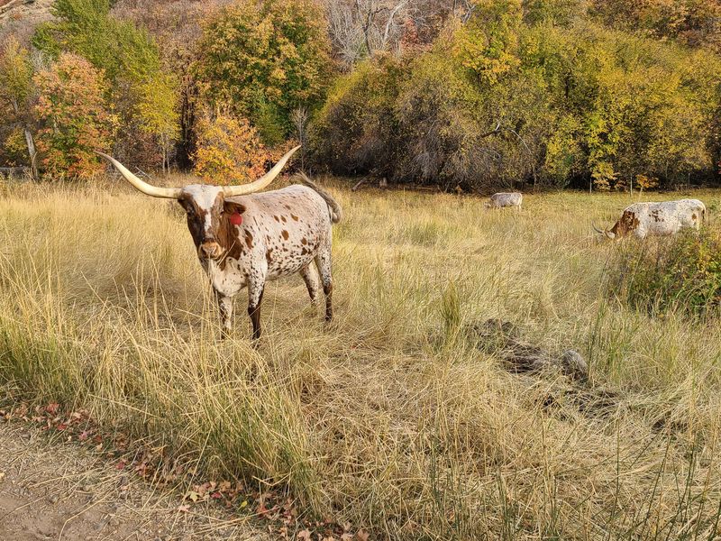
We did not see any other people on the entire hike, but several mountain bike riders passed us as we rode back to Birch Canyon after the hike - and there were long-horned cattle, too.
Trip Summary:
- Participants:
Dave P. and Dave W.
- Drove 12
miles to Birch Canyon
- Started
hiking about 8:20 a.m., lunch on the ridge 1:20 to
2:05 p.m, ending at the Dry Canyon road at 4:50 p.m.
- Mostly sunny
skies, windy and cool
- 10 miles
with 3600 feet ascending and 3500 descending
Thanks to Dave W. for the narrative, photos and GPS data and Dave P. for photos.
 |
|
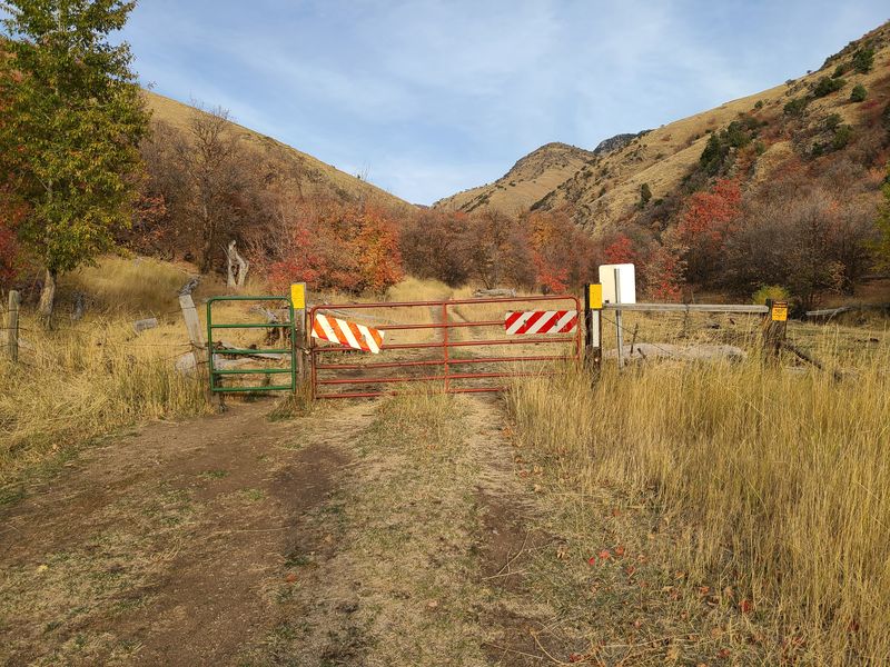
| The gate at
the Forest boundary in Birch Canyon and the start
of our hike |
|
 |
|
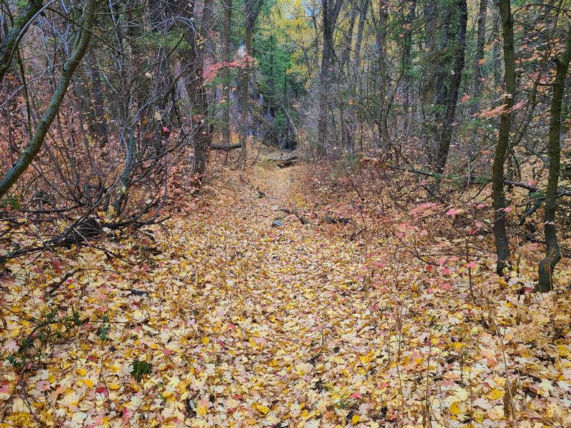
| The trail was
paved with fallen leaves |
|
 |
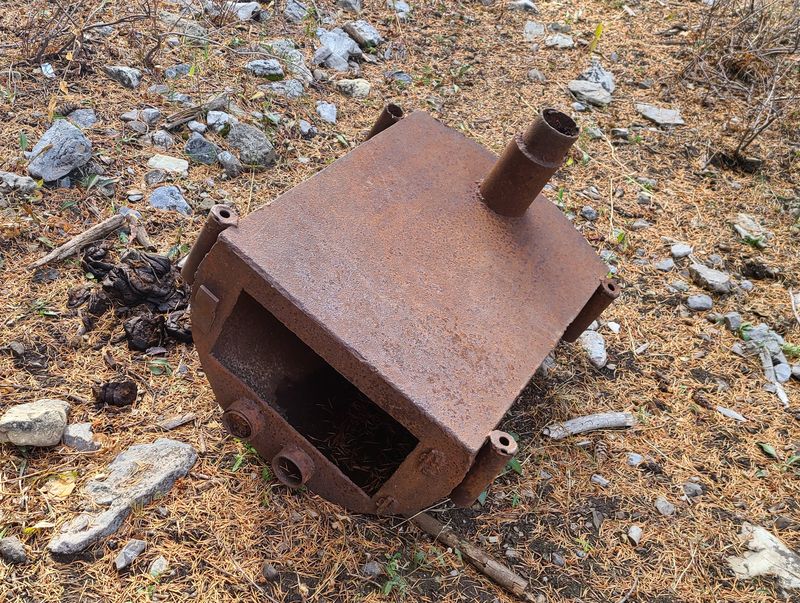 |
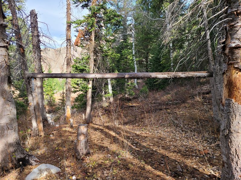
| A ridgepole for a shelter and wood stove remain from an illegal Wilderness camp | |
 |
|
| There was a wildfire
near the camp in 2019 |
|
 |
|
| The cirque at the head of Birch Canyon |
|
 |
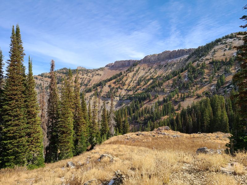 |
| Cherry Peak and Mt. Naomi to
the north |
Mt. Elmer to the east |
 |
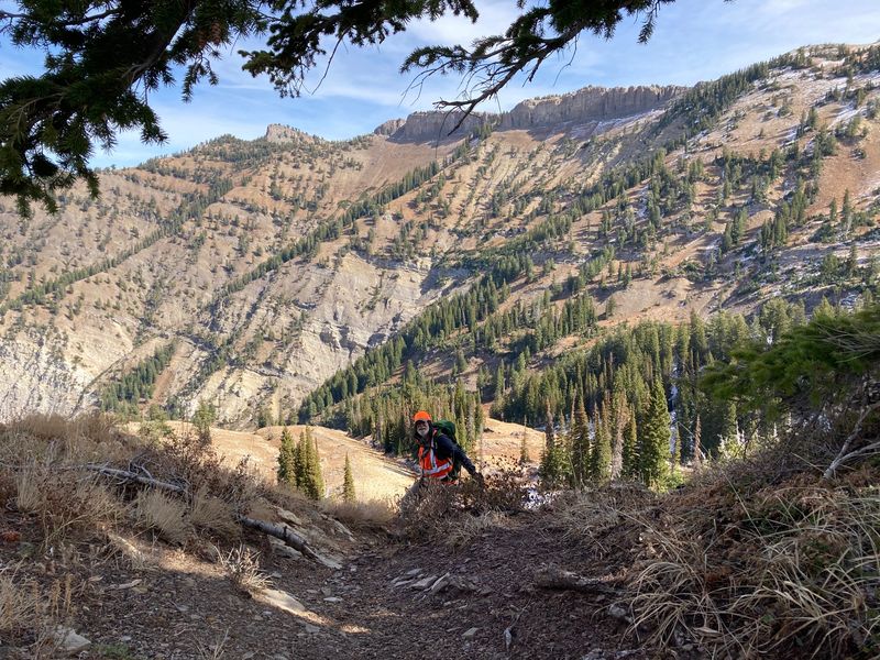 |
| Dave P, heading to the top |
Dave W, almost there |
 |
|
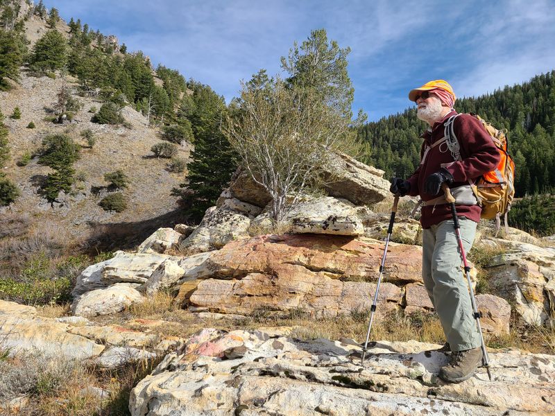
| Dave P. consulting a geological
reference |
|
 |
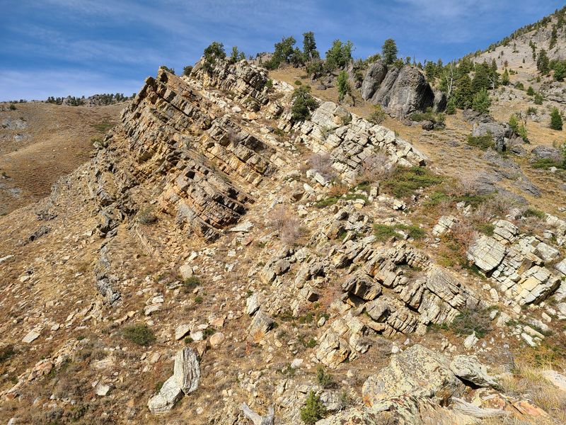 |
| Looking at the rock layers |
Exposed rock in Dry
Canyon |
 |
|
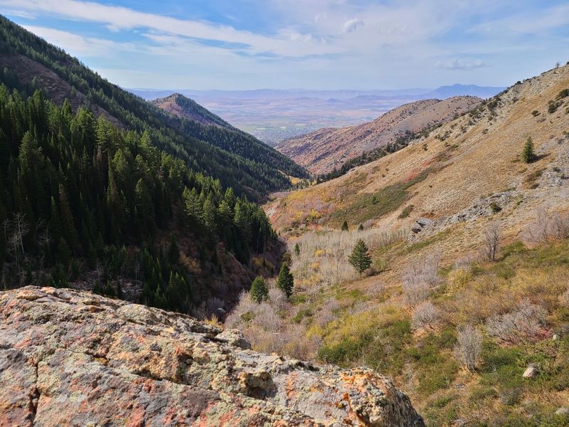
| Cache Valley and Dry Canyon, looking west | |
 |
 |
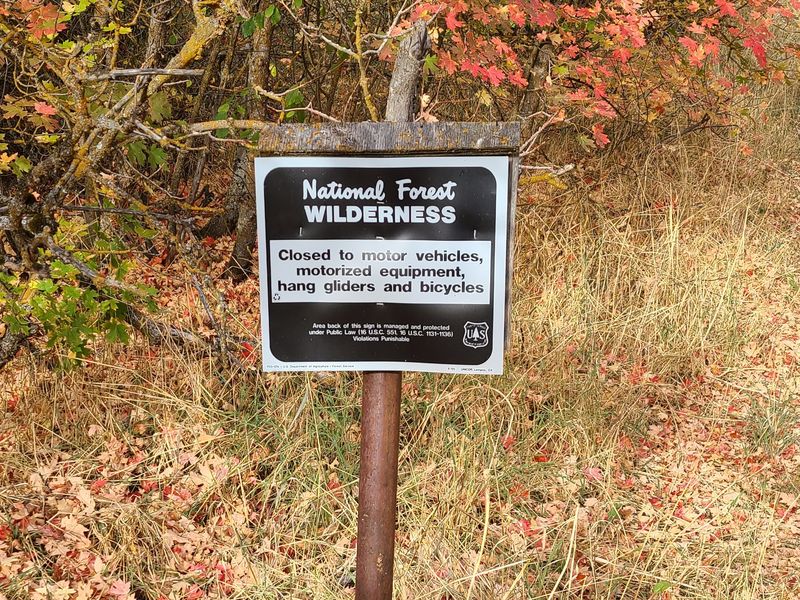
| Wilderness sign in Dry Canyon |
Long-horned cattle in Birch
Canyon |
 |
|
|
Our GPS track shows about 10
miles and 3600 feet of ascent and 3500 feet of
descent.
You can look at our route using Google Earth or download our GPS file. |
|