Home
Blind Hollow to Wood Camp, 8 October, 2020
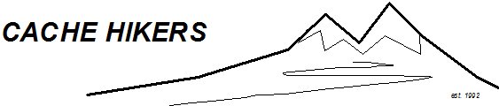
It had been a while since I hiked this route, so I invited Dave P. to join me. This was a good time, since the weather was favorable and the hordes of deer hunters should not arrive for another week. It was elk hunting season, however, so we wore appropriate clothing for safety.
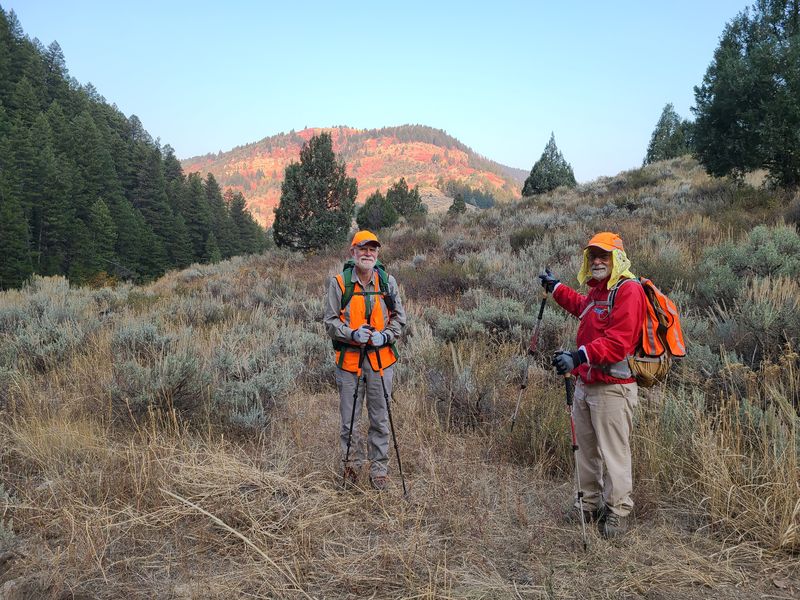
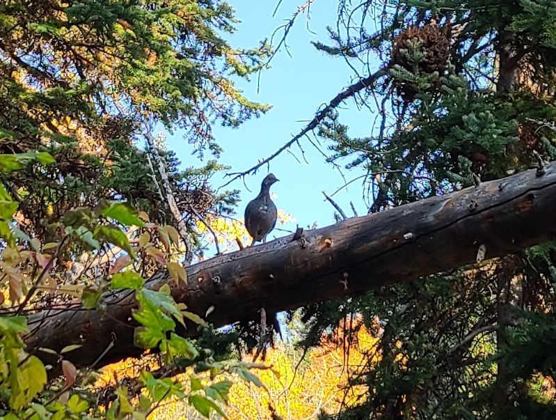
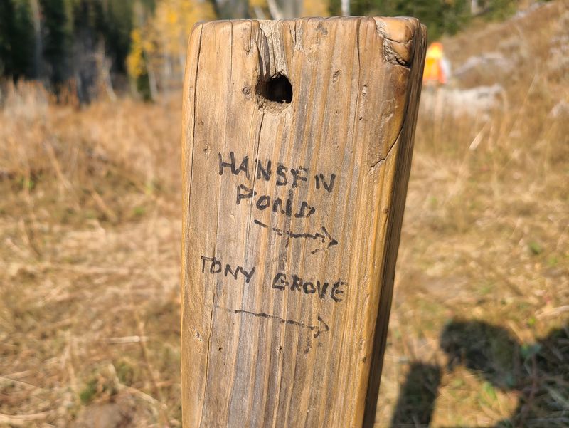
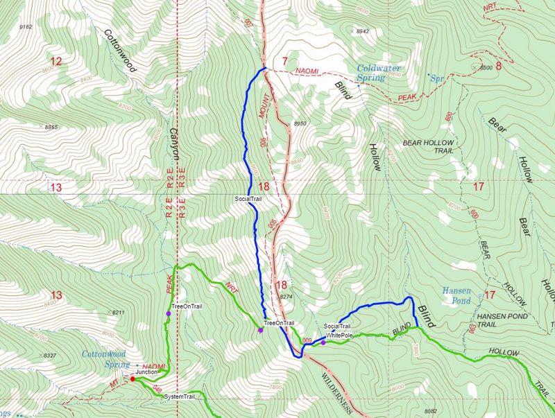
Jane dropped us off at Blind Hollow about 8:40 a.m. and we "hit the trail" for a pleasant hike up Blind Hollow. The trail was clear of fallen logs and brush and we saw several dusky grouse, and we observed evidence of recent beaver activity although there was only a trickle of water in the creek. At 3.7 miles we kept on the Blind Hollow Trail, a Forest Service "system" trail (009), to the Cottonwood Canyon ridge and the Wilderness boundary, while it looked like most trail users followed the unofficial social trail (or "user trail") that continues up Blind Hollow for a couple of hundred yards before turning west. There were no trail signs for the entire distance of Blind Hollow - nothing at the trailhead, no sign on the post at the Hansen Pond trail (063), no sign at the Wilderness boundary and no sign at the important junction with the Mt Naomi Peak NRT (005).
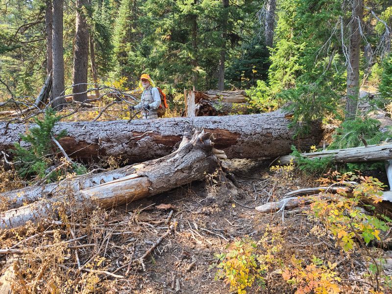
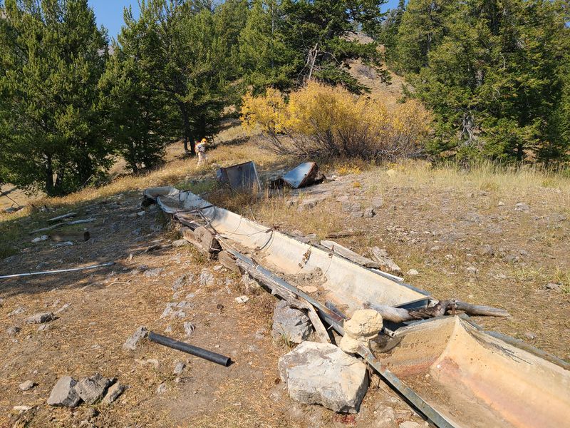
Shortly after descending into Cottonwood Canyon on the Mt Naomi Peak NRT we noted the well-traveled social trail that runs south from the Smithfield Canyon trail junction, parallel to and downhill to the Mt Naomi Peak NRT. We also encountered some very large trees across the trail. We ate lunch at Cottonwood Spring, but it was completely dry and the water trough was badly damaged.
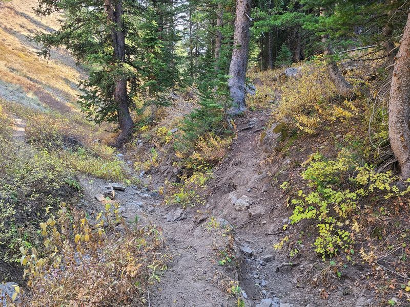
After Cottonwood Springs we turned southeast on the Cottonwood Trail (048) and were pleased to see evidence of recent foot traffic and recent (although minimal) trail maintenance. 2.5 miles later we came to a junction with the unauthorized social trail that runs up Cottonwood Canyon from US-89. We stayed on the system trail, heading south toward Wood Camp, but it looks like most trail users went down (or came up) the social trail. In fact, we might have gone that way if we had been inattentive.
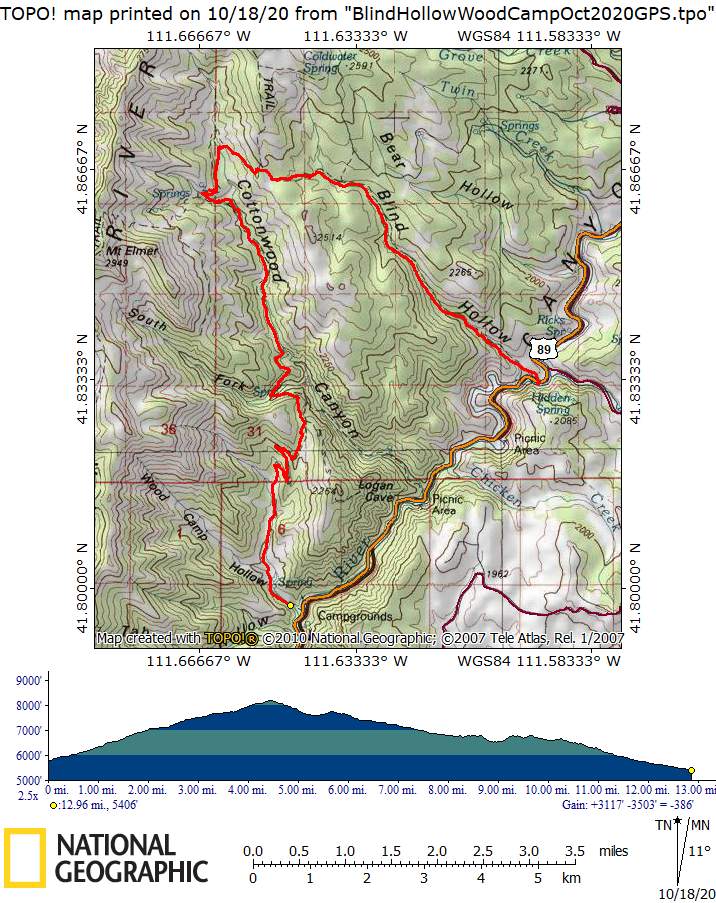
We finally got to the Old Juniper Trail (014) and the first trail sign of the day at 4:20 p.m., 9.8 miles from our start. The sign announced the Wilderness boundary (it was facing away from our direction of travel, of course). As we hiked down the trail we encountered several hikers and (illegal on this non-motorized trail) e-bike riders, the first people we have seen all day. About 4:45 p.m. we arrived at the Wood Camp trailhead and our vehicle after 13 miles on the trail and a climb of 2900 feet and descents totaling 3300 feet.
Note: This hike description is more detailed than usual in order to serve as a reference
Trip Summary:
- Two
hikers: Dave W. and Dave P.
- Jane drove Dave P. 15 miles up Logan Canyon to Blind Hollow, picking up Dave W. at Wood Camp along the way (everyone took COVID precautions)
- Started
hiking about 8:40, lunch at Cottonwood Spring from
12:40 - 1:15, ended at the Wood Camp trailhead 5:45.
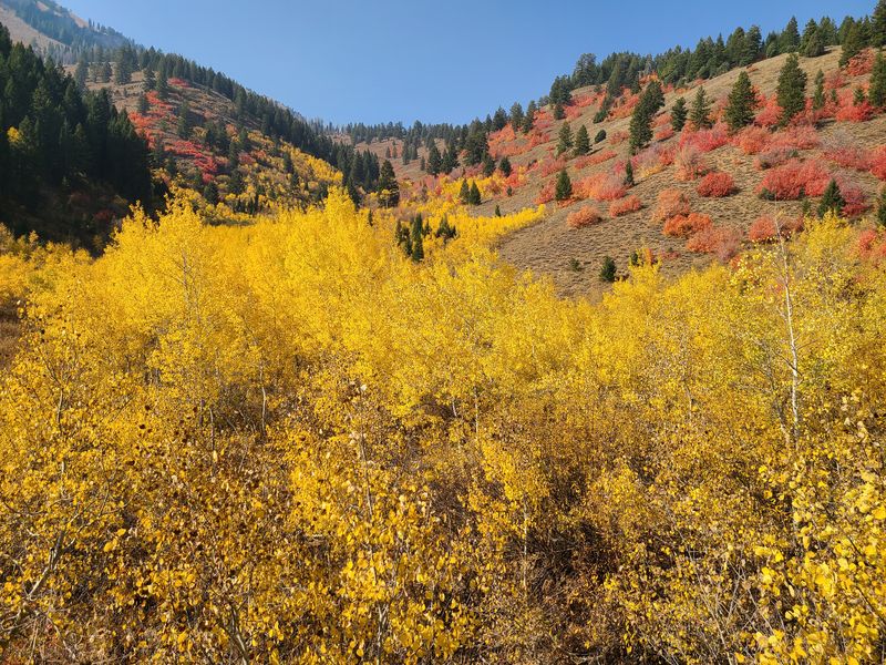
- Clear skies,
calm winds, pleasant temperatures and colorful scenes
- Covered 13
miles with 2900 feet ascending and 3300 feet
descending
Thanks to Dave W. for the narrative, photos and GPS data and Dave P. for photos.
 |
|
| At the Blind
Hollow trailhead |
|
 |
 |
| Dusky grouse |
A small beaver dam |
 |
 s s |
| A social trail heading toward
Nielson's
Well |
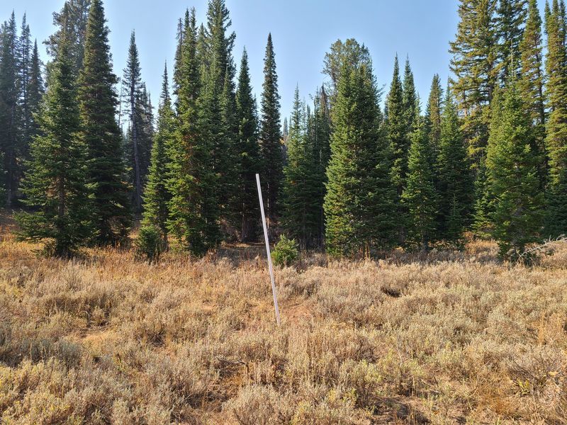
A white pole near
the trail in upper Blind
Hollow, about 150
yards south of USU's yurt |
 |
 |
| Missing trail signs |
|
 |
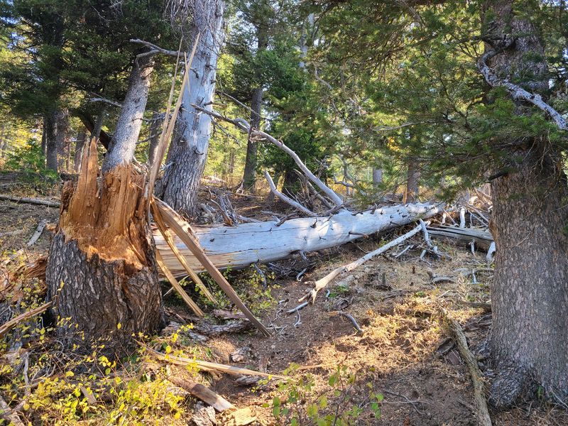 |
| Fallen trees across the Mt Naomi Peak
NRT |
|
 |
 |
| No water and a damaged trough
at Cottonwood Spring |
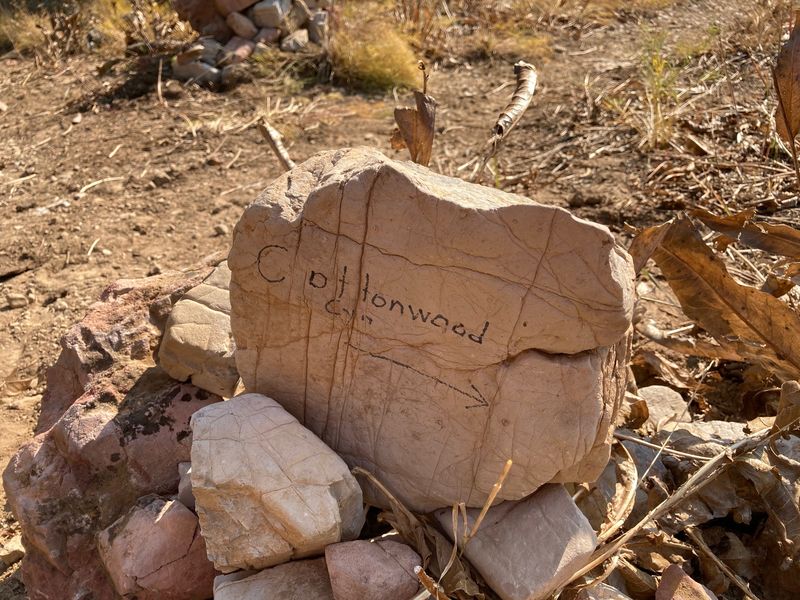
Mt. Naomi NRT - Cottonwood
Trail junction |
 |
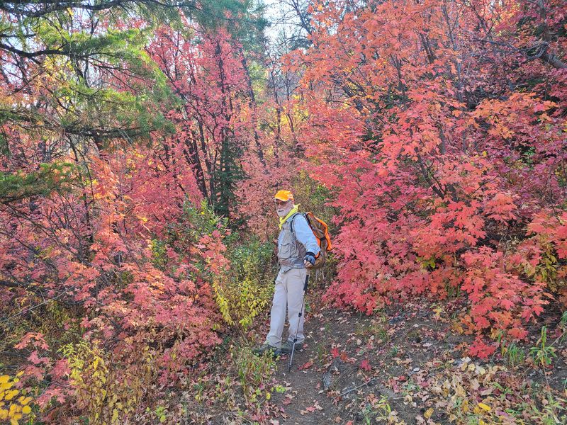 |
| Colors of fall
in Cottonwood Canyon |
|
 |
|
| Social trails (blue) in upper Blind
Hollow and Cottonwood Canyon |
|
 |
|
|
Our GPS track shows about 13 miles
and 2900
feet of ascent and 3300 of descent.
You can look at our route using Google Earth or download our GPS file. |
|