
Bunchgrass Ski/Snowshoe, 14 January, 2018
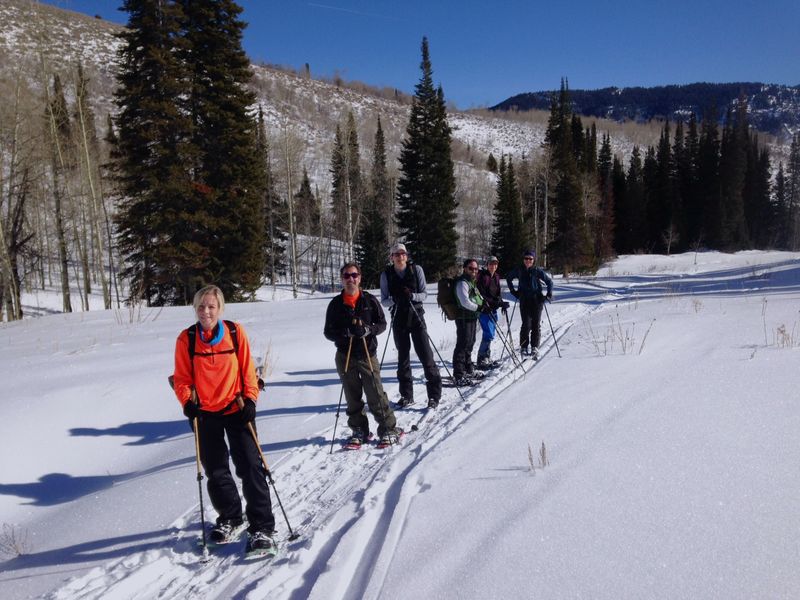
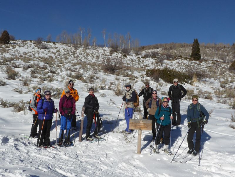
Twelve people enjoyed a balmy outing along Bunchgrass Creek; 8 on snowshoes: Kathy, Susan, Jeff, Jane, Laurel, Clay, Wendy and Maggie; and four on skis: Chris, Teresa, Dave W, and Dave P (leader). On the uphill trek some of the skiers were slipping a little, except Dave P who had climbing skins. Although the temperature was above freezing the snow was dry with a hoar frost surface. Several inches of powdery snow above a firm base made for good skiing. With only about a foot of snow near the trailhead, there was barely enough ice and snow to bridge the stream crossing.
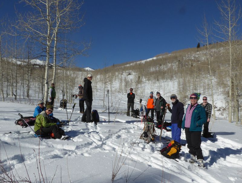
We stopped for lunch at a sunny spot above Goring pond, where Dave W's probe showed a firm crust 6 inches from the surface and 24 inches total snow depth. The skiers enjoyed a fine ride down the hill, turning at will, as long as they avoided the sagebrush and other exposed obstacles. The snowshoers strolled along without a problem, although one person had a problem with ice kept building up on the bottom of her snowshoes (it helped when we applied cross-county ski glide wax).
Trip Summary:
- Participants: Jeff, Susan, Jane, Kathy, Laurel, Clay, Wendy and Maggie on snowshoes and Chris, Teresa, Dave W. and Dave P., the leader, on skis
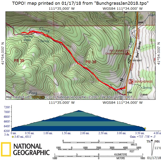
- Drove 23 miles up Logan Canyon to the Bunchgrass Nordic Trailhead parking area
- On the trail at 10:50 with lunch near Goring Pond, 12:15 - 12:50
- Back at the trailhead at 1:45 and Logan about 2:30
- 24 inches of snow near our lunch spot, much less than last year
- Cloudless skies and calm winds
- 3.7 miles round trip, with 760 feet of ascent and descent
Thanks to Dave P. for the narrative and photos, and Dave W. for photos and GPS data
|
|
| At the Bunchgrass Trailhead | |
|
 |
Crossing Bunchgrass Creek |
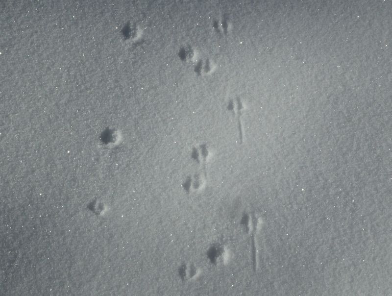
Mouse tracks in the snow |
 |
|
| A sunny day | |
2018.jpg) |
|
| Skiing up the trail | |
 |
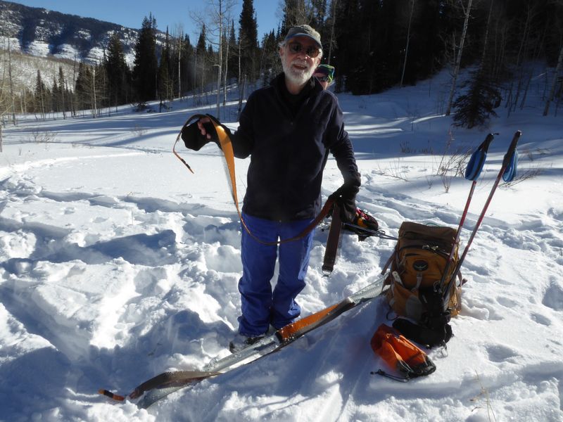 |
| Lunch near Goring Pond | Removing climbing skins before skiing back down |
 |
|
| 3.7 miles round trip, with 760 feet of ascent and descent | |
You can look at our route using Google Earth, the various map and aerial views of Google Maps or download our GPS file. |
|
2018.jpg)