
Home
Bunchgrass Ski/Snowshoe, 11 January, 2026
On a stunning winter day with vivid blue skies, thirteen adventurers made their way up Bunchgrass Creek. Nine participants used snowshoes (Anne, Christine, Dave W, Jane, Laurel, Michelle, Mike, Susan, and Ralph—who led the group), three opted for skis (Chris, Dave P, Teresa), and one chose a split snowboard (David). Two snowshoers took an easy alternative "ambling" route via the old jeep road, continuing west on a newer trail section to the historic Tony Grove Guard Station near Lewis Turner Campground.
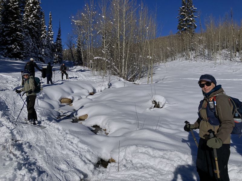
The group convened at Smith’s on Main Street, then split into carpools for the 23-mile drive to the slow vehicle turnout, about half a mile past Tony Grove Road. By around 10:50 a.m., everyone had crossed US-89, geared up, and started up the first hill, pausing for a group photo at the Bunchgrass Creek crossing, a Cache Hikers tradition that allows comparisons of annual snow depth. This year the snow depth was fairly low, yet it was still ample for both skiing and snowshoeing.
Fresh snowfall on a solid base ensured excellent trail conditions. The path traced the west side of Bunchgrass Creek, where occasional glimpses of flowing water added movement and sound to the quiet landscape.
Bunchgrass Creek flows through the geologically younger Wasatch Formation, unlike Logan Canyon's older mountains and limestone cliffs. Composed of softer conglomerate and siltstone, the Wasatch Formation has allowed the creek to carve out broader, meadow-like sections along its course.
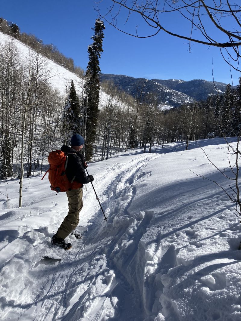
Aspen groves are prominent along this route, thanks to the Wasatch Formation’s moisture retention compared to the surrounding limestone. As elevation increases, the forest shifts to include Douglas Fir, Subalpine Fir, and Engelmann Spruce.
After less than two miles of steady climbing, the group reached Goring Pond, a stock pond formed when ranchers dammed a spring. On this snowy day, the pond was blanketed in white except for some cattails and an animal-made trench, possibly created by a porcupine.
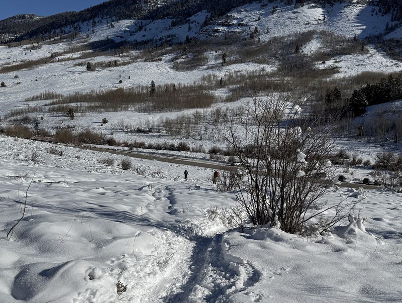
Lunch was enjoyed among aspen trees near the pond before everyone headed back. The skiers and snowboarder descended quickly, while the snowshoers made their way down the trail, returning to the trailhead around 2:00 p.m. and reaching Logan by 3:00 p.m.
During the outing, several other groups on skis and a couple of dogs were spotted, clearly relishing the snowy conditions. Mountain chickadees and red-breasted nuthatches were heard along the trail, and two bald eagles were spotted on the drive up Logan Canyon.
Trip Summary:
- 13 Participants: Anne, Chris, Christine, David, Dave P, Dave W, Jane, Laurel, Michelle, Mike, Susan, Teresa and Ralph (leader)
- Drove 23 miles up Logan Canyon and parked at the "slow vehicle turnout" near the Bunchgrass Trailhead
- Set out around 10:50 a.m., paused for lunch between 12:40–1:00 p.m., returned to the trailhead around 1:50 p.m., and arrived in Logan by 2:45 p.m.
- Temperatures were in the thirties with clear, calm weather.
- Total distance covered: approximately 3.7 miles with an ascent of about 800 feet (the "amblers" went 1.3 miles, about 80 feet ascending and 140 descending).
Thanks
to Ralph for the narrative, photos, and GPS data, and
Jane, Teresa and Dave P for photos.
 |
 |
||
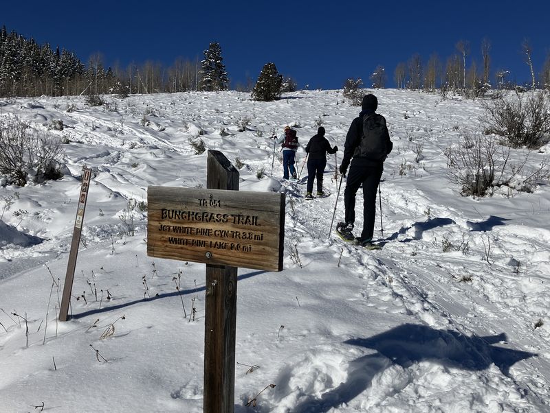
| The Bunchgrass trailhead at US-89 |
Crossing Bunchgrass Creek |
||
 |
|||
| Ready to start
up Bunchgrass Creek |
|||
 |
|||
| The trail had been "broken" by skiers | |||
 |
|||
| Blue skies and
fresh snow |
|||
 |
2026.jpg) |
||
| Bunchgrass Creek was nearly covered by
snow |
Heading up the trail | ||
 |
|||
| Approaching
Goring Pond heading west |
|||
 |
2026.jpg) |
||
| Goring Pond looks better when it's covered in snow | |||
 |
 |
||
| These tracks may have been made by a porcupine | Lunch among aspen trees |
||
 |
|||
| Looking east
(downhill) from Goring Pond |
|||
 |
2026.jpg) |
||
| Traveling down the trail by snowboard
(left) and skis (right) |
|||
 |
|||
| Almost back to
US-89 |
|||
 |
|||
|
Our GPS track (red) shows about 3.7
miles and 800 feet of ascent and descent. The
"ambling" route (blue) was about 1.3 miles with
80 feet ascending and 140 feet descending.
You can look at our route using Google Earth
or download our GPS file.
|
|||