Card Canyon Loop, 16 September, 2017
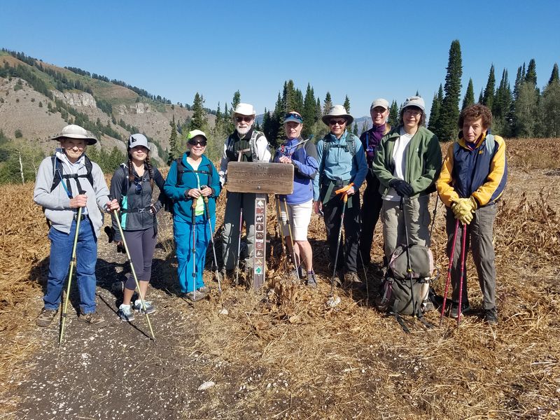
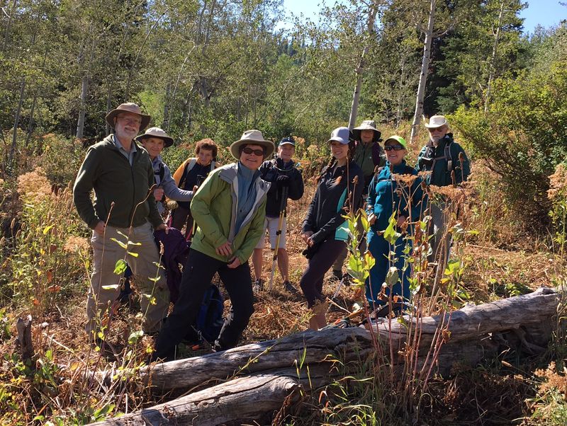
Ten hikers (Susan, Dave W., Dave P., Cathy, Jane, Teresa, Laurel, Carol, Gordon, Jocelyn) walked 0.6 miles up the Archery Range road to the Card Canyon trailhead to walk a loop hike. The hikers began on the West Card Canyon trail connecting to the East Card trail via a cutoff that Dave P. and Dave W. scouted out last year.
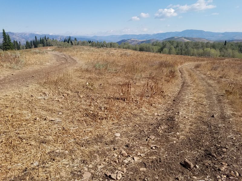
The West Card trail climbed steadily uphill in the shade as the sun had not crested the ridge. Some hikers had very cold hands! A brisk breeze greeted the hikers as they reached the large meadow at the top of the trail. We found the cutoff ‘road’ to the beaver ponds and then followed one of the sheep ‘trails’ to the junction with the East Card Canyon trail. Dave W. had flagged the cutoff a few days before the hike. We ate an early lunch at some logs about mid-way down the cutoff. The vegetation in this area was trampled by sheep.
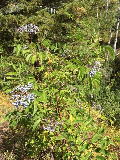
A young bull moose was spotted at the beginning of the hike and a grouse was flushed out of the brush a bit farther up the trail. Some underbrush plants and bigtooth maples were starting to turn fall colors. Much of the vegetation was dry although elderberries were ripe and not unpleasant tasting.
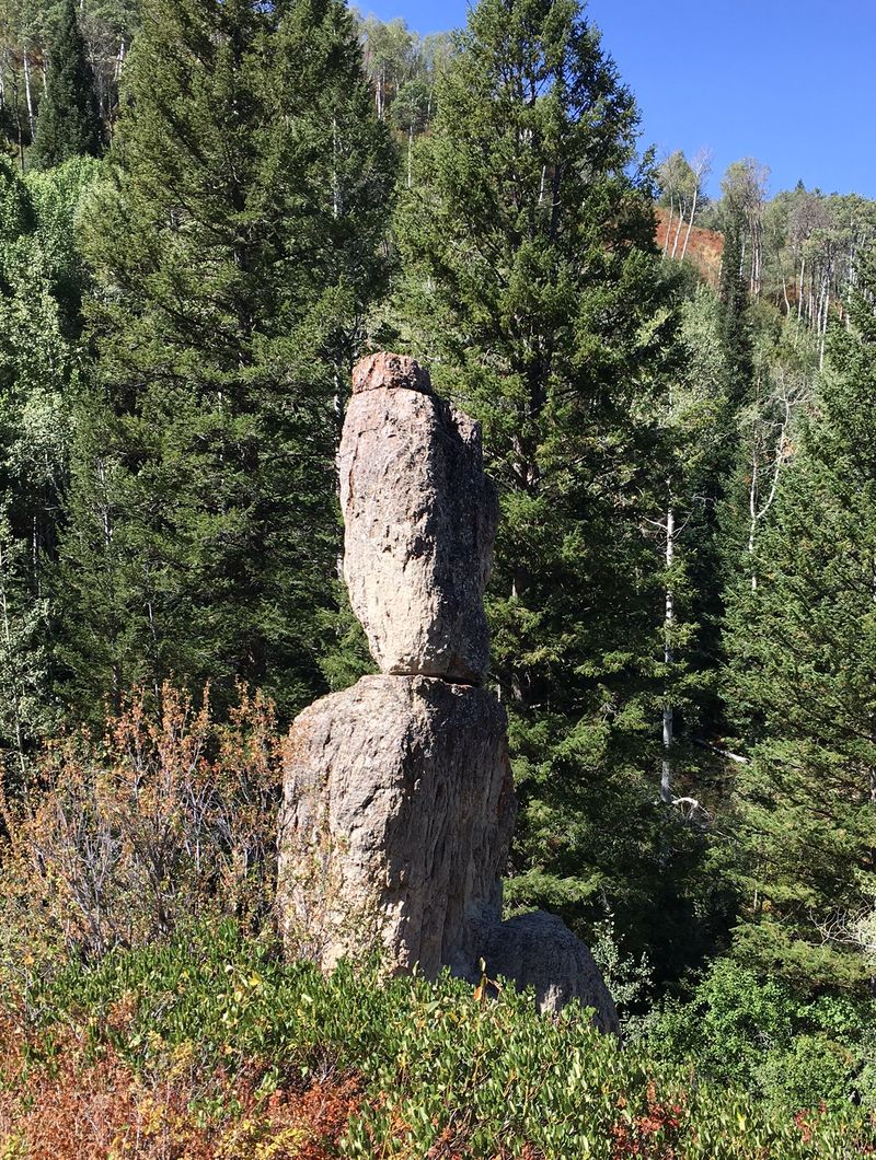
As we followed the East Card trail back down to the trailhead we stopped to look at the interesting hoodoo like rock formation along the way. Following about a fifteen minute route finding discussion with two motorcyclists, we headed back to the vehicles, packed up, and headed back to Logan.
Trip summary:
- 10 Cache Hikers: Susan (leader), Dave W., Dave P., Cathy, Jane, Teresa, Laurel, Carol, Gordon, Jocelyn
- Left Logan a little after 8 am and traveled about 8 miles up Logan Canyon to the Card Canyon/Logan Archery Range turnoff
- On the trail about 8:30 am
- Lunch at a little after 11 am (30 min)
- Talk with motorcyclists parked at the picnic tables at the end of the East Card trail: 15 min
- Back at parking area about 1:45 (a few minutes to chat and pack up)
- Back to Logan about 2:15 pm
- Clear skies and very cool temps starting out. Cool temps and stiff breeze during much of the remainder of the hike
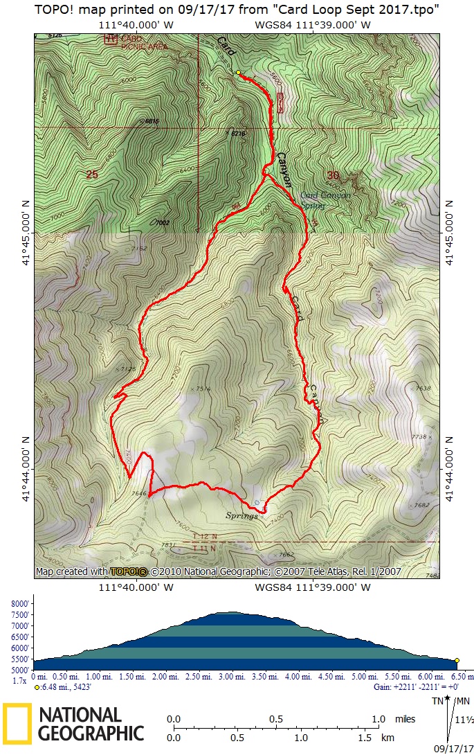
- Our GPS track shows 6.5 miles with 2200 feet of ascent
Thanks to Susan for narrative and photos, Jane for photos and Dave W. for photos and GPS work
|
|
| Near the top of Card Canyon West | |
|
 |
The meadow vegetation was dry and trampled |
Ready to go after our lunch break |
 |
|
| The standing rock in Card Canyon East | |
|
|
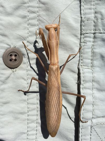
| Elderberry | Praying mantis |
 |
|
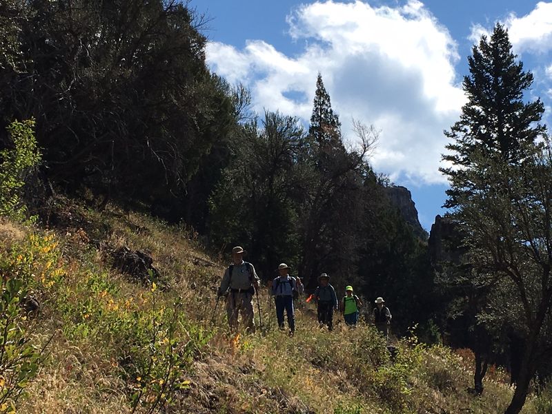
Hiking down Card Canyon East |
|
 |
|
| Our GPS track shows 6.5 miles with about 2200 feet of ascent | |
You can look at our route using: Google Earth, the various map and aerial views of Google Maps or download our GPS file. |
|