Home
Coldwater Spring Loop Hike, 27 July, 2014
Cache Hikers Ryan, Dave W., Jane, Kathy C, Denis, Christine, and Dave P.
(leader) hiked this loop. We found Coldwater Spring to still be gushing strongly
out of the metal pipe. When we got to
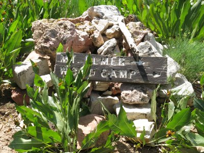
the ridge there were great views of Cottonwood Canyon, Mt. Elmer,
and even the Uintas in the distance. Early
wildflowers like mules ears and arrowleaf balsamroot on the ridge were wilted,
but there were still plenty of flowers particularly owls clover, buckwheat and
wild geranium.
After lunch we dropped down into Blind Hollow and stopped to
see the yurt. We strolled down Blind
Hollow but had to make up for it by climbing back to Bear Hollow past Hansen “Pond”. The pond has filled in and is now a wet grassy
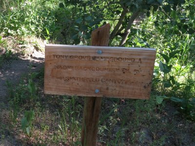
meadow but still has a trickle of water coming from it. The hot slog uphill was relieved by tall meadows of wildflowers, particularly larkspur and Indian paintbrush. From the Coldwater Spring – Bear Hollow junction we took the newly-signed trail toward Tony Grove campground, which
turned out to be steep and eroded, as an alternate route down to the parking lot.
We were pleased to see a big reduction in the number of logs across the trail and some new signs, but several sign concerns remain:
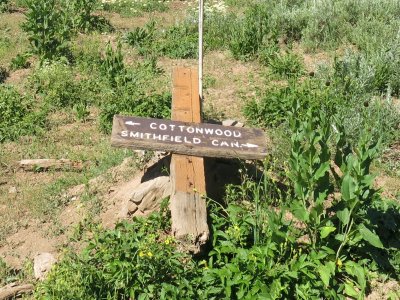
- A new sign near the Bear Hollow junction directs hikers down a steep, eroded and non-maintained trail to the campground . The trail toward the backcountry trailhead is a little longer but it is in much better condition and an easier walk (hikers can split off this trail to get to the campground at a junction previously marked by a sign - see "Missing Sign 1", below)
- Signs are missing at the campground junction and the Hansen Pond - Blind Hollow junction
- Signs are broken at the Wilderness boundary, the Cottonwood Canyon Ridge, and the Hansen Pond - Bubble Spring junction (the broken signpost here can swivel, directing hikers down the wrong trail).
Trip Summary:
- Started on the trailhead at 9:00
- Arrived Coldwater spring at 10:00
- Lunch on the ridge about 11:00
- Hansen Pond junction at 12:20
- Back to the trailhead at 1:50
- Our GPS track shows 7.1 miles and more than 1700 feet of elevation
- Calm winds, clear skies and hot weather (but much cooler than the mid-90 degree temperatures down in Cache Valley)
(Thanks to Dave P. for the narrative and photos, and Dave W. for photos and the GPS work)
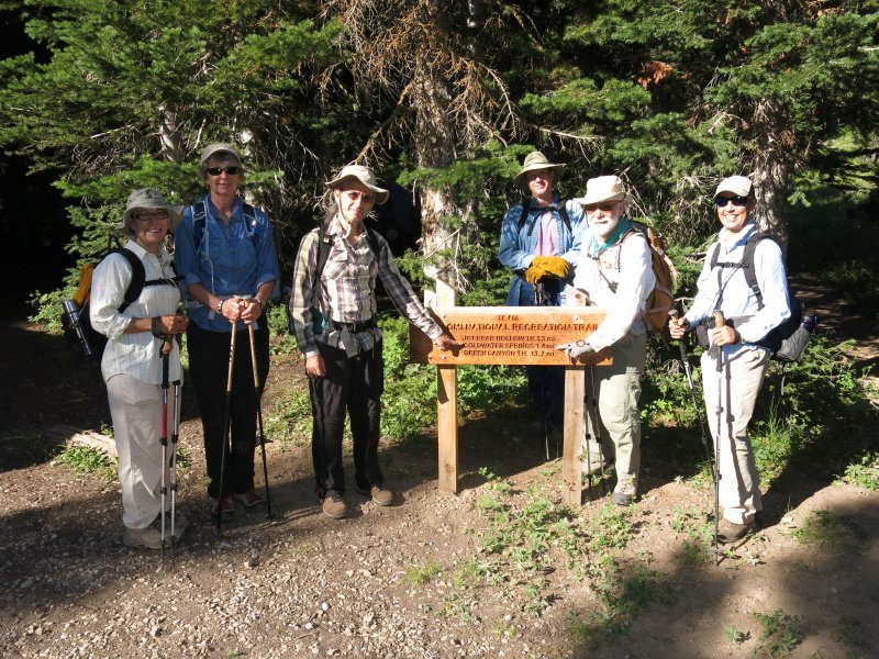
Cache Hikers and the new sign at the trailhead
|
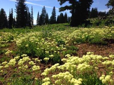
Wildflowers on the Cottonwood Canyon ridge
|
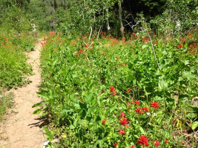
Wildflowers along the Bear Hollow trail |
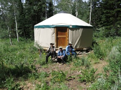
We visited the nearby Blind Hollow yurt |
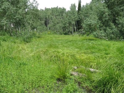
Hansen Pond has become a wet meadow
|
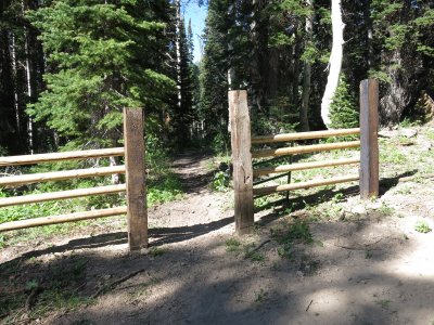
New gates and fencing across the trail |
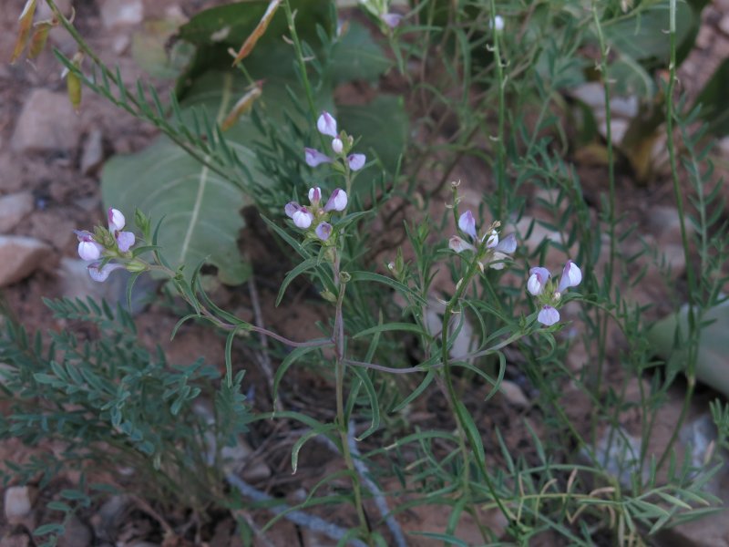
This owlclover variety is only found our local area
|
This questionable sign directs hikers down a steep, eroded and non-maintained trail |
Broken Sign 1, at the Wilderness Boundary |
Broken Sign 2, on the Cottonwood Canyon Ridge |
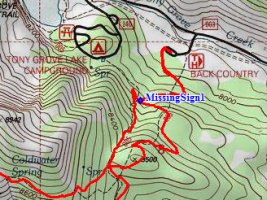
Missing Sign 1, at the campground trail junction |
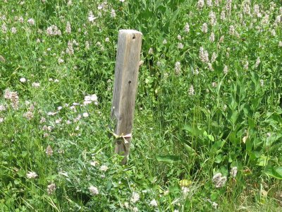
Missing Sign 2, near Hansen Pond |
.jpg)
Broken Sign 3, at the Bubble Spring junction, swivels to point the wrong direction |
Missing and broken signs require hikers to be alert and aware of their location
|
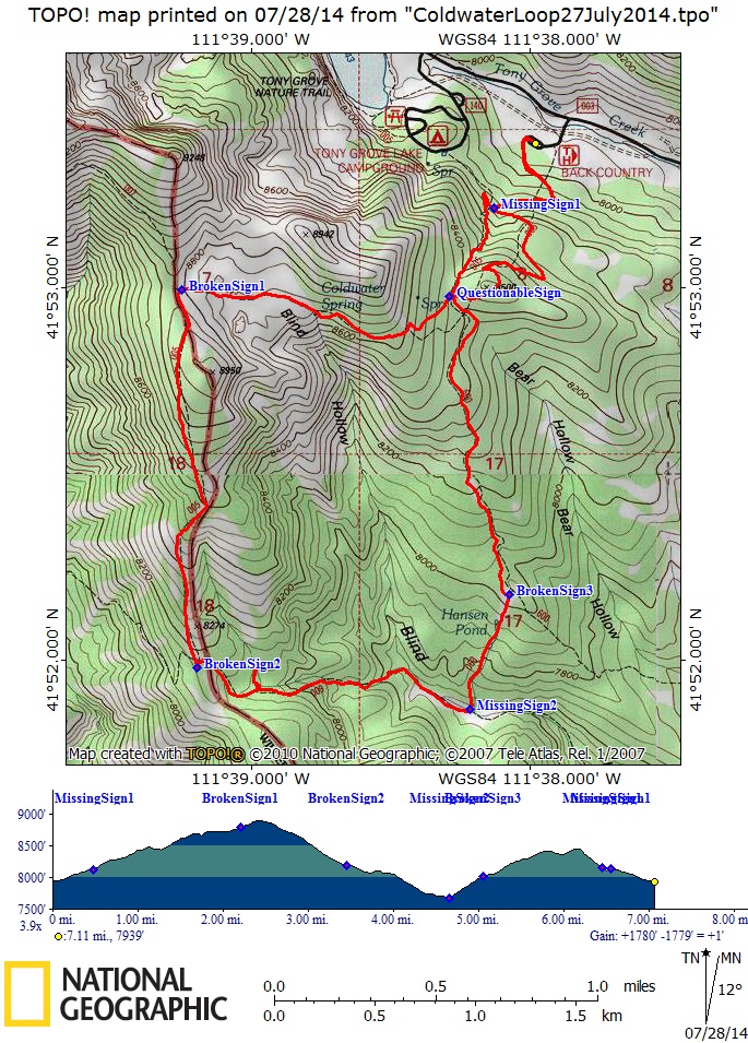
Our GPS track shows 7.1 miles and more than 1700 feet of elevation |
You can also look at our route using Google Earth or the various map and aerial views of Google Maps.