Deer Fence/Bonneville Shoreline Trail, 26 May, 2018
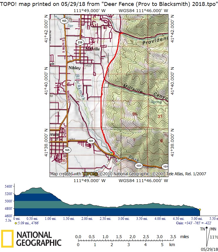
Ten Cache Hikers and 2 dogs enjoyed this fine spring hike on the Deer Fence Trail. We hiked the 5-mile section from Providence Canyon to Blacksmith Fork, part of the Bonneville Shoreline Trail system. Before the hike we had left a "shuttle" car at Blacksmith Fork, and three cars took us to Providence Canyon.
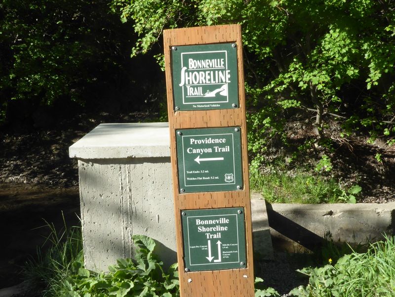
At Providence Canyon we admired the new signpost marking the nearby trails, although the arrows on the Bonneville Shoreline Trail could be confusing unless you already knew where the trail went. We were struck by the contrast in vegetation along the trail, with fields of wildflowers and lush foliage on the other side of the Deer Fence and grassy slopes on our side. After passing Millville Canyon we encountered cows and calves along the trail. Another hiker warned us of overly protective cows but they did not bother us. Coyotes serenaded us with their howls as we passed the National Wildlife Research Center facility although none of the animals were visible from our distant vantage.
After stopping for a scenic lunch on the grassy slopes overlooking the Blacksmith Fork River, we followed the new trail section to the trailhead. This section, built in the fall of 2016 by the Utah Conservation Corp, bypasses a potentially difficult stream crossing (see our report of May 2016).
We saw longleaf phlox, arrowleaf balsamroot, mulesear, bitterbrush, spider milkweed and sego lily as we hiked along the trail.
This hike required a complicated car shuttle, which meant up to 45 miles of travel for some drivers. Upon arriving at the Blacksmith Fork Trailhead the drivers loaded into the car that had been left there and rode back to Providence Canyon to our three other cars. Then they drove back to Blacksmith Fork to pick up the remaining hikers before finally returning to Logan about 12:50.
Trip Summary:
- Participants: Jim, Nancy, Jane, Dave W. (leader), Dave P., Laurel, Debbie, Brent, Gordon and Monika, with Fritzi and Bruiser (dogs).
- Drove 6 miles to Providence Canyon to begin, then 10 miles returning from Blacksmith Fork after retrieving our shuttle car.
- Started hiking 8:30 with a "lunch" break from 10:40 - 11:05. Arrived at Blacksmith Fork about 11:40 and Logan at 12:50 (after the car shuttle).
- Sunny skies, calm winds and pleasantly warm temperatures.
- Our GPS track shows 5.1 miles with about 300 vertical feet of uphill travel.
Thanks to Dave W. for the narrative, photos and GPS data and Jane for photos. .
|
| New trail signs |
 |
| On the Deer Fence Trail, overlooking fields of arrowleaf balsamroot in flower |
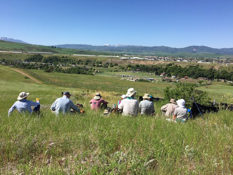 |
| Admiring the vew from our lunch spot |
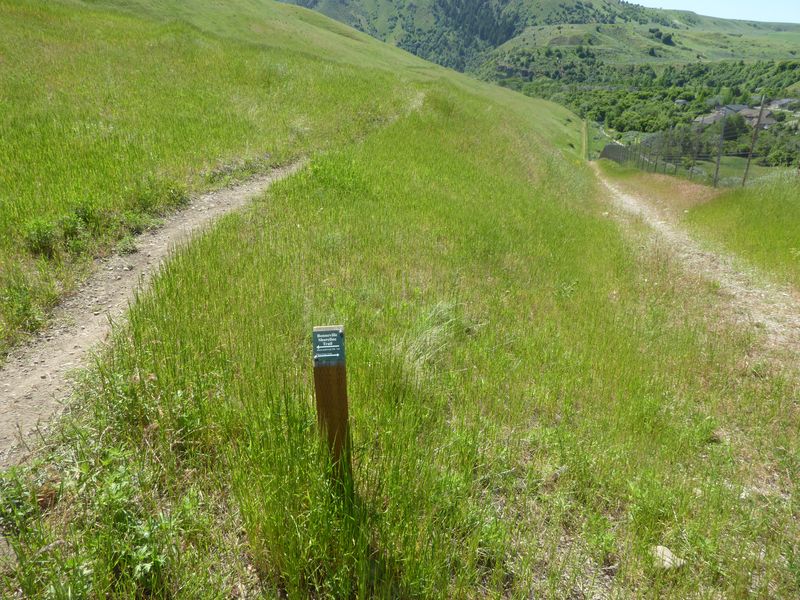 |
| We went left, following the new trail section to Blacksmith Fork (the right trail follows the Deer Fence) |
|
Our GPS track shows 5.1 miles with about 300 feet of ascent and more than 700 feet of descent |
You can look at our route using: Google Earth, the various map and aerial views of Google Maps or download our GPS file. |