
Home
Franklin Basin Moonlight, 31 January, 2026
The first full moon hike of 2026 had beautiful clear skies and very temperate weather. Luckily the moonrise was early evening so the group was able to enjoy a brief view of the orange sunset. Due to very limited snowfall, the group decided to travel on the groomed road. Most wore boots, some with "microspikes" (trail crampons), and two opted for cross-country skis. Only a couple of snowmobilers were still out in the back country and they returned just after the hike began, so the entire area along Franklin Basin Road was ours to enjoy without interruption. We heard the hoot of a great horned owl and saw various tracks by the waters edge. There are dippers by the beaver ponds that are a joy to watch. At the turn around point we all shared some treats and headed back. The skiers were able to make very good time. Once back at the truck Dave shared some Moon Pies. A wonderful evening.
Trip Summary:
- 14
participants, Mike, Anne, Dave W, Brent L, Lynne,
Brent J, Ophelia, Bree, David, Michelle, Catherine,
Deb, and Sue and Bruce (leaders), with twelve booters
and two cross-country skiers
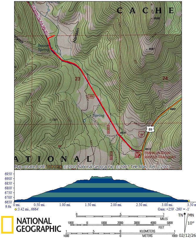
- Drove 26 miles to the newly-enlarged Franklin Basin Winter Trailhead
- Started hiking about 5:45 pm, turned around at Hansen Hollow about 7:20 pm and returned to the trailhead about 8:30 pm
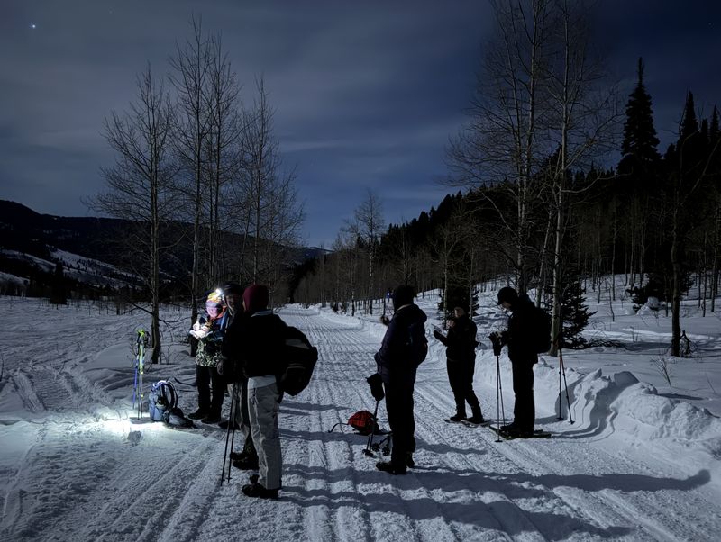
- Some high
clouds but clear views of the moon, and bright enough
to see without using artificial light
- Snow on the groomed trail was hard-packed but off-trail snow was too shallow for comfortable travel
- Most traveled about 3.5 miles to Hansen Hollow, while others "ambled" about 3.2 miles, just past Beaver Spring
Note: Franklin
Basin is entirely located in Idaho.
The area along the Franklin Basin Road in Utah is
actually upper Logan Canyon (US-89 leaves
Logan Canyon at the Franklin Basin Road, then follows
Beaver Creek and passes through Amazon Hollow and
North Sink on the way to Bear River Summit).
Thanks
to Sue for the narrative and photos and Dave W for
photos and GPS data.
 |
|||
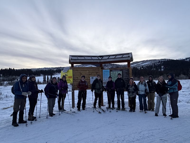
| Trailhead | |||
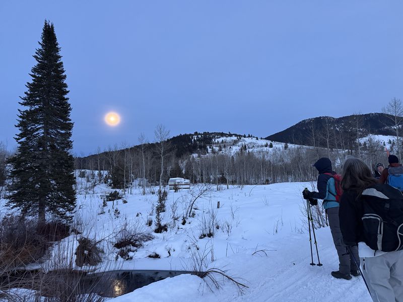 |
|||
| Moonrise | |||
 |
 |
||
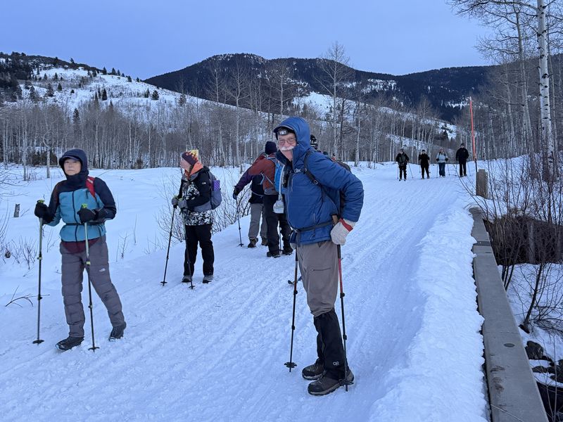
| On the Logan River bridge |
Snowshoes and headlights were not
needed for travel on the groomed trail |
||
 |
|||
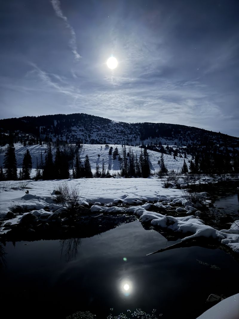
| Beaver Spring reflection | |||
2026.jpg) |
|||
| Snowmobilers rode through the
non-motorized area on the north (right) side of
the road without regard to the map on the new
kiosk that shows the motorized area on the south |
|||
2026.jpg) |
|||
| This may be a
new beaver pond - with beaver tracks?, just
upstream from the bridge |
|||
 |
|||
|
Hikers went an estimated 3.5 miles
with 260 feet of ascent, while the "amblers" GPS
track shows about 3.2 miles.
|
|||