
Home
Franklin Basin Snowshoe, March 9, 2014
Six Cache Hikers met for this snowshoe event: Dan, our leader, Dave P., Dave W., Jane, Jim, and Alexi. We drove in two cars to the Franklin Basin Winter Trailhead, which, surprising for a Sunday, was almost filled with trucks and trailers. Starting off about 11:05am, we traveled on hard-crusted snow up the road and across the Logan River bridge to the Steam Mill trailhead. After 3/4 mile following snow machine tracks up the Steam Mill Trail, we turned toward the north. The steeper terrain here prompted Dan to use the climbing feature on his snowshoes as we ascended to the ridge. At an elevation of 7480 feet and mostly sunny, it was a nice spot for lunch.
We continued northward through the untracked snow after lunch, where the steep side-slope made for some uncomfortable snowshoeing. Our climb ended on an open ridge for great views and photo opportunities, then we descended along the ridge and turned to the southeast through aspen groves. By this time the temperature had warmed quite a bit and the snow was getting sloppy and wet. We came back through meadows and eventually to our cars about 2:45pm.
Trip Summary:
- Assembled 10:00 at Smith's parking lot and organized into carpools (6 people and 2 vehicles)
- Arrived at a nearly-full Franklin Basin Winter Trailhead about 10:55
- Started on the trail about 11:05
- Lunch break about 12:30 to 1:00, 65 inches total snow depth and 42 degrees F
- Back at the parking area at 2:45 and Logan at 3:30
- Partly to mostly cloudy skies (stormy weather is on the way)
- Our GPS track showed 3.6 miles with 930 feet of climbing
Thanks to Dan for the narrative and GPS work, Jim and Dave P. for photos.
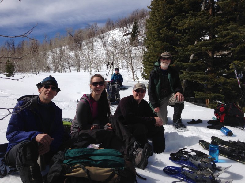
Lunch on the ridge
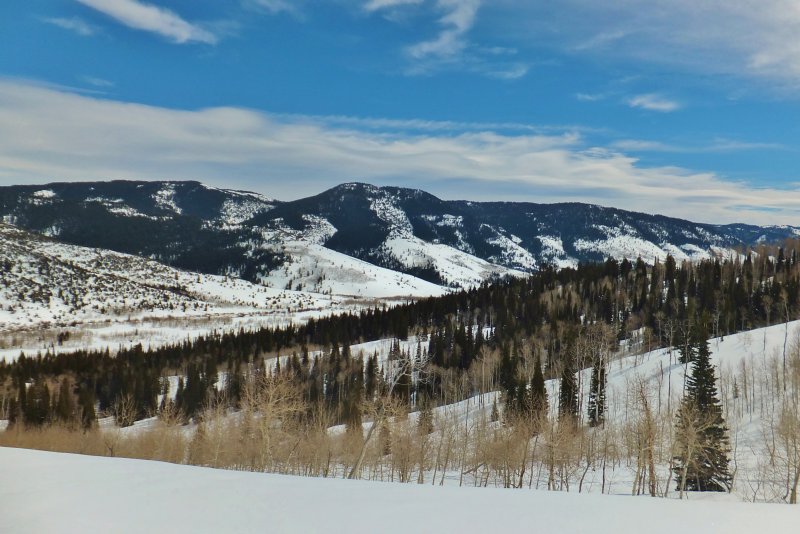
Looking SE, toward Logan Canyon
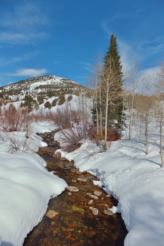
Logan River with Beaver Mountain in the background (compare with the view from our moonlight trip in mid-February)
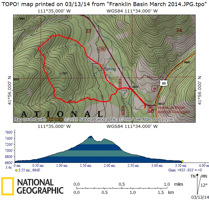
Our GPS track showed 3.6 miles and 930 feet of elevation
You can also look at our route using Google Earth or the various map and aerial views of Google Maps.