
Home
Franklin Basin Snowshoe, 8 March, 2020
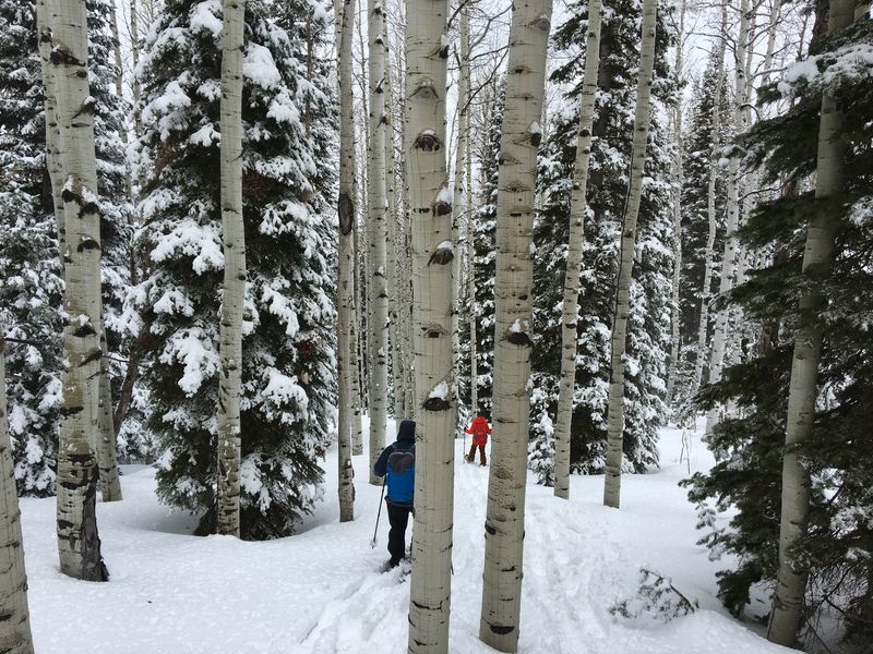
Six hikers met on Sunday for the Franklin Basin snowshoe: Chris, Michelle, David, Dave P, Brent and Dan, the leader. We were all on snowshoes. It was a warm day with cloudy skies as we pulled into the parking lot just off the highway about 10:50 a.m. Three or four inches of snow had fallen overnight on top of older sugary snow. The group made their way up the road, over the Logan River bridge and across the first meadow. Our route mostly followed the Steam Mill Trail, up through conifer forest skirting another meadow and climbing to the west. We pulled off layers as we heated up with the exertion.
After a mile and a half we stopped for a short food break, then took on the final climb to the ridge. About 1:15 and after 1200 feet of ascent, we found a nice spot for a standing lunch (there was no place to sit). After lunch we followed our familiar route NE down the ridge, about the sixth time we have gone this way. There were scenic views, with clouds and snow and sun and trees.
The descent took us through mature conifer/aspen forest, where steeper terrain made for tricky footing. The snow had softened in the afternoon, making for a slushy slog through the meadow and back to the bridge and parking lot.
Trip Summary:
- Participants: Chris, Michelle, David, Dave P, Brent and Dan, the leader.
- Drove 25
miles to the Franklin Basin Winter Trailhead.
- Started about 10:45 with a lunch stop at 1:15, back at the trailhead about 2:50 and Logan by 3:35
- Mostly cloudy skies and warm temperatures
- About 4.2
miles and 1200 feet of ascent & descent
Thanks
for Dan for the narrative, photos and GPS data and
Brent for photos.
 |
|
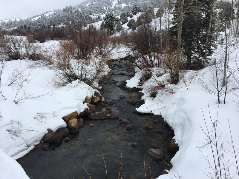
| At the Steam
Mill Trailhead, where the trail crosses Steam Mill
Creek |
|
 |
|
| Last night's
snow still was clinging to trees |
|
 |
|
| Looking north toward Beaver Mountain | |
 |
|
| Looking west over Logan Canyon |
|
 |
|
| Slogging through the soft slushy snow
of the meadow |
|
 |
|
| Logan River with Beaver Mountain
(compare to previous years) |
|
 |
|
|
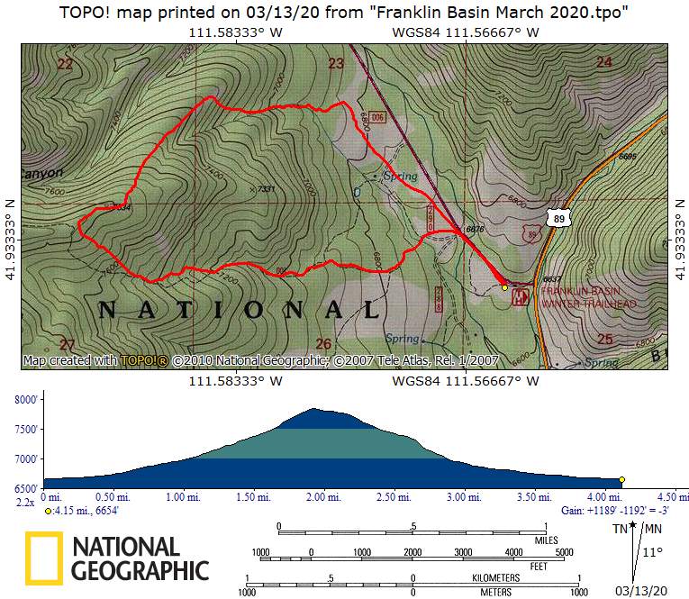
Our GPS track shows about 4.2
miles and 1200 feet of ascent and
descent.
You can look at our route using Google Earth or download our GPS file.. |
|