
Home
Green Canyon Ski/Snowshoe, February 9, 2014
Seven folks met for the outing: Dave P (leader), Dave W, and Jim had skis; Kathy, Jeanie, Jane, and Alexi had snowshoes. We set off for Wood Camp but were stopped at 1st dam by a roadblock. There had been an avalanche at the dugway and the police were not letting anyone up the canyon. They estimated a waiting time of at least 2 hours, so we decided to go to Green Canyon.
It had rained in Logan the day before, and the unplowed part of Green Canyon road had water on ice. Both vehicles needed 4-wheel drive to get us to the parking lot. We headed up the single-track and found the wet snow not too bad—it did not stick, probably because none of it was cold enough to put ice on our skis and snowshoes. Of course the skiers did not get much glide.
The sense of spring skiing was enhanced by a flock of robins feasting in a Rocky Mountain Juniper tree. We stopped for lunch at the campsite #9 picnic table and even had a table cloth thanks to Jim’s poncho. After lunch the snowshoers headed back down the road while the skiers went up to the next road crossing before heading down. The group re-united just before the parking lot and agreed it was a wet but satisfactory outing.
Trip Summary:
- Assembled 10:00 at Smith's parking lot and organized into carpools
- Changed from our intended destination of Wood Camp to Green Canyon because of avalanches on US-89
- Started on the trail about 10:40
- Lunch at campsite 9, 12:00 - 12:40, with 18 inches of snow depth and 40 degrees F
- Back at the parking area by 1:30 and Logan at 1:45
- Calm weather with an overcast sky
For the snowshoers:
- The GPS track showed 3.5 miles and 450 feet of elevation
For the skiers:
- The GPS track showed 4.2 miles with 580 feet of climbing
Thanks to Dave P. for the narrative and Dave W. for photos and GPS data.
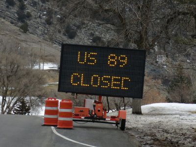
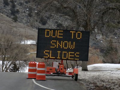
Avalanches closed Highway 89 in Logan Canyon until the following day
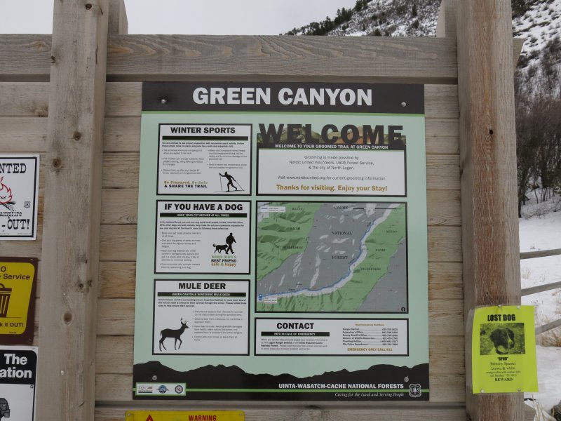
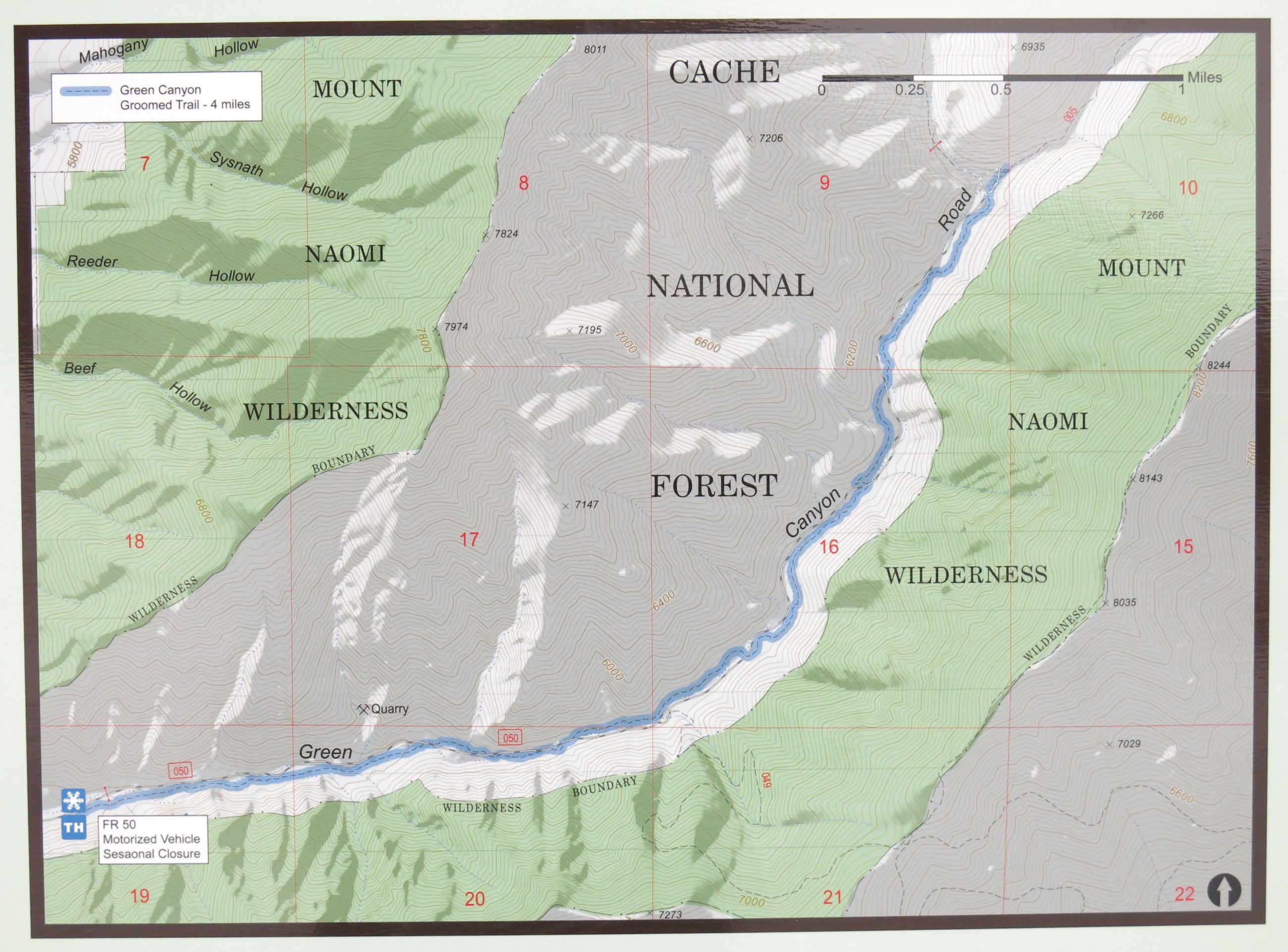
The new sign at the bottom of Green Canyon emphasizes winter recreation (click here for a larger map view)
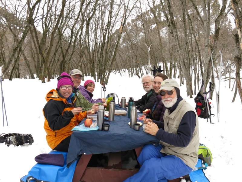
Lunch at the "Green Canyon Cafe"
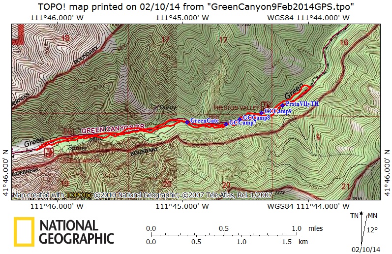
Our GPS track showed 4.2 miles and 580 feet of elevation, up the single track trail and down the road.
You can also look at our route using Google Earth or the various map and aerial views of Google Maps.