
Home
High Creek Lake, 11 July, 2021
Brent, Ophelia, Ralph, Catherine, Keith, Jane and Dave W/ departed from the High Creek trailhead at approximately 9:00 on the Mt. Naomi Peak NRT (National Recreation Trail). The unpaved road beyond the campground was rough and rocky, although a Prius and Camry (a rental) had made it.
After one mile, Dave & Jane peeled off the High Creek Lake trail to go to the waterfall. The remaining five soldiered on to the lake.
The lake was low and at least half covered in algae. Some of the air-exposed algae was thick, brown, and crispy-looking. The beaver ponds were low but with no visible algae. The high waterfall past the beaver ponds was not flowing. The waterfall at approximately mile 4.2 was low but there was a tiny amount of existing snow above it.
Overall, the day was very hazy due to distant fires. No cloud cover. Temperature high was probably close to 90 by the end of the day. Hikers were bothered by biting flies. The falls hikers returned to the parking lot about 1:00 while the lake hikers returned at approximately 4:00.
The following flowers and weeds were observed:
|
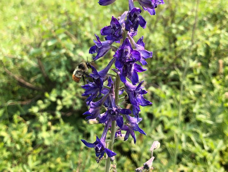
Bee balm Fireweed Salsify Lupine Groundsel Scarlet gilia Larkspur Paintbrush Horsemint Western monkshood Hound’s tongue |
Mountain bluebell Dogbane Showy daisy/fleabane Collomia linearis Penstemon Service berry Sedum Stickseed/false forget-me-not Lewis flax Service berry Wood rose |
Common cow parsnip Nootka rose Colorado columbine Western Clematis Leafy Jacob’s ladder Solomon seal Richardson geranium Western coneflower Engelmann aster Whorled buckwheat Common yarrow |
Parrot’s beak Showy goldeneye Yellow columbine Mules-ear Wythia Twin berry Western wallflower Orange mountain dandelion Yellow monkeyflower Heartleaf Arnica Sticky geranium Wild hollyhock |
Trip Summary:
- Brent,
Ophelia, Ralph, Catherine (leader), Keith, Jane and
Dave W.
- Drove 21
miles to the High Creek Trailhead east of Cove, UT.
- Started
hiking about 9:00, lunch at High Creek Lake 12:45 -
1:15, back at the trailhead about 4:00 (the waterfall
hikers returned about 1:00).
- Clear but
hazy skies, calm winds and afternoon temperature near
90 ºF.
- 10 miles with 2800 feet of ascent and descent for the High Creek Lake hikers, 4.3 miles and 1100 feet for the waterfall hikers.
Thanks to Catherine for the narrative and photos, Jane for photos, and Brent, Ralph, and Dave for photos and GPS data.
 |
|
| At the High
Creek Trailhead |
|
 |
|
| Crossing High
Creek on a well-constructed foot bridge |
|
 |
 |
| Dave and
Jane took the Waterfall trail |
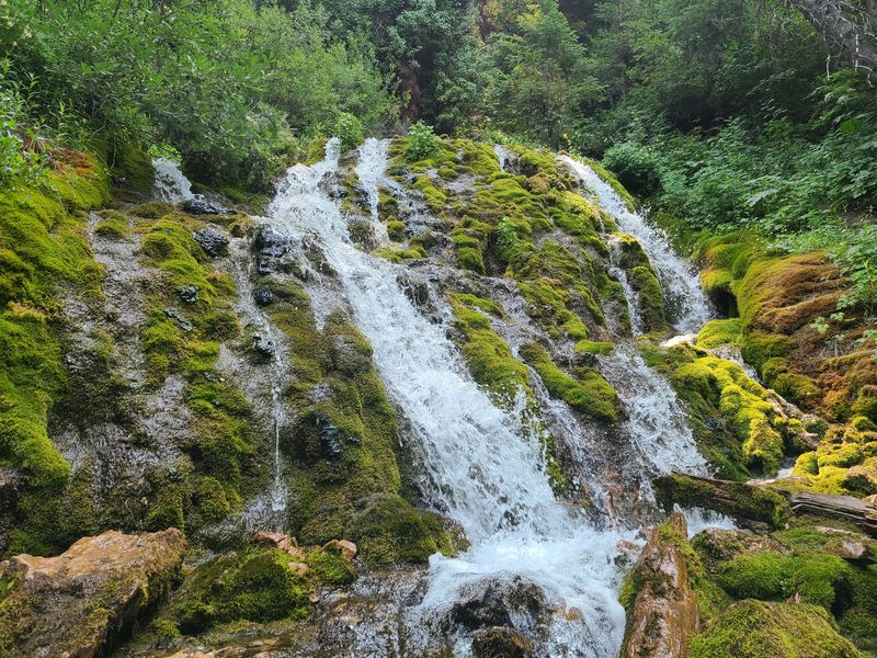
It's more of a mossy cascade than a waterfall |
 |
 |
| The waterfall is a rewarding
destination after a moderate hike |
|
 |
 |
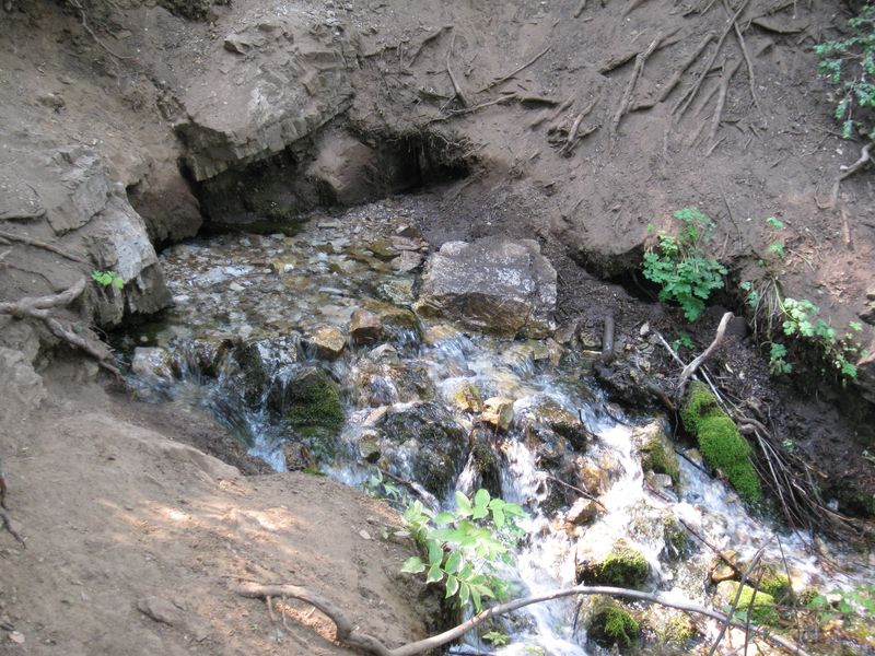
| This spring is the source of
the waterfall's flow |
Crossing the Little Left Hand
Fork of High Creek (this is the stream that comes
from the waterfall) |
 |
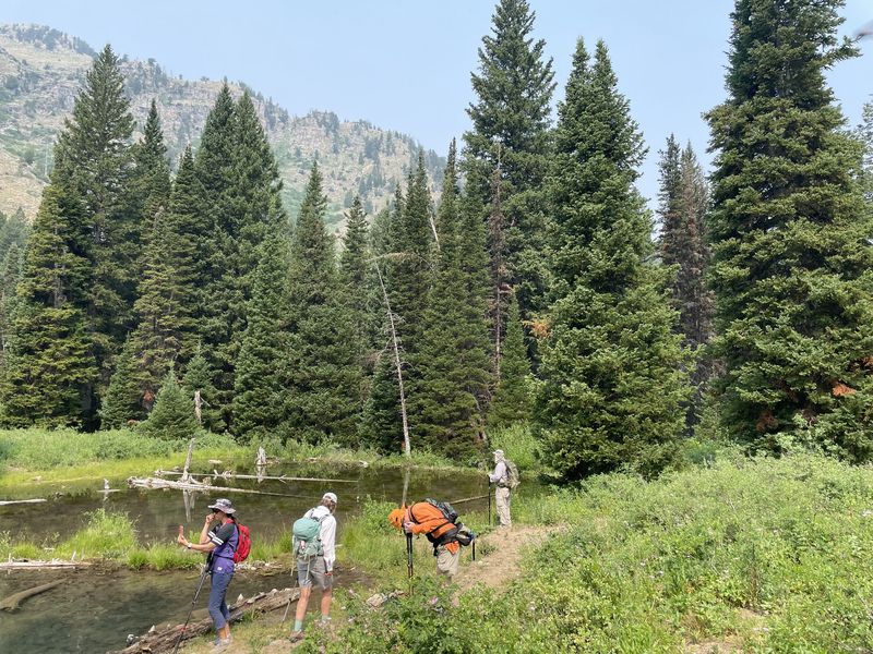 |
| Another High Creek crossing |
There are beaver ponds at about
mile 3.5 |
 |
 |
| Hiking through the meadow below
High Creek Lake |
Enjoying lunch near High Creek
Lake |
 |
 |
| In recent
years High Creek Lake has been afflicted with
floating mats of algae |
|
 |
 |
| Yellow columbine |
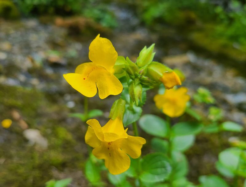
Yellow monkeyflower |
 |
 |
| Paintbrush |
Richardson's geranium |
 |
 |
| Twinberry |
Lupine |
 |
 |
| Larkspur (and a bee) |
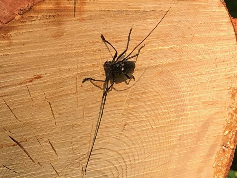
Long-horned beetle |
 |
|
|
Our GPS track shows about 10 miles
and 2800 feet of ascent and descent (4.3 miles
and 1100 ft for the waterfall).
You can look at our route using Google Earth or download our GPS file (or Earth and GPS files for the waterfall). |
|