Limber Pine Ski/Snowshoe, 17 March, 2018
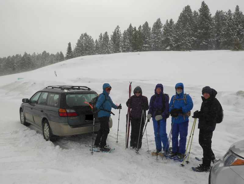
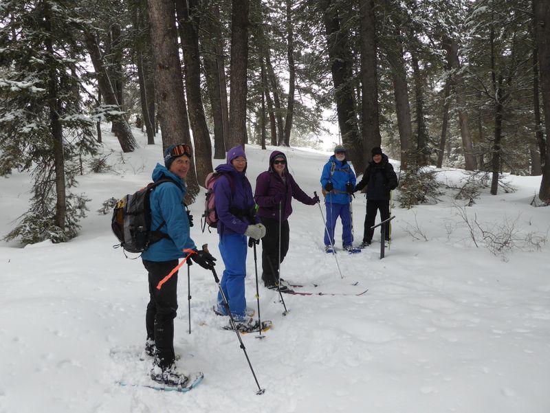
Six Cache Hikers participated in this last scheduled activity of the 2018 winter season despite a weather forecast of rain in the valley and snow in the mountains: Dave P., Dave W. (leader), Maggie (skis), Gordon, Jane and Laurel. We made tentative plans for a lower-elevation alternative, but good road conditions encouraged us to continue on to our original destination.
We parked at the side of US-89 at Bear Lake Summit in howling winds and blowing snow, but conditions improved considerably after we reached the sheltered Limber Pine Trailhead 500 feet down the road. There was 6 inches of new snow on about 2 feet of base, far less snow than last year (see the photo comparison, below).
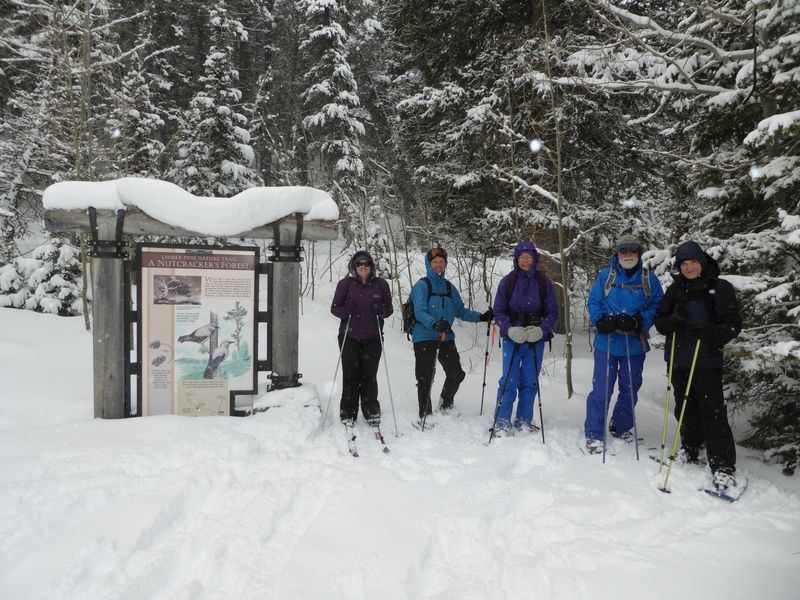
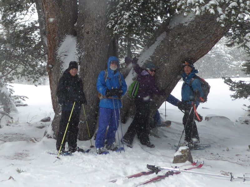
We were pleased to see the new interpretive signs installed by the trail adopter, the Yellowstone to Uintas Connection as we went up the trail to the Limber Pine. We often stop at the tree for lunch, but snowy and windy conditions prompted us to move on toward a more sheltered location.
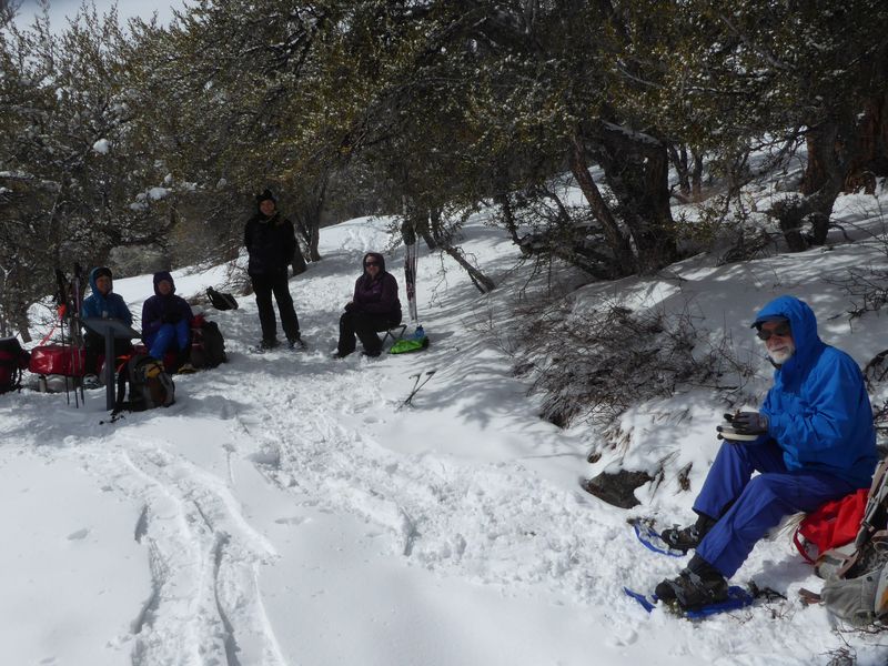
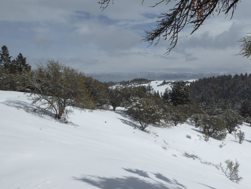
The snow hid the trail here so we got a little off-track as we headed back, but we reached our lunch spot, a bench with a potential view of Bear Lake, about 12:20. The mountain mahogany trees here did a good job of sheltered us from from the wind and the skies cleared up just enough for a glimpse of the blue waters of Bear Lake in the distance. Laurel shared homemade double chocolate cookies with everyone, a special treat.
After lunch we continued to the trail head. This was a short trip, so most people opted for another trip around the loop - but in the opposite direction, for a different experience.
Trip Summary:
- Participants: Dave P., Dave W. (leader), Maggie (skis), Gordon, Jane and Laurel
- Drove 35 miles up Logan Canyon to Bear Lake Summit
- Started out about 11:10, at the Limber Pine 11:45 with lunch 12:20 - 12:50
- Back at our cars 1:45 after a second loop around the trail, and Logan about 2:30
- Variable weather: windy to calm, overcast to clearing, snowing at times
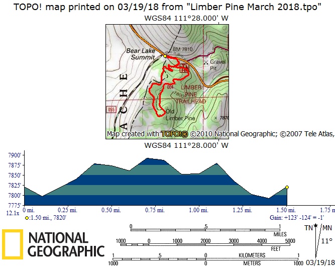
- Our GPS track showed 1.5 miles with about 150 feet of ascent and descent (nearly double this for those who took two loops around the trail).
Thanks to Dave W. for the narrative, photos and GPS data.
|
|
| Snowing and blowing at Bear Lake Summit | |
 |
|
| Calmer conditions at the trailhead | |
 |
 |
| The snow was much deeper in 2017 (right) | |
 |
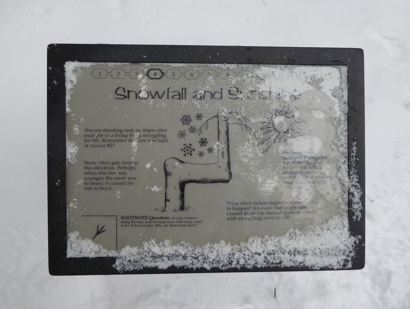 |
| On the trail | New interpretive signs |
 |
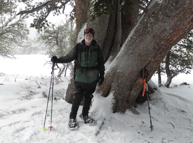 |
| Two-person tree hugging | Dave was there, too |
 |
|
Lunch |
|
 |
|
| Bear Lake view, from our lunch spot | |
2018.jpg) |
|
| Heading back in the sunshine | |
 |
|
| Our GPS track shows about 1.5 miles and 150 feet of ascent and descent | |
You can look at our route using:Google Earth, the various map and aerial views of Google Maps or download our GPS file |
|