Home
Mount Elmer, 12
September, 2015
Four Cache Hikers participated on the trip to Mt. Elmer, a
prominent peak in the Bear River Range. Dave W, Dave
P and Chris drove up 1900 North in Logan to the end of the
Green Canyon Road, stopping along the way to chat with
Camille of the Logan Ranger District. At the end of
the road we met Ryan, who had ridden up on his
cruiser-style bicycle. Dave W was the substitute
hike leader, since the scheduled leader, Alex, was away
for the weekend.
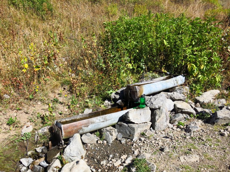
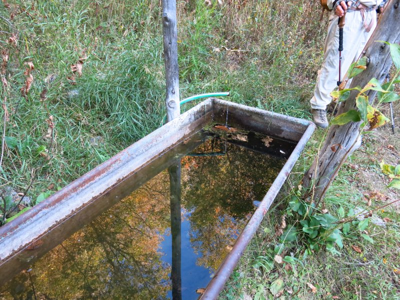
We started hiking just before 9:00 under clear skies and pleasant temperatures. About 10:30 we arrived at the spring and watering trough, 2.8 miles from the trailhead. Our pace slowed a bit as we climbed the steep trail to the main ridge. Energetic Ryan pushed ahead, reaching Mt. Elmer before the others, and tired Dave W dragged along, finally getting to the peak about 1:30.
We enjoyed lunch on the peak, with great views, accompanied by a dozens of ladybird beetles crawling everywhere. About 2:00 we started back. Ryan hurried ahead to make sure he got back on time for a commitment in Logan. The others arrived at the trailhead at 5:20 and Logan by 6:00. We did not encounter Ryan on the way, so we assume he made it back in time.
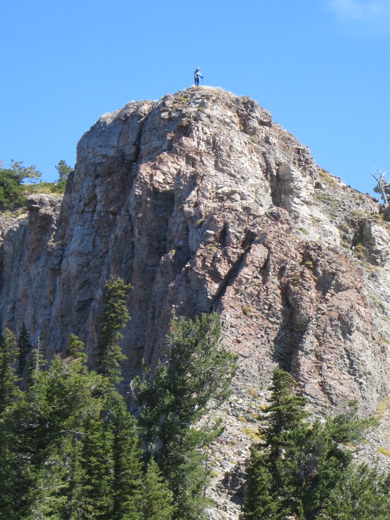
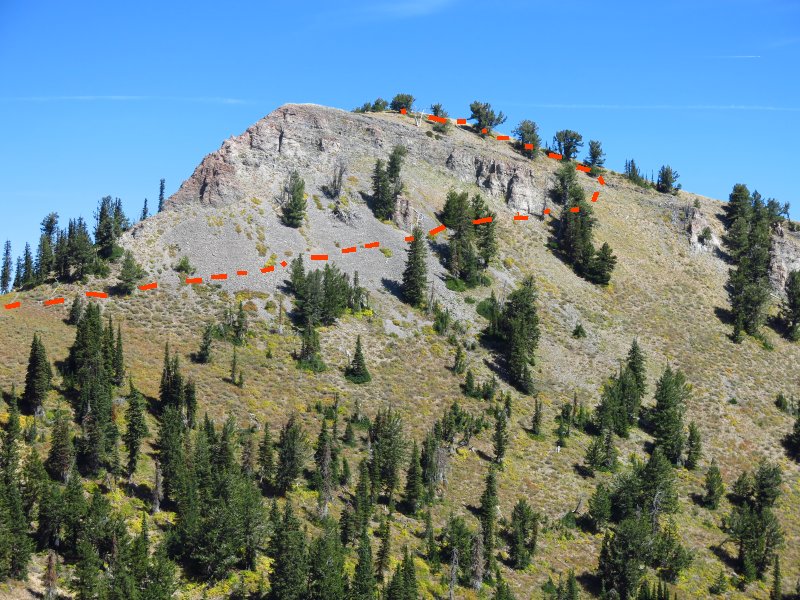
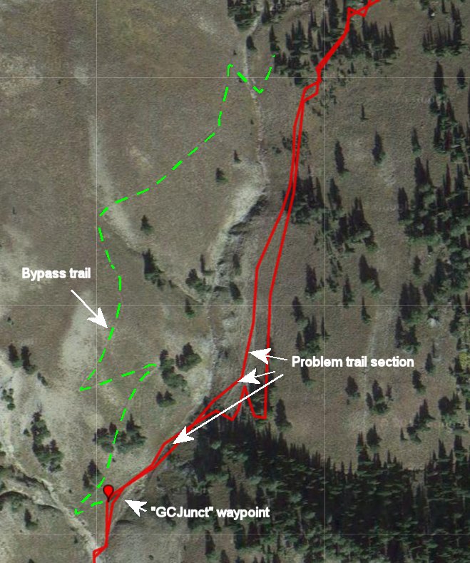
Trail Notes: 1. A steep and rocky section where the trail crosses over to the east side of the drainage about mile 3.1 continues to cause difficulty. We experienced poor footing here and a cow carcass showed this section could be treacherous for livestock. The Forest Service built a trail section to bypass this area on the west, but few trail users follow it. The bypass trail branches off about mile 3.0 (waypoint "GCJunct" on the map and links below) and switches back uphill for a short distance before turning north and gradually descending to the canyon bottom and back uphil to the original trail. Unfortunately the trail at the north end becomes indistinct and there are no signs marking either end. 2. We traversed a steep side hilll to get around cliffs on our way to the top of Mt. Elmer (see our off-trail route marked on the photo, below).
Trip Summary:
- Left Logan 8:05 and drove 9 miles to the end of the Green Canyon road
- Started hiking 8:55
- Lunch 1:30 to 2:00 on Mt. Elmer
- Back at the trailhead at 5:20 and Logan at 6:00
- Clear skies and pleasant temperatures
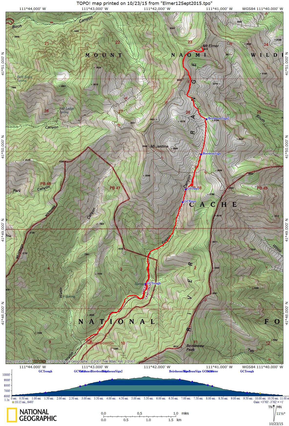
- 11.1 miles with more than 3500 feet of climbing
Thanks to Dave W for the narrative, Dave W, Dave P, Chris and Ryan for photos and Dave W for the GPS work
|
|
|
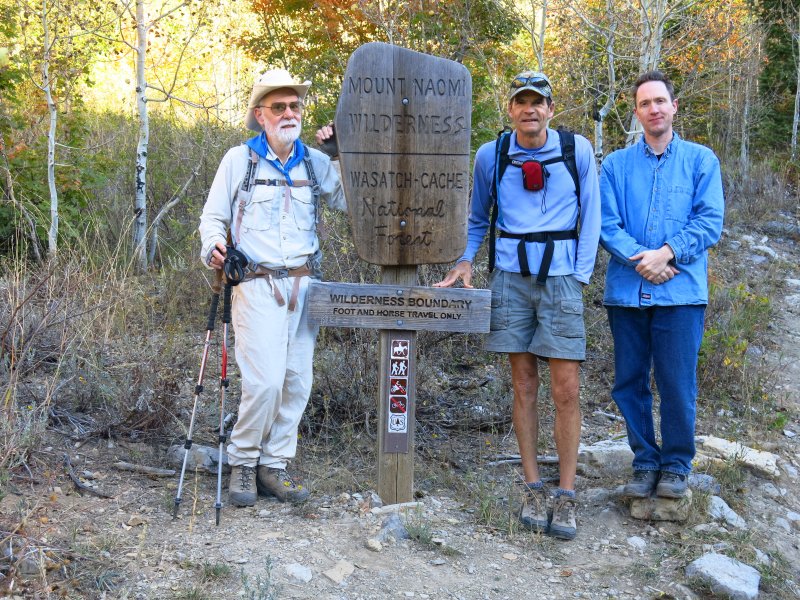
| At the Wilderness Boundary | |
|
|
|
|
Spring and water trough at mile 2.8 (halfway to the peak) |
|
 |
|
| Looking east to Mt. Elmer, showing our off-trail route around the cliffs and up to the top | |
 |
|
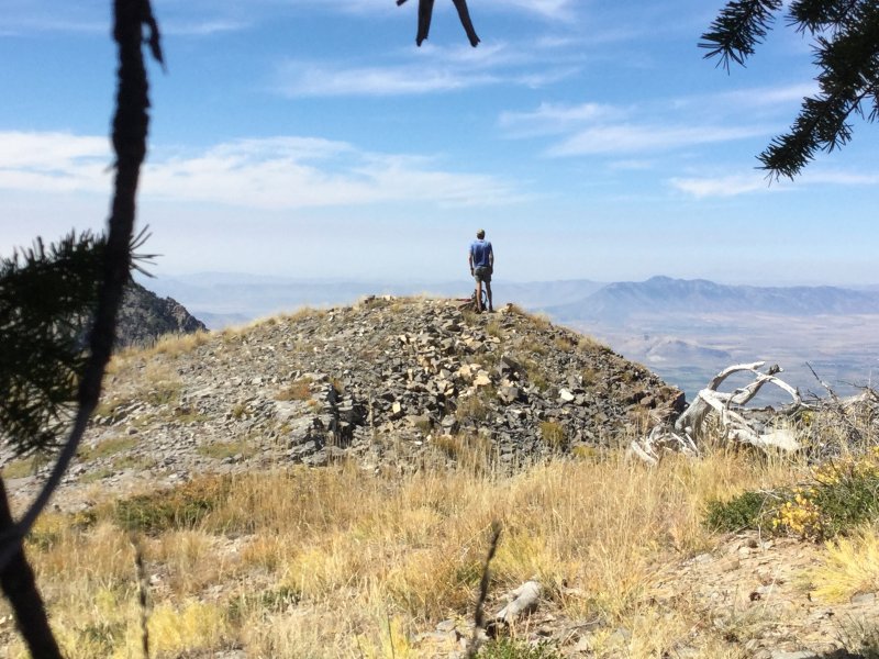
| Looking west from Mt. Elmer, over Flattop and toward Cache Valley, with hikers on the trail below | |
|
|
|
| Ryan on Mt. Elmer | Dave W, almost past the Mt. Elmer cliffs |
|
|
|
| Ladybird beetles on our clothing (and everywhere) | Chris enjoying the view from Mt. Elmer |
 |
|
| Checking water flow at the first trough, 1.4 miles from the trailhead | |
 |
|
| Trail users are ignoring the "new" trail section built to bypass a problem area | |
 |
|
| Our hike totaled 11.1 miles, with 3500 feet of climbing | |
|
You can also look at our route using Google Earth or download our GPS file. |
|