Home
Mount Jardine Hike, September 1, 2012
Dave P. led the Cache Hikers to Mount Jardine in the Mount Naomi
Wilderness Area. We have explored several routes to this peak in
recent years, and this route promised to be the most direct
way. We planned to start hiking up the trail we usually call
the "Green Canyon Trail", but that name officially belongs to a
hiking/biking/horse trail in lower Green Canyon. In
fact, our trail actually is the south-western end of the Mt. Naomi
Peak National Recreation Trail (NRT), a 24-mile wilderness trail
extending from Green Canyon to High Creek, with access to Tony
Grove and Naomi Peak along the way.
A morning thunderstorm threatened to interfere with our plans, but
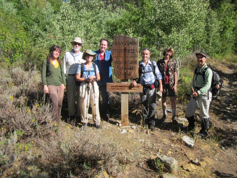
the weather cleared by 8:00, our usual meeting time. Eight
hikers joined this event; Dave P., Dave W., Denis, Ryan, Kathy,
Jane, Anne and Florence. The rough road to the Green Canyon
Trailhead made for slow travel, so we did not actually start
hiking until nearly an hour after we left Logan. Long, wet
grass along the first two miles of trail soaked our legs, but we
knew our long pants would be appreciated during the off-trail
section below Mount Jardine.
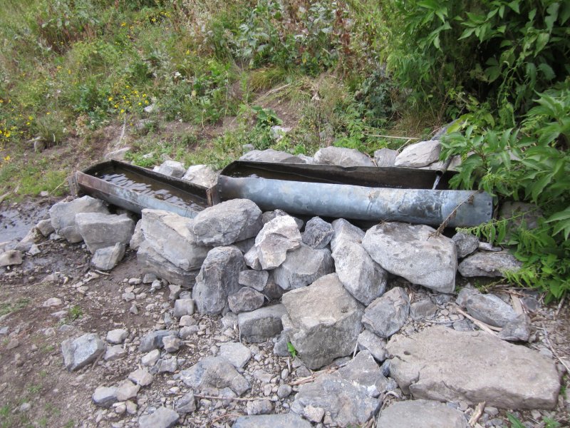
The watering troughs at mile 2.75 provided a pleasant spot for a
late morning rest. We were still at the spring when a group
of horse packers arrived, three riders and five heavily-laden pack
stock, on their way to set up a wilderness hunting camp. After less than 1/4 mile past
the water trough spring, we came to the unsigned junction that marked our
departure from the main trail. A few years ago trail crews
started building an alternate route along the south-facing slope
at this point in an apparent attempt to bypass difficult terrain
on the other side. The new trail segment only goes about 2/3
mile before it stops, compelling up-canyon hiker travelers to
descend to the canyon bottom and cross over to the old trail on
the other side. However, we realized this new trail segment
could be an excellent place to start an off-trail trek up to Mount
Jardine.
We took the new trail up the south-facing slope for about 0.4
miles. This was the turn-around point for three of our
hikers, and the others headed directly up the ridge toward Mt.
Jardine. Topographic maps actually show a trail along this
route, but we found no trace of it (it is marked as trail
131 on the map, below). Nevertheless, although steep and
moderately brushy, this ridge route proved to be a quick and
relatively easy way to Mount Jardine. Fortunately we enjoyed
cool temperatures and a partially cloudy sky, since this open,
south-facing slope could be brutal under a blazing sun in hot weather.
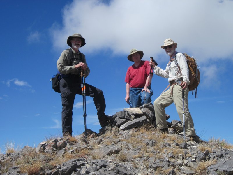
We started back down after a leisurely lunch and photo session on
the peak, just as dark clouds started moving in from the
southwest. The threat of rain soon became reality, but
fortunately the main storm held off until we were safely in our
vehicle, driving down Green Canyon. (This was the northern
edge of a major storm, with severe winds and flooding along
Wasatch Front to the south).
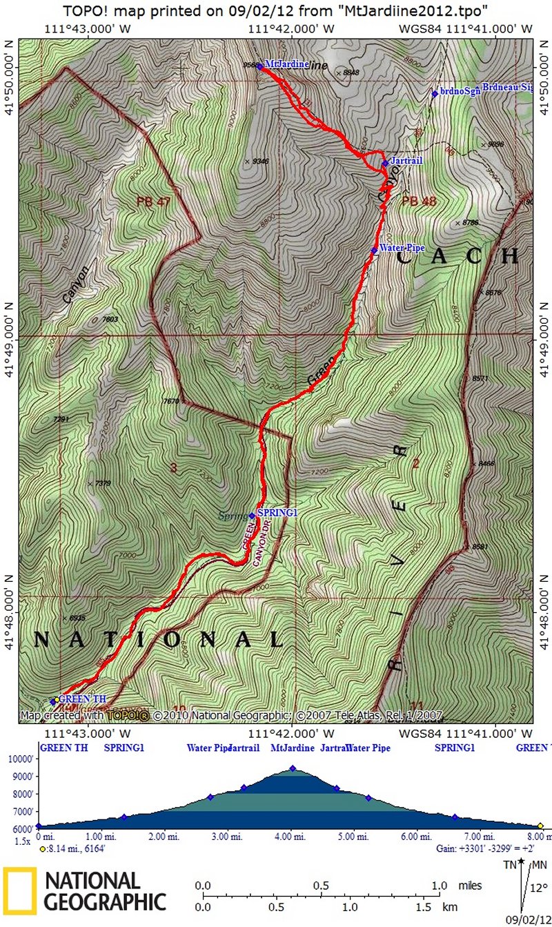
Our hike to Mount Jardine totaled eight miles with 3300 feet of
elevation and six hours duration. The three hikers who went
back early traveled 6.5 miles and 2200 feet of elevation. By
splitting into two groups, we were able to combine a long,
strenuous hike with a shorter and easier option, an approach we
likely will take into account when planning future outings.
The Wilderness boundary,
1.75 miles into the hike.
This spring, at 2.75 miles, is a reliable source of cool, clear
water
Mount Jardine summit, 9566 ft. (2916 meters) elevation
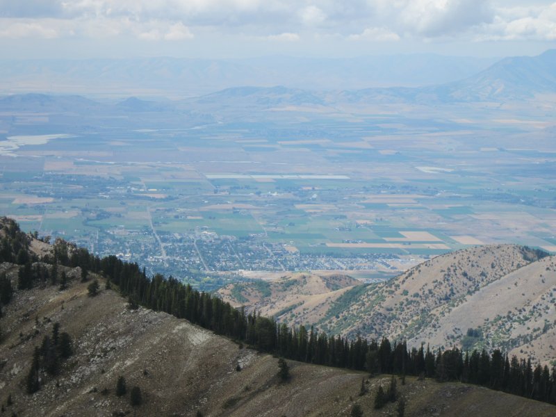
Looking over Cache Valley and Smithfield, from Mount Jardine
The GPS track of our trip shows 8 miles total distance, with 3300
feet of climbing