
Home
Nielson's Well Hike, 30 August, 2020
Twelve hikers departed the Smith's parking lot around 8:10 a.m. to our destination, the Blind Hollow trailhead. We met our thirteenth hiker at the trailhead and departed for our hike at 8:40 a.m. with a brisk 49 degree temperature, calm winds, and clear, but slightly hazy skies. A quick road crossing and climb of 150 feet got us into sunshine as the sun rose over Temple Fork.
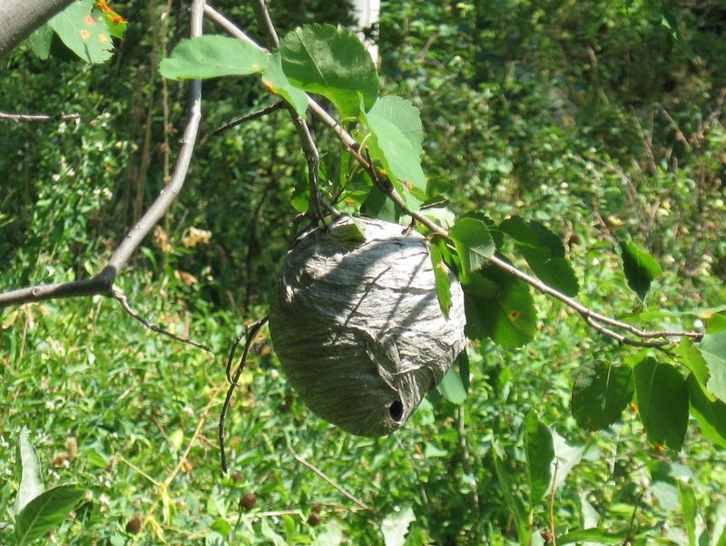
From there we proceeded into the narrow confines of Blind Hollow. About the one-mile mark we started to see the first trickles of water in the formerly dry stream bed. We continued to see and hear water in the stream until we reached our turn-off point at about mile 2.5. The hike to this point was in a mixture of aspens and evergreens. Hikers noticed the stark difference in canyon walls to the east (dry and brown) with those to the west (green and lush). We met a pair of hikers descending the hollow about half-way up and stopped to admire a well-formed, but apparently empty hornet's nest.
After gathering at our turn-off point, we ventured southwest into an unnamed drainage on our way to our ultimate destination of Nielson's Well. Nielson's Well is a relatively recently "discovered" and mapped cave, having been explored and mapped during a 2-year period from 1986 to 1988 by Ken Stahley, Jim Nicholls, Mike Beer and Rodney D. Horrocks. Additional information about the discovery and mapping activities can be found at https://caves.org/grotto/timpgrotto/caves/nielsons_history.html. In keeping with the Federal Cave Protection Act of 1988 (https://www.law.cornell.edu/uscode/text/16/chapter-63) we will not disclose the location of this cave. Our GPX track only shows one of our lunch spots.
We arrived at the cave around 11 a,m, to find very recent trail work on the final 30 yards, or so leading to the cave, including a few tools that appear to have been left behind. We also noticed a gear stash nearby which we left undisturbed.
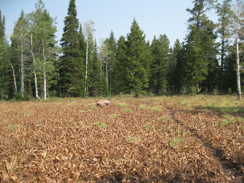
With temperatures around 65 degrees, we decided on an early lunch. A few in the group decided to have lunch at the cave, while the remainder chose a viewpoint to the East of "the rock in the middle of the meadow." The "cave group" enjoyed a shaded lunch among the towering firs and the grotto-like cave opening. The "view group" enjoyed lunch on a sunny rock outcropping with views of Temple Peak and a refreshing breeze.
After lunch we returned to the Blind Hollow trail about about 12:30, and began our return route. Gathering the group once again, we began our return trip to the trailhead. We encountered one mountain biker (with dog) descending the trail, as well as two additional hikers heading up the hollow.
At various points along the return we noticed serviceberry shrubs which we had overlooked earlier in the day. Several of the shrubs contained ripe fruit and several hikers liberally sampled the berries. Another abundant berry visible during the hike were on Baneberry bushes - hikers DID NOT sample these poisonous berries.
We made it back to the trailhead around 1:40 p.m. where the 13 hikers said their goodbyes and headed home.
Trip Summary:
- Participants: Brent, Dan, Dave P, David, Deanna, Jane, Kathy, Kris, Laurel, Michelle, Susan, Tawnya, Teresa
- Drove 15 miles to the Blind Hollow trailhead
- Started hiking at 8:40 a.m. Lunch at 11:15 a.m. Returned to trailhead at 1:40 p.m.
- Temperature of 49 degrees at the start of the hike. Lunch temperature was around 65 degrees in the shade with a slight breeze. Skies were clear, but slightly hazy.
- Total distance was 7.0 miles with an elevation gain of 1995 feet.
Thanks to David for the narrative, photos and GPS data, and Teresa, Tawnya and Jane for photos.
 |
|
| Enjoying the morning sun near the mouth of Blind Hollow | |
 |
|
| Lunch with a
view |
|
 |
 |
| A meadow along the way to the cave |
Near the cave entrance |
 |
|
| We found newly
dug trail tread and trailmaking tools as we
approched the cave location |
|
 |
|
| "Nielson's Well" | |
 |
|
| Gazing into the abyss |
|
 |
 |
| "Twins" |
Baneberry |
 |
 |
| Showy goldeneye |
Bald-faced hornets nest |
 |
|
| Rubber boa going into the water |
|