Home
Providence Canyon Hike, August
31, 2013
Nine Cache Hikers joined this late summer hike up Providence
Canyon: Dave W., the leader, Dave P. Jane, Stephanie G.,
Terry, Deann, Gordon, Ryan and Joe. After carpooling from Logan,
the group left the parking area at the mouth of Providence Canyon
and started out about 8:35. We enjoyed relatively cool
and shady hiking most of the way to the end of the "new" trail
after 2.9 miles. We continued on a "user" path another 0.15
miles, then walked up the road to the top end of the quarry at
mile 3.7. After eating our lunches, most of the hikers
walked up to the waterfall and springs high above on the south
side of the canyon, adding another 2/3 mile to the hike.
Of course, the afternoon portion of our hike was warmer, but the
shady trail made for pleasant walking. We encountered a
number of mountain bike riders on the trail, and people were
shooting guns at the quarry and along the road as we walked down
the canyon. Most of the summer wildflowers are gone, but we
saw hoary aster, showy goldeneye, and red Zauschneria near the
spring. To our surprise, we also saw a black-and-white
domestic rabbit about a mile from the bottom of the trail.
Our hike totaled 8 miles and 1900 feet of climbing for those who
went to the spring and 7.3 miles with 1650 feet for the
others. We returned to Logan at 2:00.
Thanks to Dave W. for
the narrative, photos and GPS work.
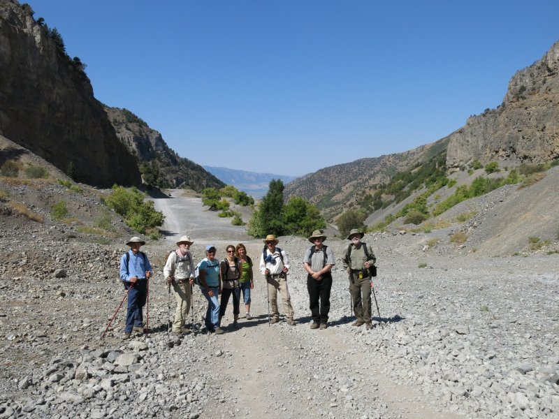
At the quarry (compare this with the photo from our March 2013
snowshoe trip).
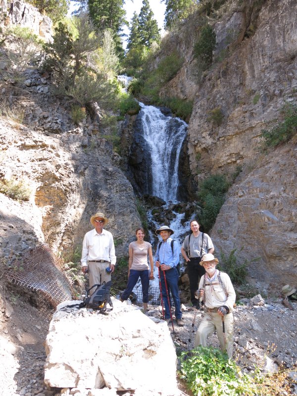
Water from this spring is diverted into an underground pipe
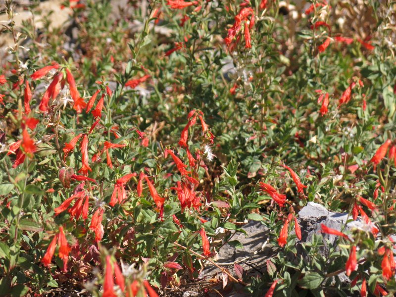
Zauschneria (Epilobium canum) growing in a dry, rocky
area near the spring
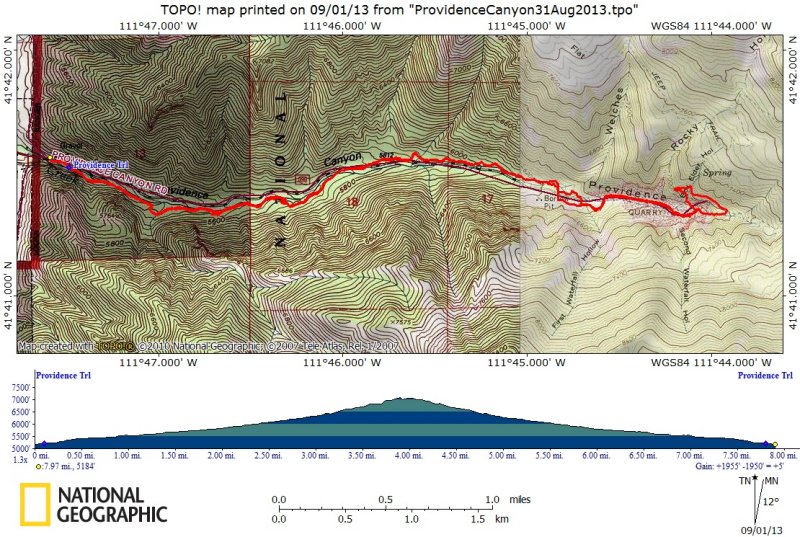
This is a topographic map showing our GPS track.
You also can see our GPS track using Google Maps or
Google Earth.