Home
Richards Hollow to Card West, 20 June, 2015 (revised 7/4/2015)
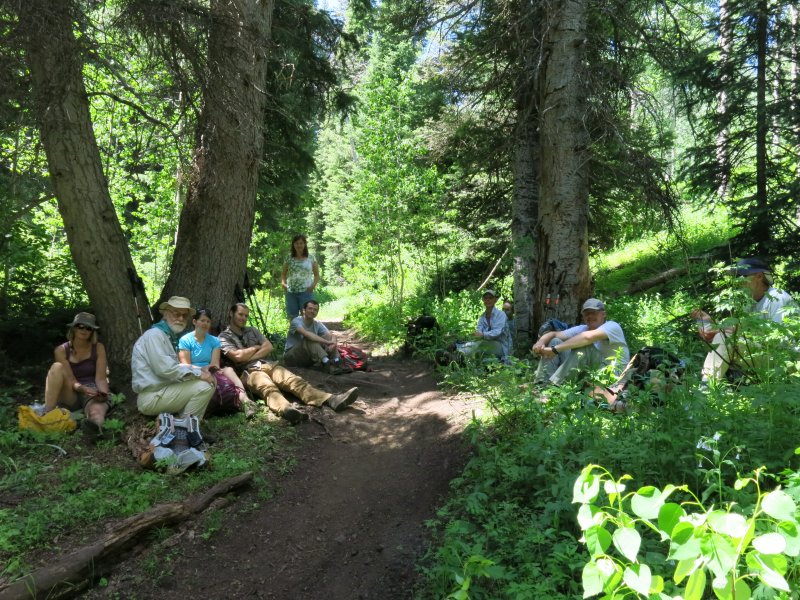
Eleven Cache Hikers participated. Jane, Dave P., Alex and Stephanie went north up Richard's Hollow with hike leader Catherine, while Dave W., Dan, Jason, Ryan, and Deanna hiked south up Card Canyon with Jim, the other hike leader. This was our first key exchange hike in many years. Despite some initial apprehension and confusion, both groups were able to find each other and have a successful key exchange in upper Richards Hollow.
Hiking north, up Richards Hollow and down Card Canyon:
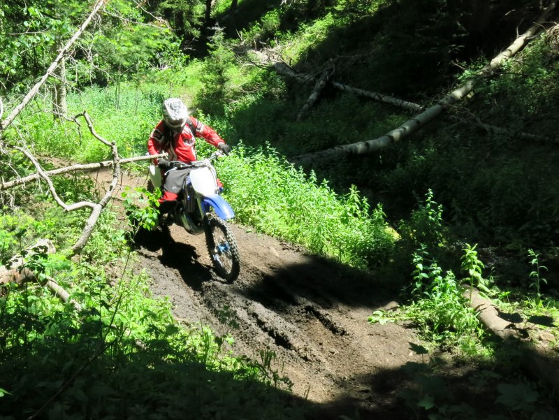
This was a good hike, not too hot especially given the weather down in Cache Valley. The vegetation was very lush and while streams were running, they could be crossed without getting wet feet. About a dozen motorcycles were encountered (it was the opinion of some of us that they were going too fast given our presence). The steepish and rocky portion of west Card Canyon caused footing problems for the downhill hikers. Mosquitoes and biting flies became bothersome in the afternoon, unlike most of our hikes and probably caused by the livestock that utilize this area later in the summer.
Hiking south, up Card Canyon and down Richards Hollow:
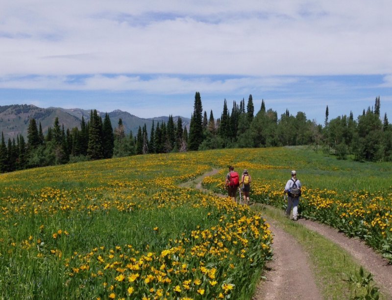
The hike up the west fork of Card Canyon was a steep slog through dense forest providing much needed shade and an occasional view of the canyon walls. We were rewarded for our efforts with a spectacular meadow of blooming wildflowers at the top of Card Canyon. We took dozens of pictures as we hiked through the meadow, with wonderful views of Card Canyon and the Bear River range in the distance.
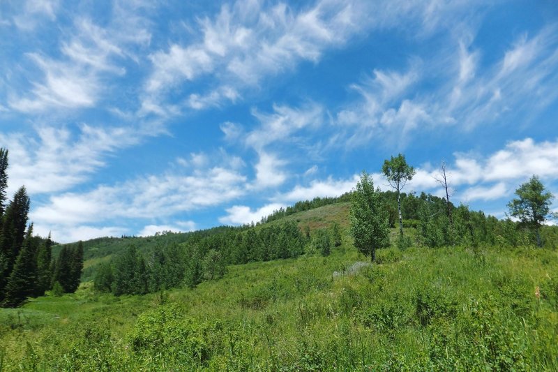
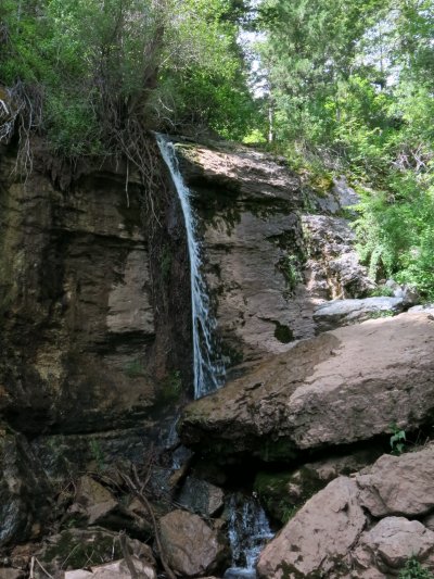
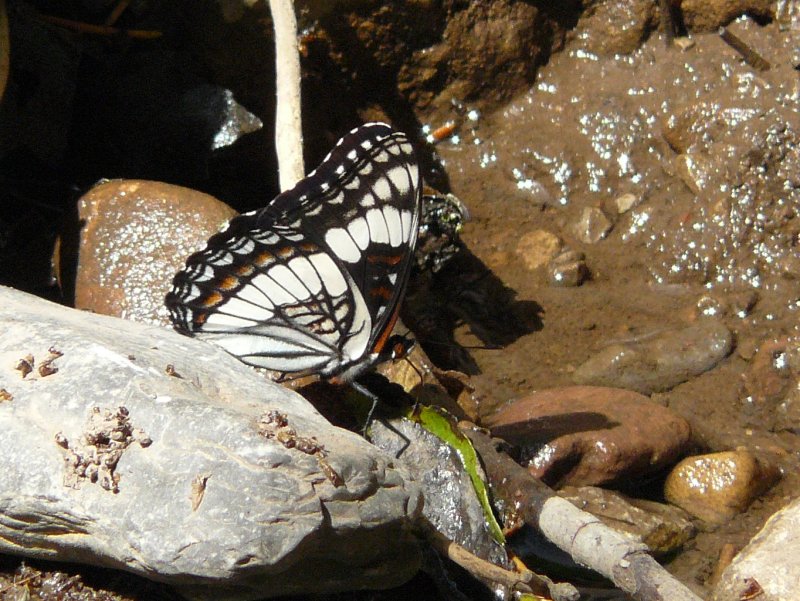
Hikers who had not been in upper Richards Hollow before were impressed with its lush and scenic beauty as we watched wispy clouds drift across the sky. Lower Richards Hollow had towering cliff faces and unusual rock formations. The group hiked down to the waterfall to find cool temperatures from the deep shade and cold water. Jason told us of his hike to the waterfall earlier in the spring when the flow was much higher and hiking conditions much wetter. At the bottom of Richards Hollow we found several different species of butterflies near the creek. Dan took a beautiful picture of a Weidemeyers's admiral (Limenitis weidemeyerii).
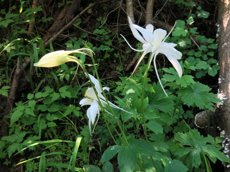
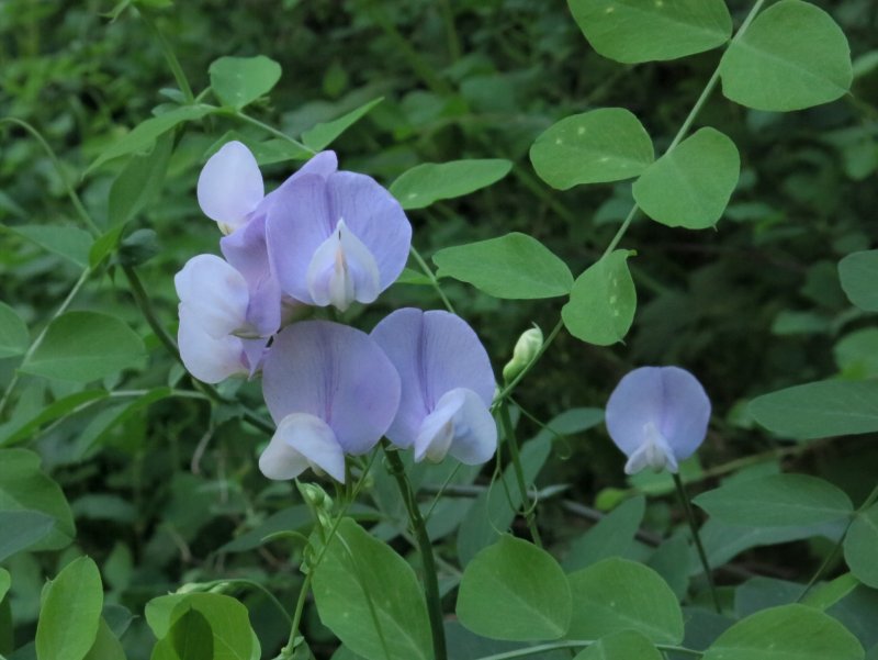
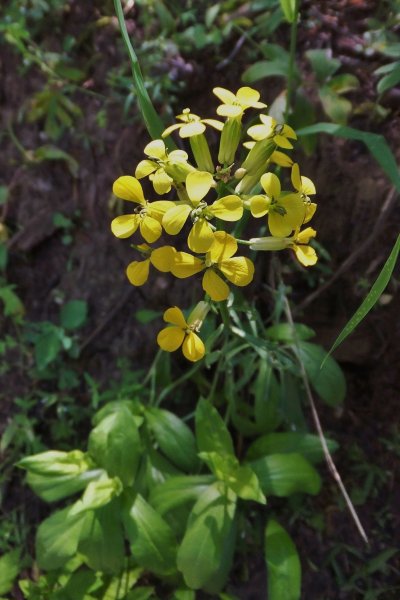
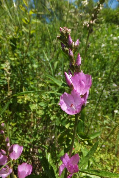
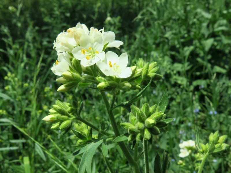
Wildflowers included wild onion, both white and pink geranium, rose, scarlet gilia, Jacob's ladder, yellow monkey flower, Indian paint brush, columbine, bluebells, larkspur, lupine, mules ear, big-leaf balsamroot, northern sweetvetch, wild sweetpea, checkermallow, wallflower and more. Hikers were especially delighted by the expansive bluebell hillsides in Richards Hollow and the stunning mulesear display at the top of Card Canyon.
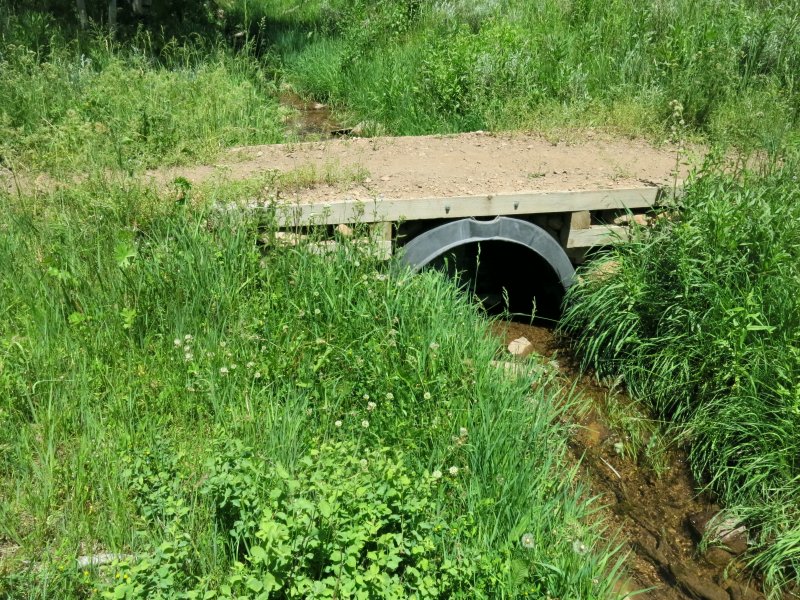
Editors note: Much of the Richards Hollow trail is part of the Great Western Trail system. We were pleased with the trail improvements here, but not so pleased with the eroded ruts and the weeds; goatsbeard, dyers woad, and especially for the first two miles north of the Richards Hollow trailhead, burdock and houndstongue.
Trip Summary:
- One group carpooled 10 miles to the Card West gate and started hiking at 8:50
- The other group carpooled 18 miles to the Richards Hollow trailhead and started hiking at 9:15
- Groups met in upper Richards Hollow to exchange car keys and eat lunch, 12:20 - 1:05
- All back in Logan by 5:00
- Mostly clear skies, calm and warm
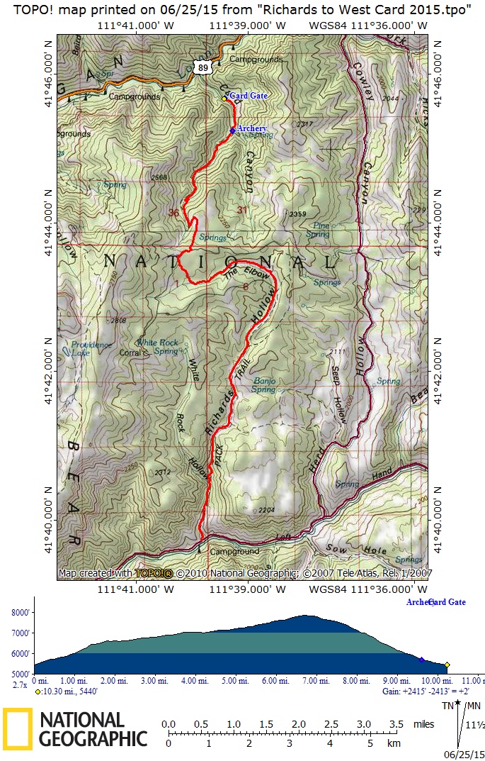
- 10.3 miles with 2400 feet of elevation
Thanks to Catherine and Jim for the narrative, Dave P, Dave W, Dan, Jim and Catherine for photos and Dave W for the GPS work.
|
|
| Enjoying a shady lunch break in upper Richards Hollow | |
|
|
Mulesear meadow at the top of west Card Canyon |
|
|
|
| Wispy clouds over Richards Hollow | |
 |
 |
| Wallflower | Oregon Checkermallow |
 |
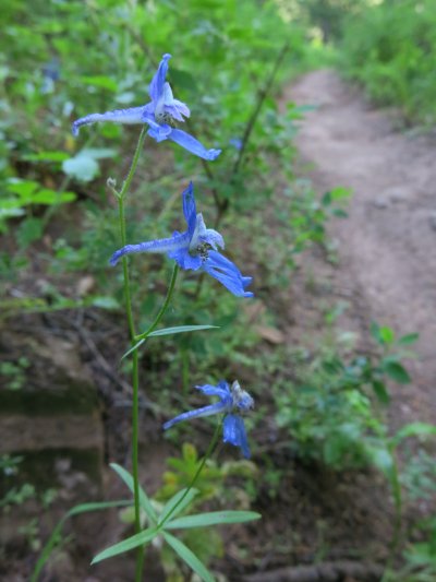 |
| Waterfall in Richards Hollow | Larkspur |
|
|
| Columbine | Wild Sweetpea |
 |
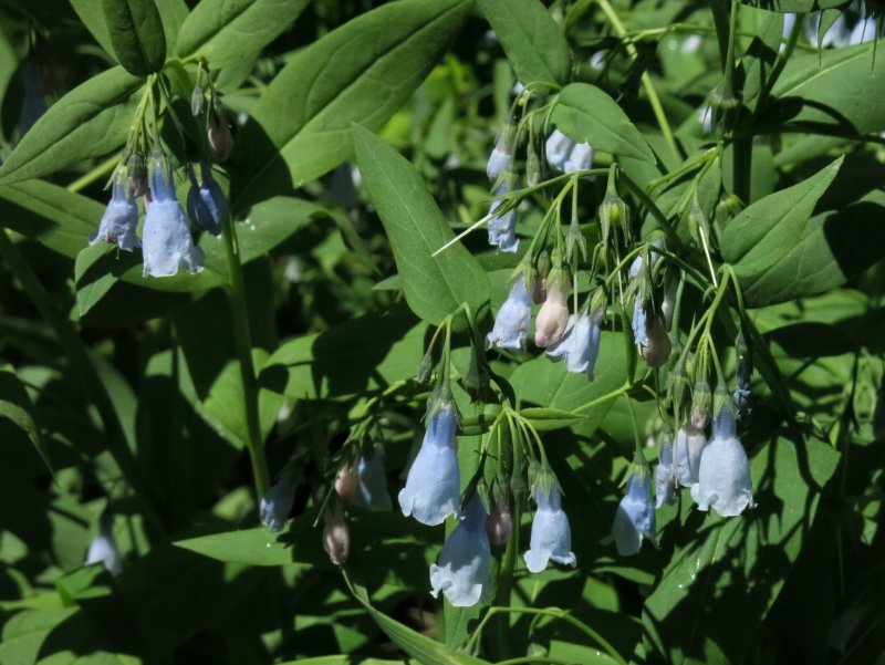 |
| Jacob's Ladder | Bluebells |
 |
 |
| Weidemeyer’s Admiral Butterfly | White Bedground Spring in upper Richards Hollow |
 |
 |
One of about a dozen motorcycles |
Trail improvements in Richards Hollow |
 |
|
| Our GPS track showed 10.3 miles and 2400 feet of elevation gain | |
You can also look at our route using Google Earth or the various map and aerial views of Google Maps |
|