Home
Stump Hollow Ridge, 15 February, 2026
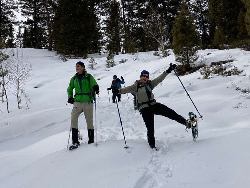
Twelve Cache Hikers turned out for the Stump Ridge snowshoe, all on snowshoes. The group arrived at the trailhead at Beaver Junction Winter Trailhead about 11:00 to warming temperatures. We crossed US-89, donned snowshoes, and made our way up the trail and into the woods. Everyone started by following the "official" trail (Stump Hollow GWT, 7606G). Four "amblers" (Christine, Jane, Brent L and Dave W) stopped after 1/3 mile to saw a log that had fallen across the trail before continuing. Four "ridge" people, Teresa, Dave P, Ophelia and Dan, followed the trail for one mile before heading off-trail to the west, up to the ridge. The remaining four, Chris, Sue, Bruce and Kathy continued up the trail, following the "traditional" route up Stump Hollow.
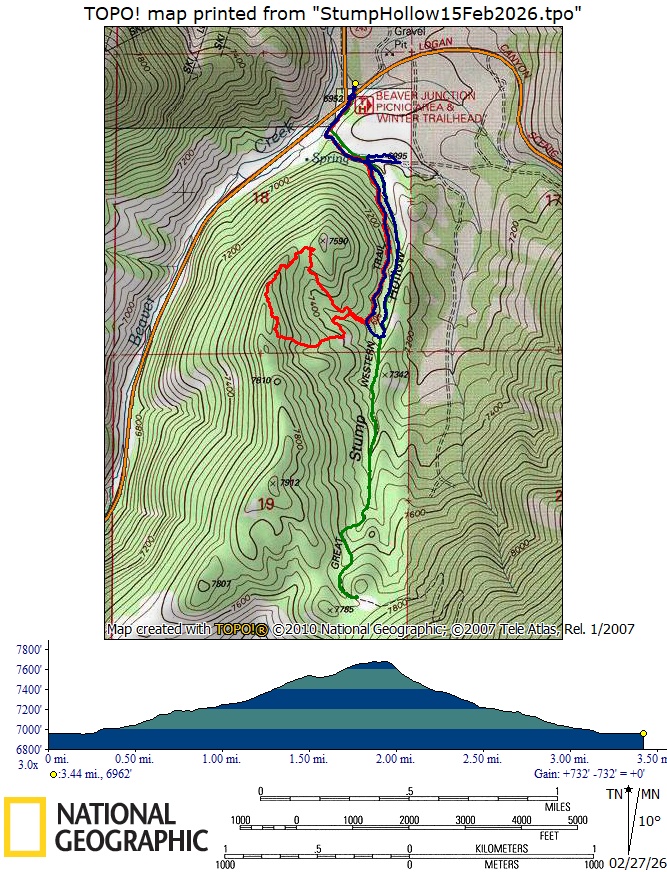
The ridge group traveled toward the northwest, climbed a steeper section onto a small hill with good views and an interesting dead tree. They continued through open forest with mountain mahogany, reaching the ridge at an elevation of approximately 7500 ft. and stopped for a lunch break. Traveling southwest along the ridge, they passed large Douglas fir trees and enjoyed views of Beaver Mountain and Stump Hollow. Upon reaching an elevation about 7700 ft., they left the ridge, descended to the east to the trail, then north and back to the trailhead by way of the old jeep road in the drainage.
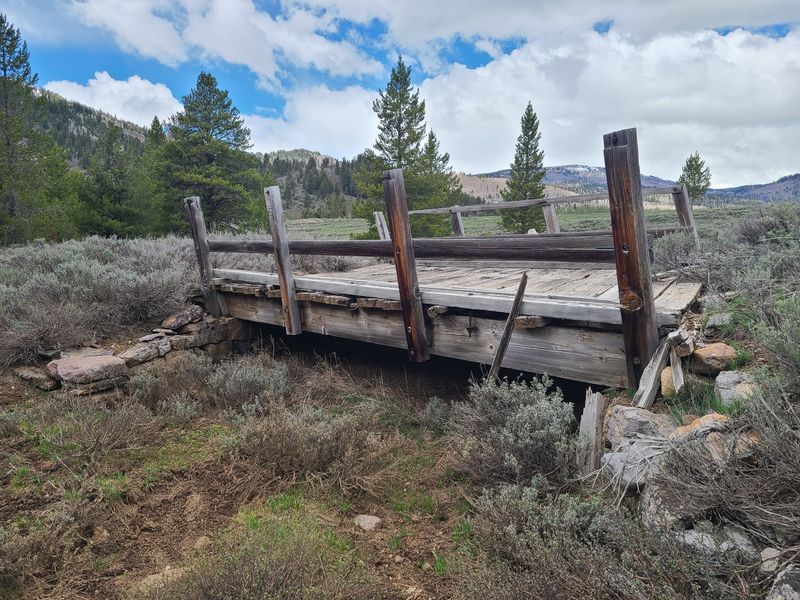
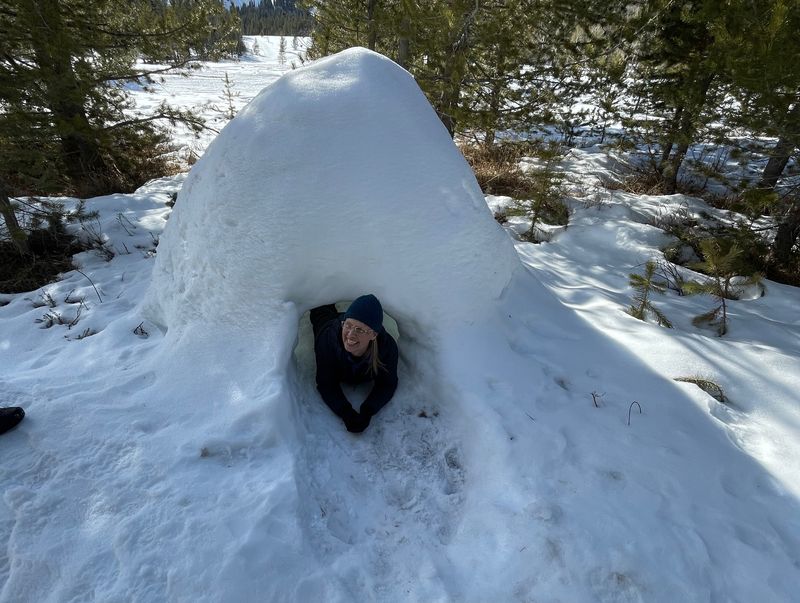
After sawing the log that was blocking the trail, the ambler group traveled south on the official trail until they reached the old jeep road in the drainage. After a lunch break, they started down the old road and were soon joined by the tradional group on their return. Both groups made a side-trip to an historic bridge on the old Garden City Road route before returning to the trailhead about 2:45. From the trailhead, the amblers drove up to the Sink Hollow Winter Trailhead to see an igloo (it was built on Jan 20 by someone using an "Ice Box" tool). The ridge group returned to the trailhead about 3:05.
Trip Summary:
- Twelve snowshoers, Dave W, Dave P,Jane, Chris, Brent, Christine, Bruce, Sue, Teresa, Kathy, Ophelia and Dan (leader)
- Drove 28 miles to the Beaver Junction Winter Trailhead
- Participants
separated into three smaller groups, each with their
own objective (they communicated with walkie-talkie
radios)
- Started hiking about 11:05, returned to the parking area from about 2:45 to 3:05
- Overcast skies, calm winds and moderate winter temperatures
- About 3.5
miles and 750 ft. ascent (ridge group), 2.4 miles and
200 feet ascent (ambler group), and 4 miles with 800
feet of ascent (traditional group)
Thanks
to Dan for the narrative and photos, Dave P, Sue, Jane
and Ophelia for photos, and Dave W and Teresa for GPS
data.
 |
|||
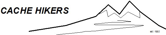
| At the Stump Hollow trailhead | |||
 |
Feb2026.jpg) |
||
| The ambler
group did a good job cutting that troublesome
fallen log (Jan 4, 2026, left,and Feb 15,
2026, right) |
|||
 |
|||
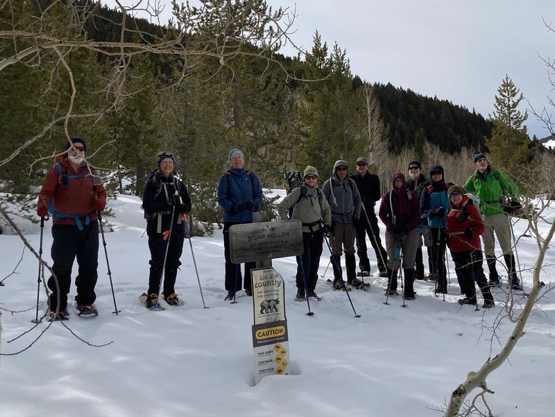
| The ridge group, ascending | |||
 |
 |
||
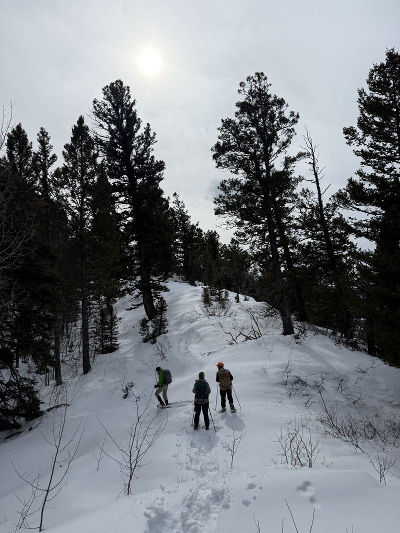
| Ridge people,
enjoying lunch and descending |
|||
 |
|||
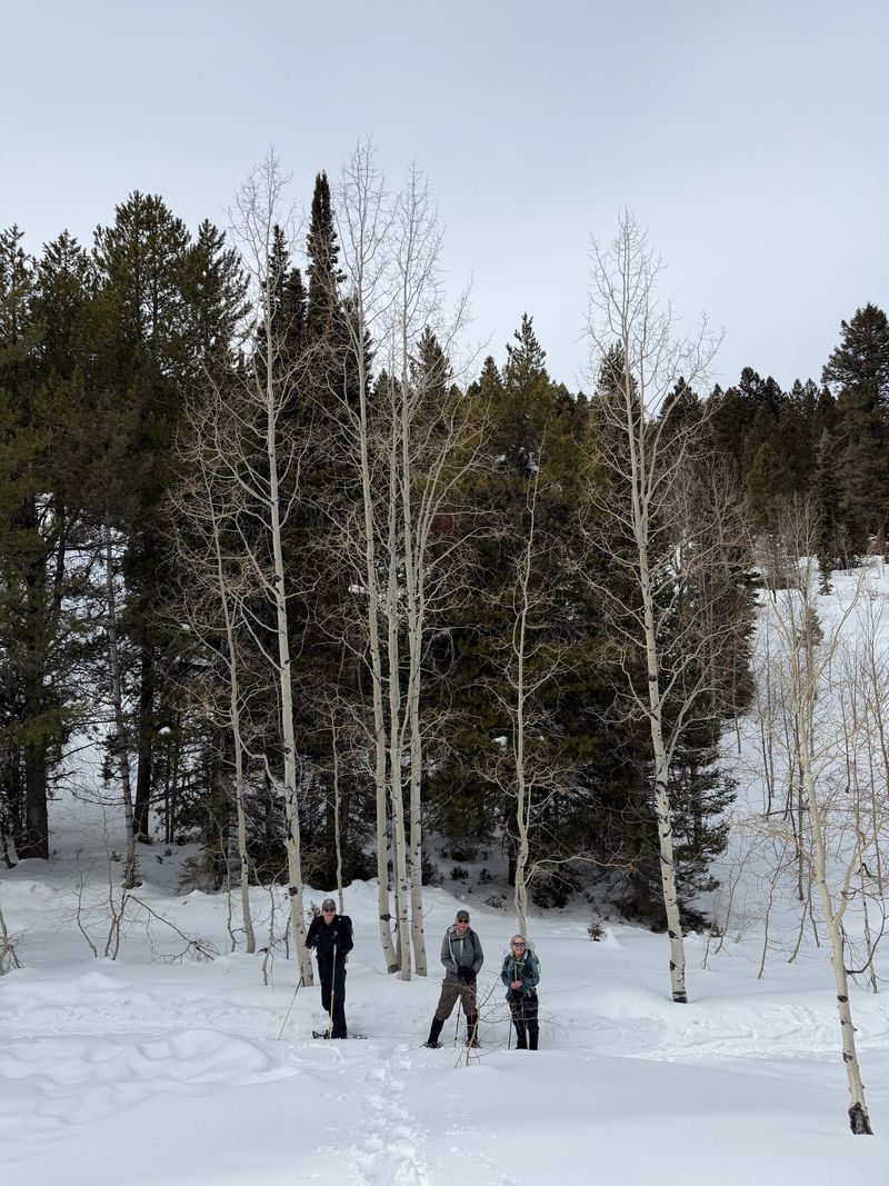
| The
traditional group, on the trail |
|||
Feb2026.jpg) |
 |
||
| Ambler and traditional groups at the bridge on the historic Garden City Road | The old bridge is showing recent
damage, as shown by a comparison with this photo
from May 2022 |
||
 |
 |
||
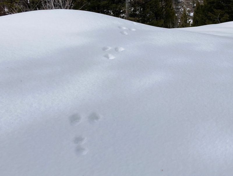
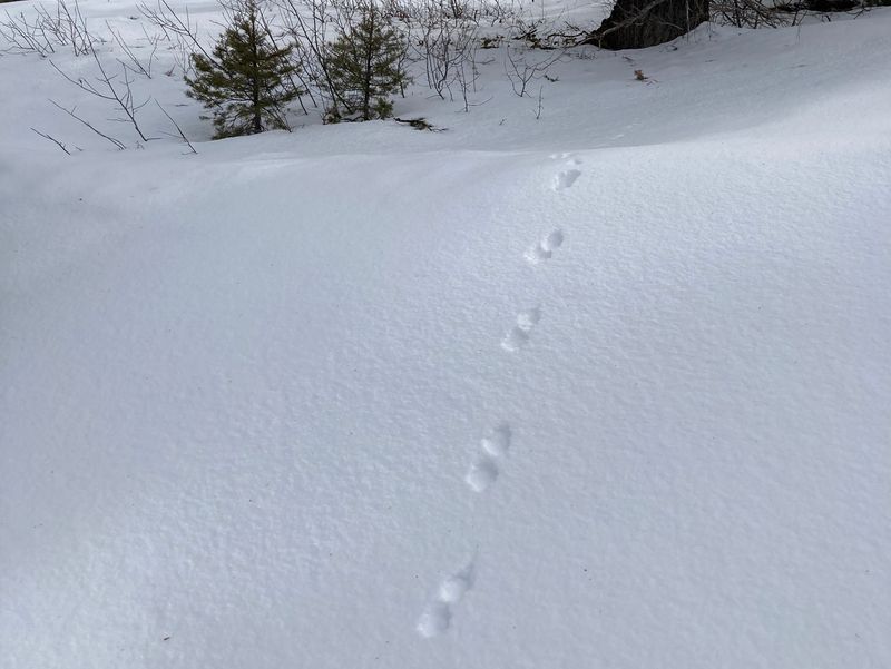
| Snowshoe hare tracks |
Unknown tracks |
||
 |
|||
| This small igloo was built near the Sink Hollow Winter Trailhead on January 20, 2026 | |||
 |
|||
|
Our GPS track shows about 3.5 miles
and 750 feet of ascent for the "ridge" group
(red), 2.4 miles and 200 feet for the amblers
(blue), and 4 miles with 800 feet for the others
(green). You can look at the ridge route using Google
Earth or download our GPS
file.
|
|||