Home
Swan Peak, 19 July, 2020
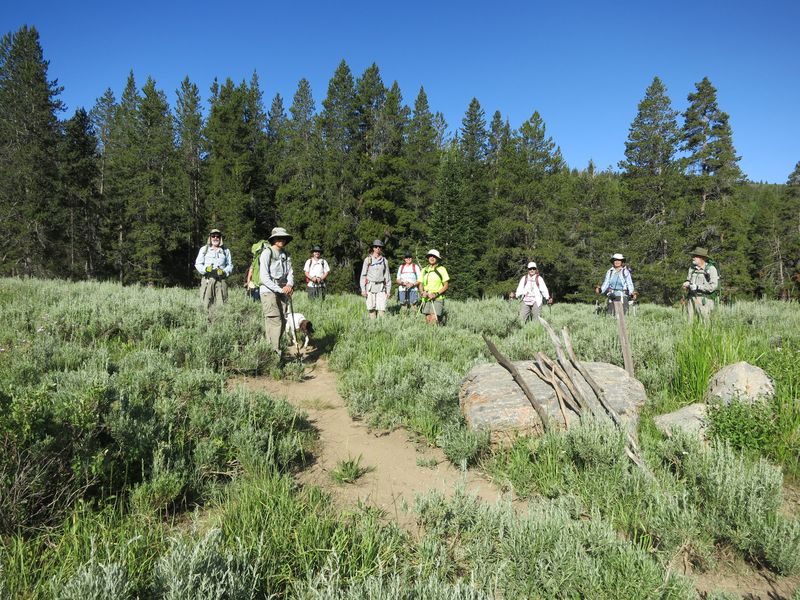
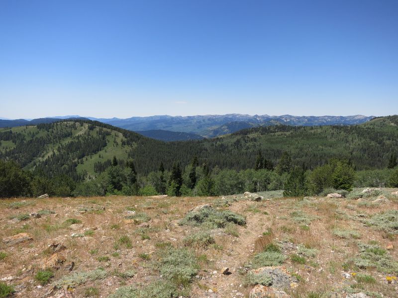
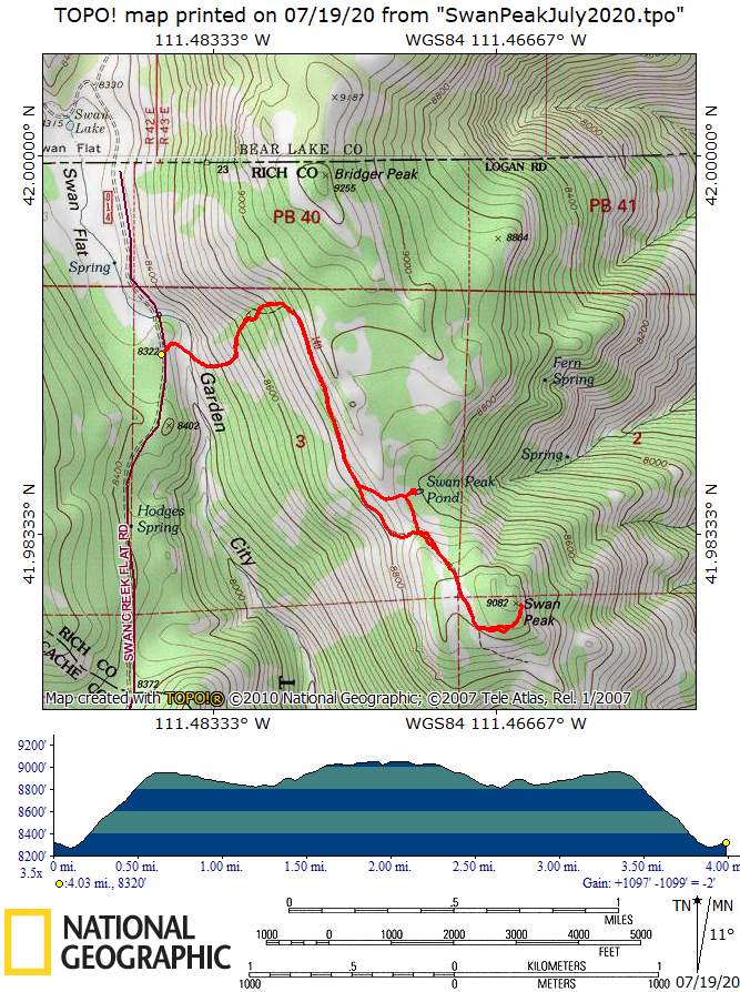
Eleven hikers drove up Logan Canyon to Swan Flat Road, and then another 3 miles to the Swan Peak trailhead. The hike is rated as moderate; however, you gain 650 feet (straight up) in the first half-mile. The remaining 1.5 miles to Swan Peak is undulating. Hiking conditions were wonderful: clear skies, pleasant temperatures, and a slight breeze. Looking to the west along the trail, we could see several peaks in the Bear River Range, including Logan Peak, Beirdneau, Elmer, and Naomi.
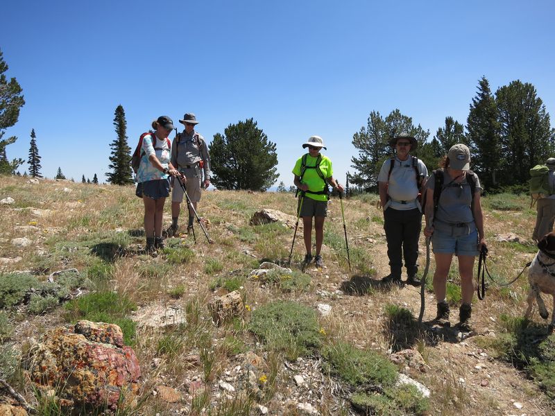
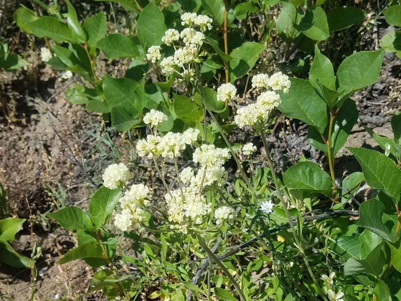
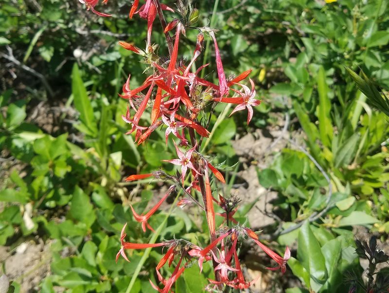
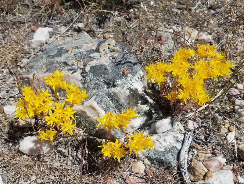
We walked through mixed conifer/aspen, sagebrush, and mountain mahogany vegetation. Wildflowers were abundant, including sego lily, stonecrop, geranium, yarrow, Indian paintbrush, whorled buckwheat, tapertip hawksbeard, tall larkspur, groundsel, and forget-me-not. We came across several slabs of fucoidal quartzite with well-defined burrows created by ancient marine worms.
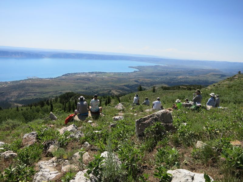
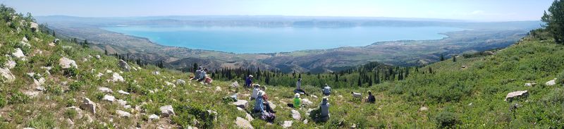
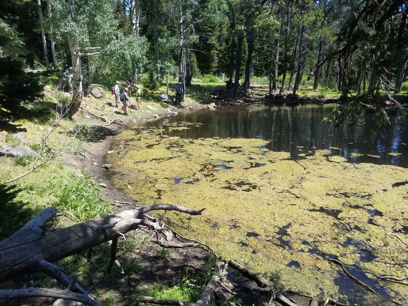
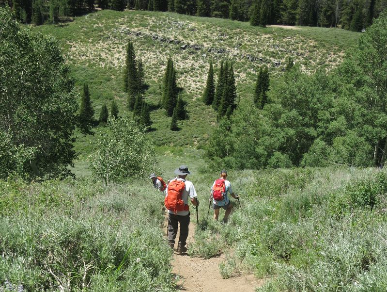
We ate lunch near the top of the peak, while enjoying an amazing panoramic view of Bear Lake. On the return trip, we took a branch trail to a small pond surrounded by conifers and aspen. We then headed back down the main trail and negotiated the 650-foot slope at the end.
Editor's note: At a grade of nearly 30%, the lower Swan Peak Trail is one of the steepest trail sections in our area.
Trip Summary:
- Participants: Dave W., Jane, Linda (and dog Riley), Brent, Kris, Laurel, Michelle, David W., April, Deanna (and dog Jasper), and Chris (leader).
- Drove 28 miles from Logan to the Swan Flat Road turnoff, then 3 miles to the trailhead.
- Started hiking about 9:15; had lunch on peak 11:00-11:30; back to trailhead by 1:00; and back to Logan by 2:00.
- Clear skies, nice temperatures, and a slight breeze.
- About 4 miles round trip with 900 feet of ascent.
Thanks for Chris for the narrative and photos and Dave W. for photos and GPS data.
 |
|
| Near the Swan
Peak trailhead |
|
 |
|
| Swan Peak
lunch |
|
 |
|
| Swan Peak
panorama, a +30-mile wide view of Bear Lake Valley |
|
 |
|
| The Bear River
Range from Swan Peak |
|
 |
 |
| Identifying plants |
Swan Peak Pond |
 |
 |
| Descending the steep lower Swan
Peak Trail |
Whorled buckwheat |
 |
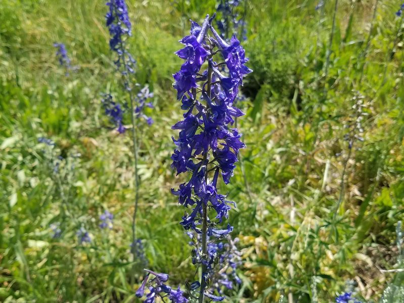 |
| Scarlet gilia | Tall larkspur |
 |
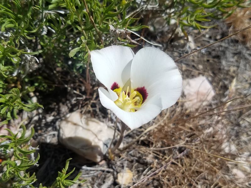 |
| Stonecrop | Sego Lily |
 |
|
|
Our GPS track shows 4 miles
and about 1000 feet of ascent and
descent.
You can look at our route using Google Earth or download our GPS file. |
|