
Home
Tony Grove Hike, 23 August, 2020
The originally scheduled hike was somewhat changed due to very dense wildfire smoke producing a high PM 2.5 fine particulate count which has the potential of damaging the lungs through high exertion activities. Original leader Dave P. decided against hiking because of this poor air quality.
After much discussion at the Smith’s parking lot, Brent, Jane, Susan (leader), Laurel, Teresa, Kris and Tawnya (at the backcountry trailhead) decided to pursue a shorter and less strenuous route around the Tony Grove Lake area.
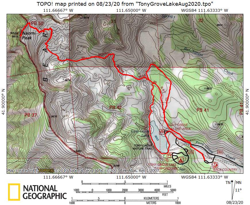
Drove 29 miles to the Tony Grove backcountry parking area and met Tawnya who was camping at the backcountry area and started hiking around 9:15 a.m.
From the Backcountry Trailhead, the hikers proceeded about 0.8 miles on the Mt. Naomi Peak National Recreation Trail (NT), past the Tony Grove Lake parking area to the trail junction.where they took the right fork, the White Pine Lake Trail. After another 0.6 miles and another junction, the group took the left fork, the White Pine Cutoff Trail, toward the Mt. Naomi trail.
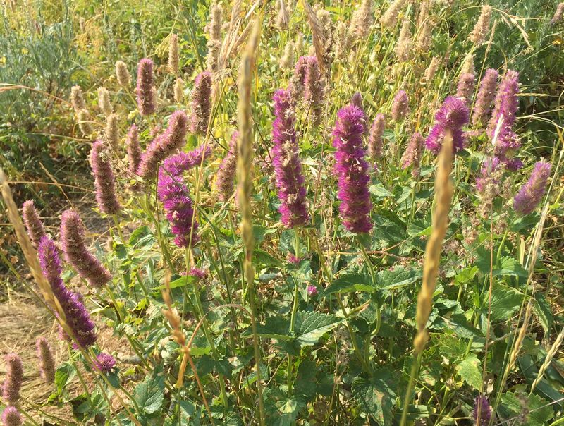
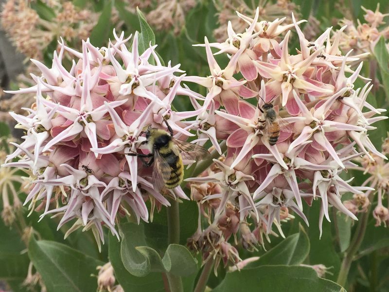
At the junction of the Mt. Naomi trail, 1.7 miles from the beginning, Tawnya, Teresa, and Kris decided to continue up to Mt. Naomi. The rest of the group (Susan, Jane, Brent, and Laurel) turned back toward Tony Grove Lake. At the bottom of the “stair steps” geologic feature, we turned right on a small path that led us down to the nature trail that surrounds Tony Grove Lake. We passed below the “steps”. Pockets of wildflowers were still blooming and we observed many pollinators foraging for late season nectar.
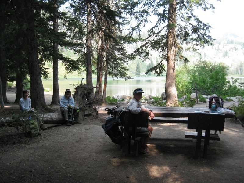
Jane attempted to find “grass of Parnassus” that she and Dave had recently seen along a small stream with no luck. The group then merged onto the Nature Trail and continued around the west side to the picnic tables on the south end of the lake where we had a leisurely early lunch (around 11:15 p.m.).
The hikers proceeded back to the cars walking partly on the road and partly on the trail arriving at the backcountry trailhead parking at about 12:15 p.m.
Many people and dogs were recreating at the lake.
Trip Summary:
- Participants:
Jane, Susan, Brent, Laurel (Tony Grove Lake hikers)
and Tawnya, Teresa, and Kris (Naomi Peak)
- Drove 29
miles to the Tony Grove Backcountry Trailhead
- Started
hiking about 9:15. The Tony Grove Lake hikers returned
to the trailhead about 12:15 and about 3:15 for the
Mount Naomi hikers
- Warm, hazy atmospheric conditions, some clouds with increasing cloud cover later in the hike.
- About 3.7
miles and 500 feet of ascent/descent for the Tony
Grove Lake hikers and 7.9 miles with 2200 feet of
ascent/descent for the Naomi Peak hikers.
Thanks to Susan for the narrative and photos and Jane for photos (no GPS data so the routes were estimated from satellite views and from previous trip data).
 |
|
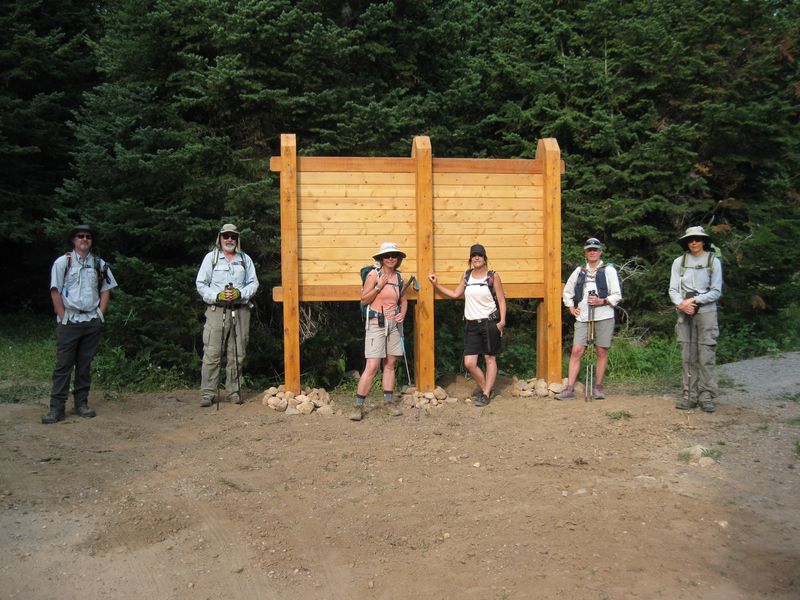
| A new
signboard at the trailhead |
|
 |
|
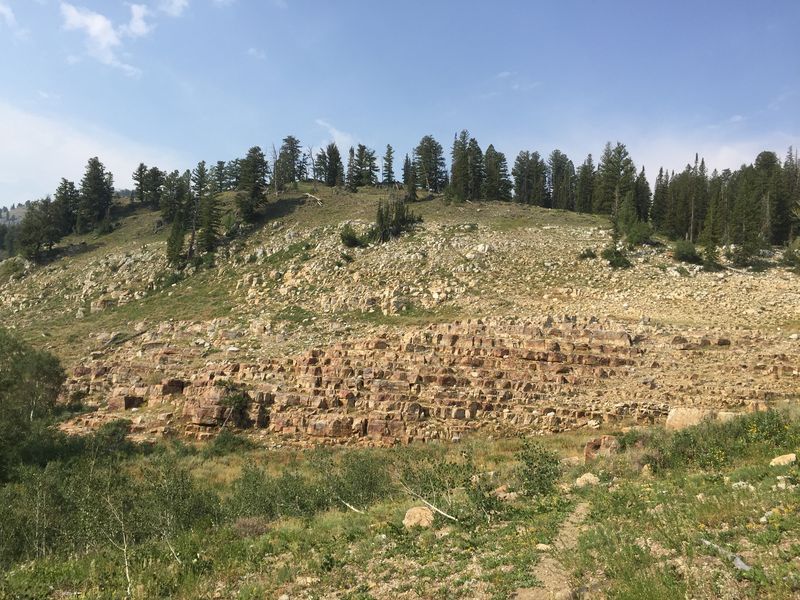
| The quartzite
"stairs" of Wikipedia
fame |
|
 |
 |
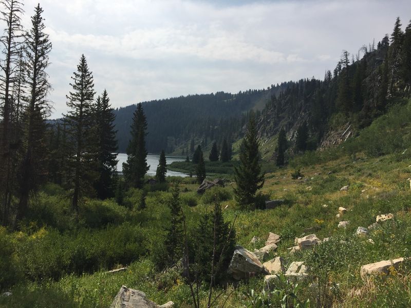
| Looking south toward Tony Grove
Lake |
A picnic table lunch at the
south end of Tony Grove Lake |
 |
 |
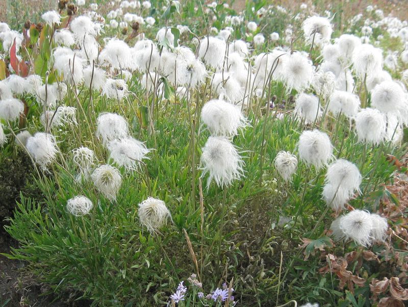
| Hairy clematis, with
fuzzy seed heads |
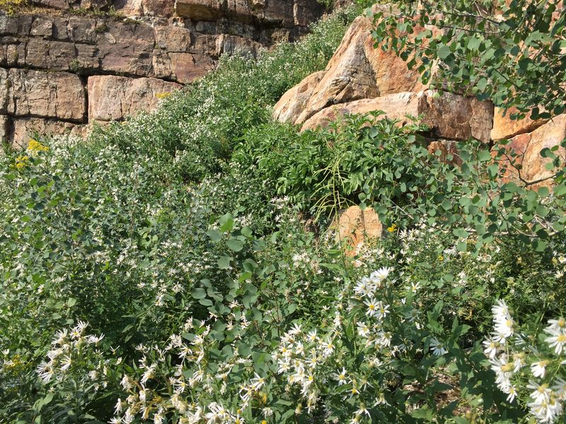
Asters and quartzite |
 |
 |
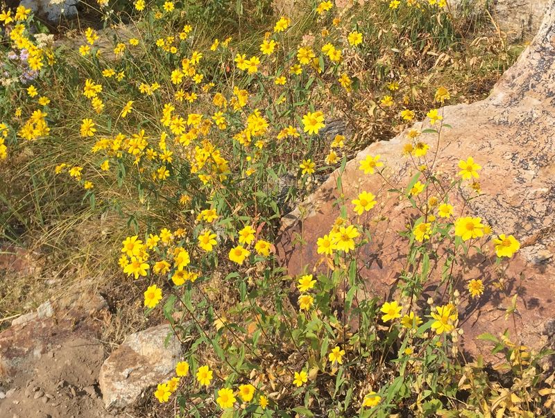
| Showy goldeneye |
Baneberry |
 |
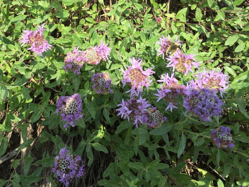 |
| Horsemint |
Little beebalm ("coyote mint") |
 |
|
| Showy milkweed flowers with bees |
|
 |
|
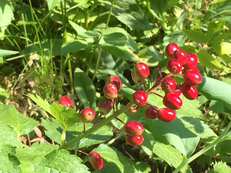
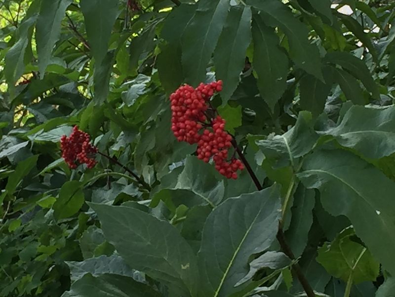
| Red elderberry | |
 |
|