
Tony Grove - Blind Hollow loop, 18 August 2019
Originally planned as a strenuous 12.5 mile hike, we decided to do a shorter and easier trip instead, a route that would also allow us to investigate some recent changes to area trails. Starting at the Tony Grove Backcountry Trailhead, we hiked south on the Mt. Naomi National Recreation Trail (NRT), sampled ripe huckleberries as we ascended the north-facing slope, then continued past Coldwater Spring to the Wilderness boundary at the edge of Cottonwood Canyon.
The "official" Mt. Naomi NRT heads south along the Wilderness boundary at the edge of Cottonwood Canyon, but we took a relatively new path, apparently created by horse users. This new "horse path" runs to the south and parallel to the official trail. It is a shadier and a somewhat easier (but less scenic) alternative, although hikers could easily go the wrong way where it rejoins the Mt. Naomi NRT. We turned east at that point, back to the Cottonwood Canyon - Blind Hollow ridge and the Blind Hollow Trail. A couple of cairns marked this important junction, but here was no trace of the sign that had been here in the past. After enjoying a scenic lunch on the ridge we followed another "new" route, a heavily-used social trail that goes southward on the ridge before heading down to the east, past the Blind Hollow yurt before rejoining the Blind Hollow Trail about 1/4 mile west of the Hansen Pond Trail (you can see our route on the map, below).
The sign was missing at the Hansen Pond Trail but we knew
where to go. After passing the marshy remnant of Hansen
Pond we continued north on the Blind Hollow Trail. A
couple of years ago the Forest Service widened this route
to accommodate construction vehicles for a water project.
Boulders and tree trunks placed along the route now
prevent motor vehicles from using it.We rejoined the Mt.
Naomi NRT and followed it back to the trailhead for the
final 1 1/4 miles of our trip.
This was a pleasant hike, not too long or strenuous, with good weather, great views, wildflowers and good company. However, ambiguous trails and inadequate signage emphasized the need for routefinding equipment and skills.
Trip Summary:
- Participants: Dave P., Denis, Teresa, Maggie, Jane and Dave W. (leader)
- Drove 29 miles to the Backcountry Trailhead at Tony Grove
- Started hiking about 9:05, rested near the Wilderness boundary at 10:30, lunch 12:00 to 12:30, back at the Tony Grove at 3:20 and Logan at 4:20
- Clear skies, an occasional mild breeze, moderate temperature in the morning but hot in the afternoon
- Hiked about 7 1/2 miles with about 1700 feet of ascent
and descent
Thanks to Jane for photos and Dave W. for the narrative, photos and the GPS data .
|
|
|
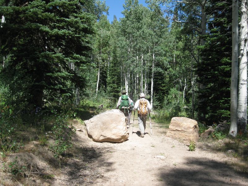
| Cache Hikers on the Mt. Naomi National Recreation Trail (NRT), between Tony Grove and Coldwater Spring | |
 |
|
| We followed the new "horse trail" into Cottonwood Canyon, to the right of this sign | |
 |
 |
| :Looking west across Cottonwood Canyon toward Mt. Elmer | Cairns at the Mt. Naomi NRT - Blind Hollow Trail junction |
 |
|
| Lunch on the ridge between Cottonwood Canyon and Blind Hollow | |
 |
 |
| Missing sign at the Hansen Pond - Blind Hollow trail junction | Boulders on the Bear Hollow Trail |
|
|
 |
| Huckleberries (Vaccinium membranaceum), probably the best crop we have seen here | |
 |
 |
| They were a tasty treat! | Longhorned beetle |
 |
 |
| Firechalice (Zauschneria garrettii/Epilobium canum) | Spotted coral root (Corallorhiza maculata)) |
 |
 |
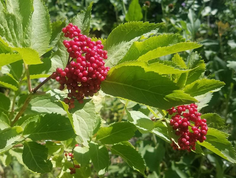
| Red elderberry (Sambucus racemosa) | Orange mountain dandelion (Agoseris aurantiaca?) |
 |
|
| Our GPS track shows about 7.5 miles and 1700 feet of ascent and descent | |
|
You can look at our route using Google Earth or download our GPS file. |
|

