Home
Tony Grove Historic Road, 2 November, 2025
Since 2019, the Cache Hikers have scheduled winter trips on the route of the lower portion of the historic Tony Grove road. The old road, believed to have been constructed in the 1930s, follows Tony Grove Creek from US-89 to Tony Grove Lake (it has been replaced by a modern paved road, Forest Road 003, that follows a longer route). This unscheduled Cache Hiker trip satisfied a long-standing interest in exploring the entire length of the old road, from US-89 to Tony Grove Lake, although we hiked it in the downhill direction, traveling east from the lake.
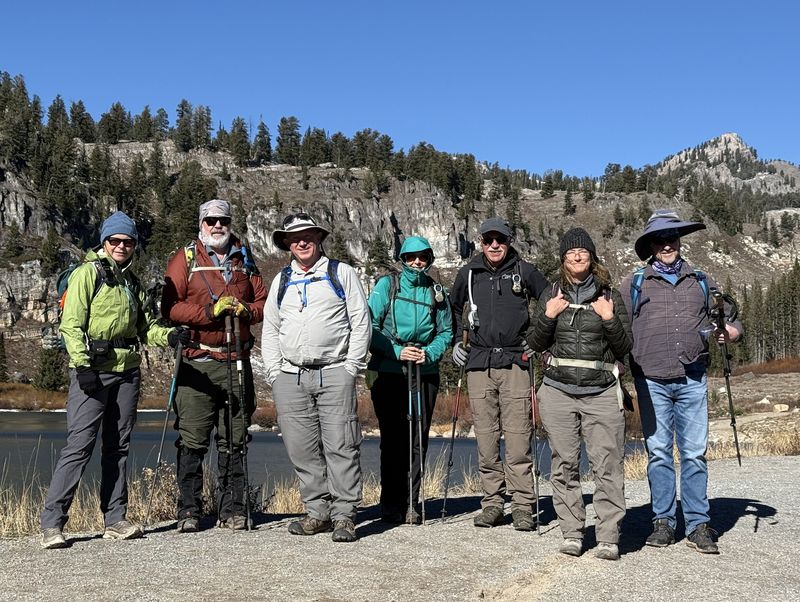
Eight Cache Hikers, Teresa, Brent L, Brent J, Sue, Bruce, Ralph, Deanna and Kamren started out at Tony Grove Lake. Jane and Dave W hiked the lower section, starting where the old road crosses the new road.
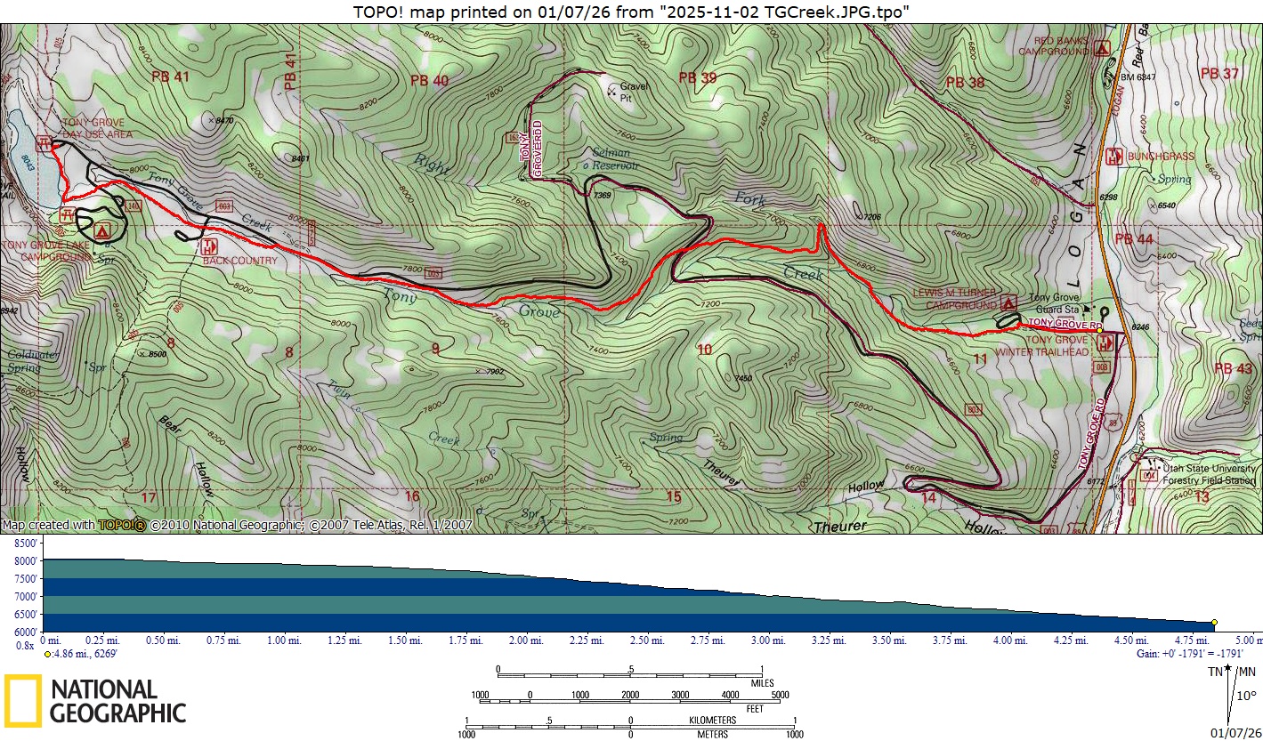
Hiking south along the Tony Grove Lake dam, the group turned east, down a footpath, to the Tony Grove Campground overflow parking area. From here, the footpath continued down the old roadbed and past the Backcountry Trailhead after 0.6 mile. The old roadbed merges with the new road where the canyon narrows and the creek approached the road, about 0.9 miles from the lake. Some hikers walked along the road here, while others followed a livestock trail south of the creek. The old roadbed reappeared after 1/4 mile and followed along the north side of the creek, eventually descending 200 feet below the big curve, 2.2 miles from the lake, where the new road turns north and leaves the Tony Grove Creek drainage .
Aspen trees encroached onto the old roadbed for the next 0.6 miles as it curved to the northeast and descended to cross the new road. This location is 2.6 miles from Tony Grove Lake via the old road, or 3.5 miles from the beginning of the new road (FR003) near US-89. This also is the location where Cache Hikers meet the new road on their winter ski/snowshoe trips, and the location where Jane and Dave W began their hike.
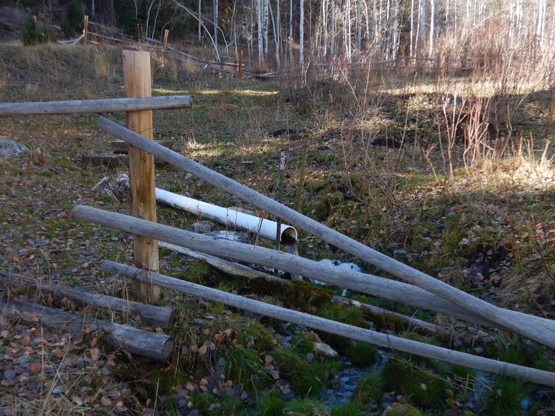
After crossing the new road, the old roadbed continues to the east about 1/2 mile, then turns abruptly to the north for 0.1 miles, crosses Tony Grove Creek North Fork and switches back to the south (the old washed-out culvert at the creek crossing is a remnant of the old road). The old road then crosses Tony Grove Creek 0.3 miles from the switchback and continues 0.6 miles to the Lewis M Turner Campground. Water infrastructure elements are seen along this section, including a dam once used to provide water for an electric generator at the Tony Grove Guard Station, a "spring" (it may be a resurfacing of water from Tony Grove Creek) that once provided water for the campground, and several accesses to an underground pipeline.
From Lewis Turner Campground, the old roadbed continues on the south side of a rail fence for another 0.1 mile, but our hikers simply walked down the paved road to the Tony Grove Winter Trailhead, passing the Forest Service pasture (with a couple of remote weather stations), a historic ponderosa pine nursery, and the road to the Tony Grove Guard Station along the way.
This was an enjoyable trip, maybe one the Cache Hikers will schedule in the future, possibly as a late-season hike to take advantage of fall colors.
Note: Cache Valley residents may be surprised to learn that the "Tony Grove" name originally described the area around the USU Forestry Field Camp (previously known as the Tony Grove Summer Camp) and the Tony Grove Guard Station. As noted in the USU student newspaper of June 24, 1924, Tony Grove, "one of the most beautiful and interesting spots in the state", was a "short walk" from the "United States Forestry ranger's cabin", while Tony Grove Lake was a "rather long and toilsome hike". The 1914 USGS topographic map shows only a trail to Tony Grove Lake, so campers likely did not visit Tony Grove Lake regularly until the road was built in the 1930s. The Beehive Archive also reports the Tony Grove name "originally applied to the campsite along the Logan River that was popular with the wealthy campers".
Trip Summary:
- Ten Cache
Hikers: Teresa, Brent L, Brent J, Sue, Bruce,
Ralph, Deanna, Kamren, Jane, and Dave W, the
leaderorganizer.
- Drove 19.6
miles from the Logan Ranger District office to the
Tony Grove road, then 6.8 more miles to Tony Grove
Lake.
- Pleasant temperatures, clear skies, calm winds, and very little traffic on the Tony Grove road.
- Hiked about 5 miles with 1800 feet of descent
Thanks
to Dave W for the narrative, photos, and GPS data,
Jane for photos, and Ralph for photos and GPS data.
 |
|||
| Cache Hikers started from Tony Grove Lake | |||
 |
2025.jpg) |
||
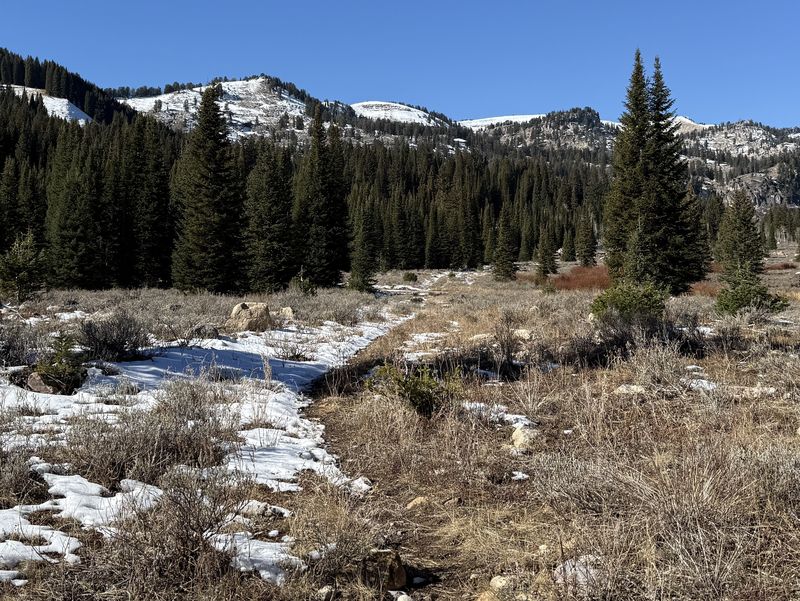
| The old road bed east of Tony Grove Lake is clearly visible and easy to follow | |||
2025.jpg) |
2025.jpg) |
||
| Most of the old road runs south of the new road | Looking uphill to the big curve on the
new road |
||
2025.jpg) |
2025.jpg) |
||
| Aspens grow in the old road after it
turns to the NE |
Enjoying a lunch break on the old road
bed |
||
2025.jpg) |
2025.jpg) |
||
| The old road crosses the new road,
looking uphill to the southwest (left) and
downhill to the east (right) |
|||
2025.jpg) |
|||
| A washed-out culvert at the switchback
where the old road crosses the Right Fork of Tony
Grove Creek |
|||
2025.jpg) |
|||
| A dam provided
water to run the generator at the historic Tony
Grove Guard Station |
|||
 |
|||
| A "spring" once provided water for
Lewis M.Turner Campground |
|||
2025.jpg) 2025.jpg) 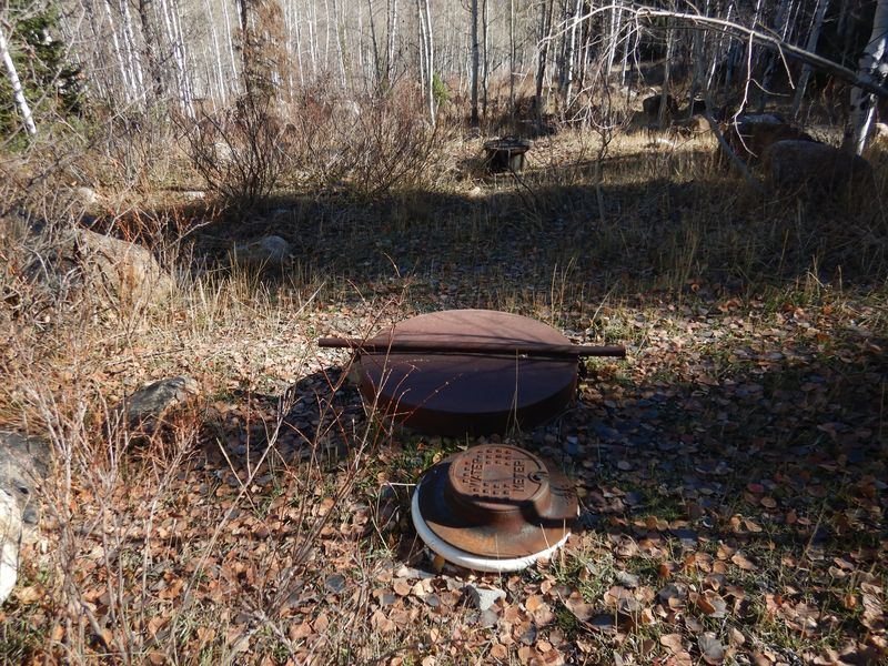 |
|||
| Above-ground
evidence of the underground water system along the
way (apparently no longer in use) |
|||
 |
|||
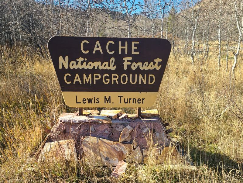
| Lewis M.
Turner Campground, a presumed camping area of the
"tony" people |
|||
 |
|||
|
Our GPS track shows about 5 miles
and 1800 feet of descent.
You can look at our route using Google Earth
or download our GPS file.
|
|||