Home
Wood Camp Waterfall, 5 June, 2022
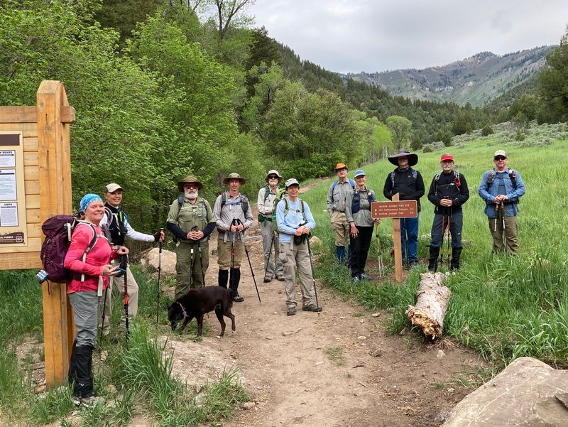
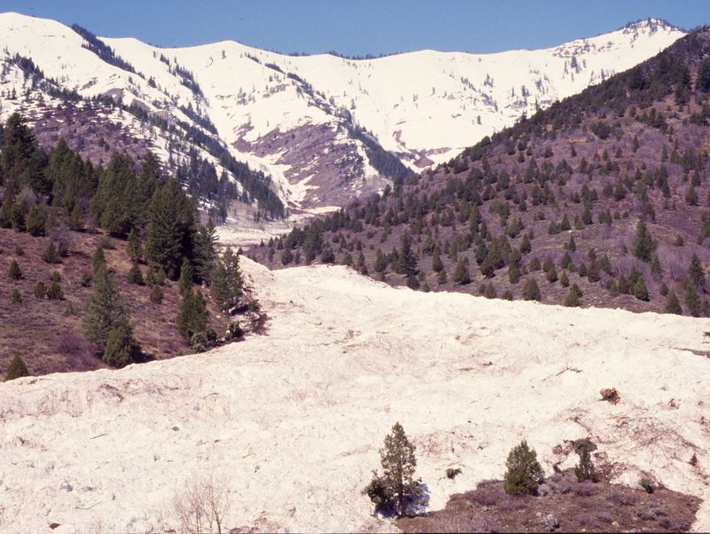
Twelve of us headed up to the waterfall: Kamren, Jane, Dave W, Ralph, Keith, Laurel and dog Zinnia, Susan, Brent, Dick, David, Michelle, and Dave P (leader). The weather was warm and a bit muggy, which made for a sweaty climb. We admired the new trail work from the day before on the Jardine Juniper trail. At the new bridge over Wood Camp drainage one hiker who was here in 1986 told us about the avalanche that came down Wood Camp hollow and buried that area so deeply that it didn’t melt until the next year. The “high ice” line can still be seen as the lower boundary of older trees. We turned off the Juniper trail to follow a brushy route up Wood Camp Hollow.
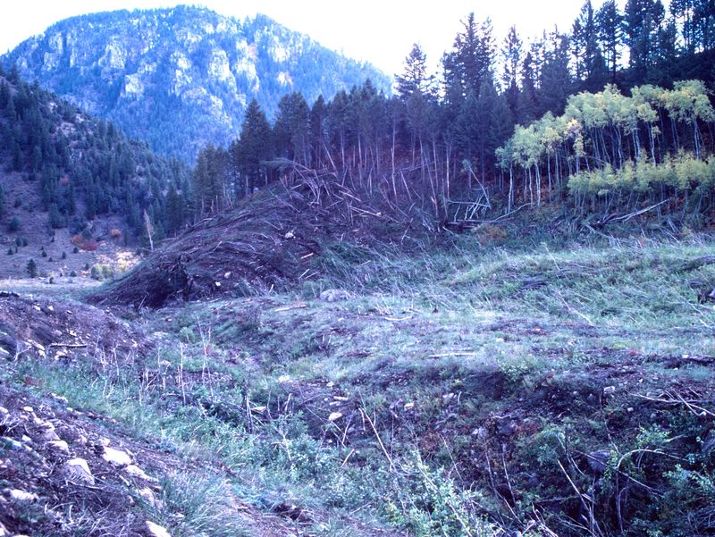
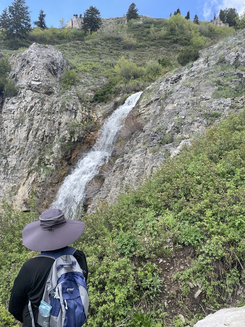
We enjoyed the lush wildflowers and fresh green aspen in the hollow which is kept open by avalanches, as shown by numerous uprooted trees and debris. We turned off the route and into the rocky gully. We admired large black sandstone slabs that probably were carried down from the Leatham Formation above the waterfall. This formation marks the late Devonian extinction, when the oceans became anoxic, killing 75 % of all species, and depositing black sulfide minerals. There was no obvious best way up the gully; some people opted for loose rocks, others for low brush. The brush was our nemesis—it took the glasses from one hiker and by the time he noticed he couldn’t find them. We made it to the waterfall and found rocks on the slope to sit on for lunch, resulting in a dispersed group. The outflow was high enough to prevent one hiker from crossing the stream to join the others.
On the way back a shower came down so quickly that most of us were nearly soaked before we could put on raincoats. And then the wet brush soaked our pants. Fortunately there was no wind and the sun came out a short time later.
Trip Summary:
- Twelve hikers: Kamren, Jane, Dave W, Ralph, Keith, Laurel and dog Zinnia, Susan, Brent, Dick, David, Michelle, and Dave P (leader)
- Drove 13
miles to the Wood Camp trailhead
- Started
hiking about 8:30, lunch at the waterfall, 11:15 -
11:40, back at the trailhead 1:20
- Cloudy,
humid and warm in the morning, a period of heavy rain
in the afternoon
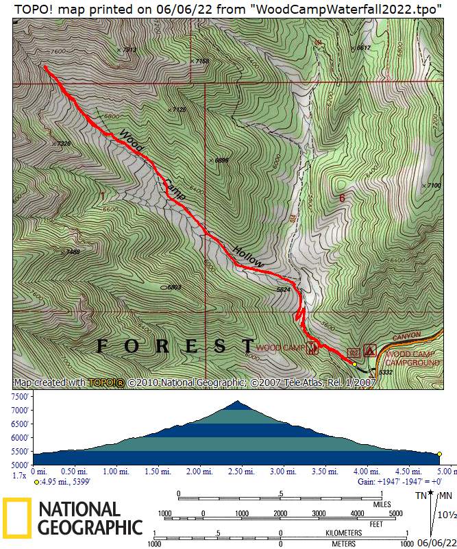
- Hiked abut 5
miles with approximately 1900 feet of ascent
Thanks to Dave P. for the narrative and photos, Ralph, Dick, Susan, and Jane for photos and Dave W. for photos and GPS data.
 |
||
| At the
trailhead, with new signage and a reworked trail |
||
 |
 |
|
| Wood Camp Hollow was filled with snow from the 1986 avalanche | Piles of debris remained after
the snow melted |
|
 |
||
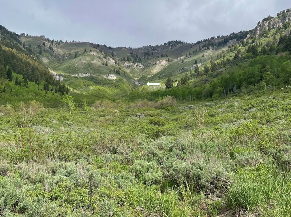
| The distant waterfall was visible from lower Wood Camp Hollow | ||
 |
 |
|
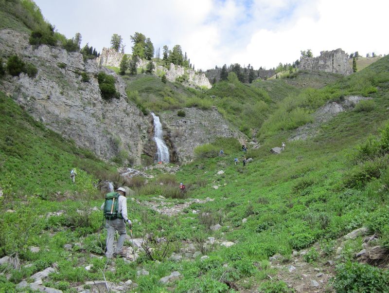
| Approaching the waterfall |
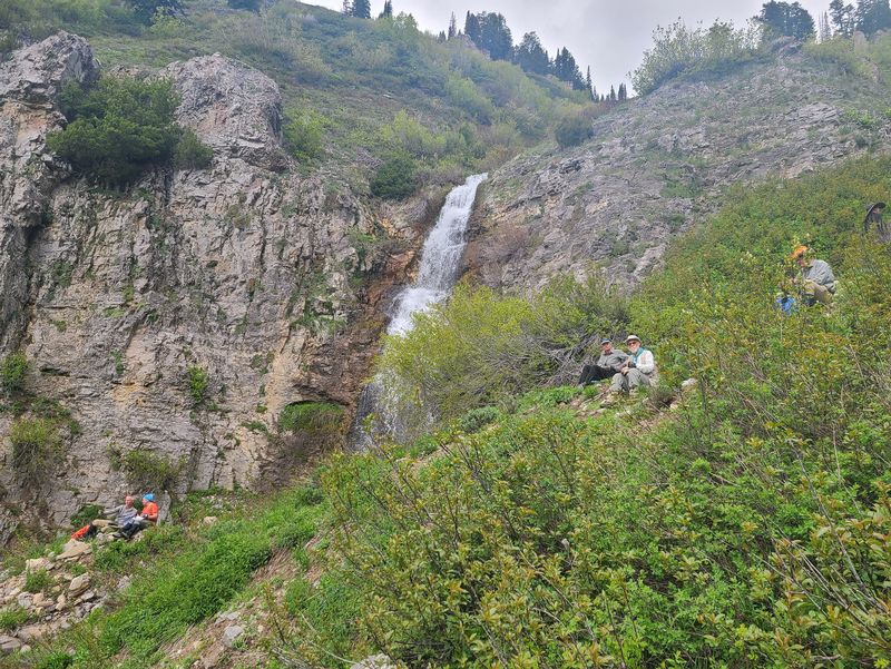
Our lunch spot |
|
 |
||
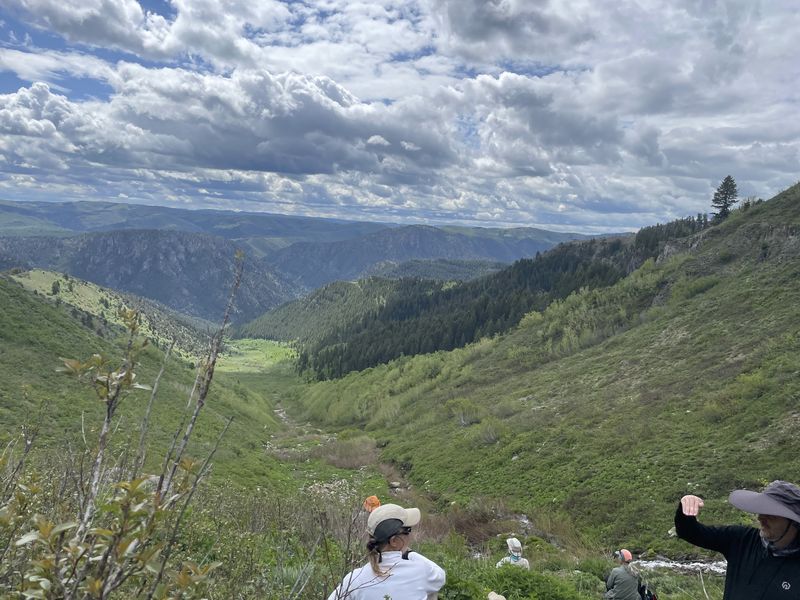
| Looking down
Wood Camp Hollow from our
lunch spot |
||
 |
||
| A last look
at the waterfall before heading back |
||
 |
 |
|
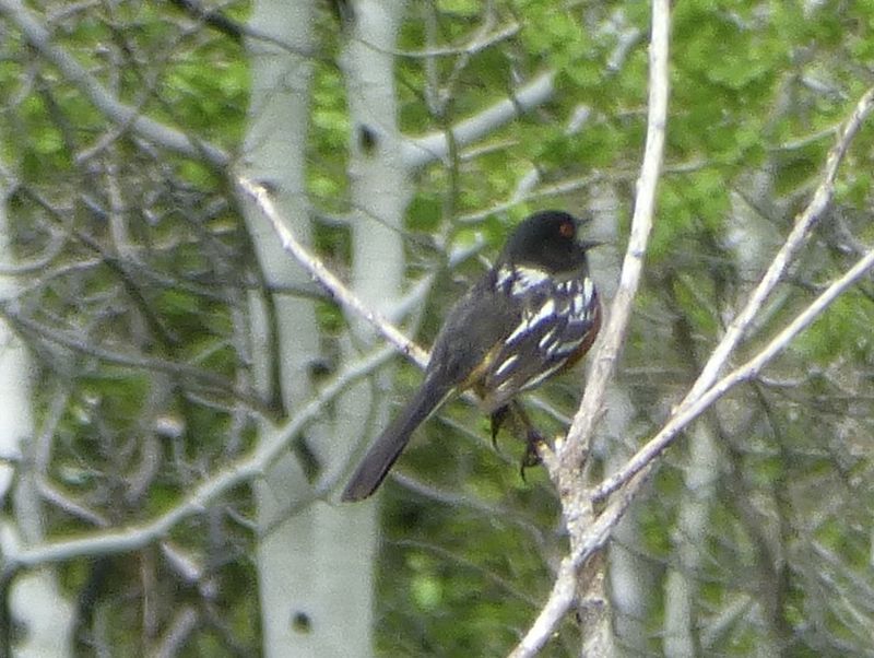
| Spotted Towhee |
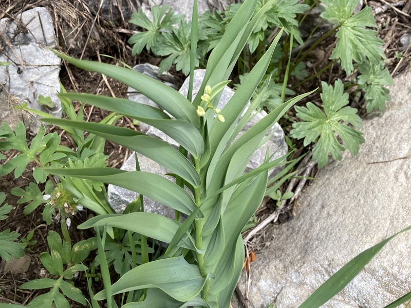
False Solomon's Seal, Smilacina
racemosa |
|
 |
 |
|
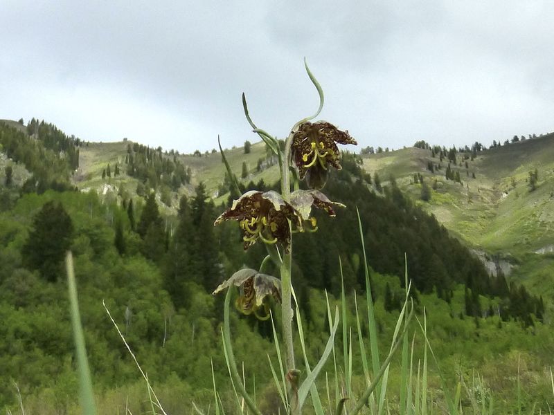
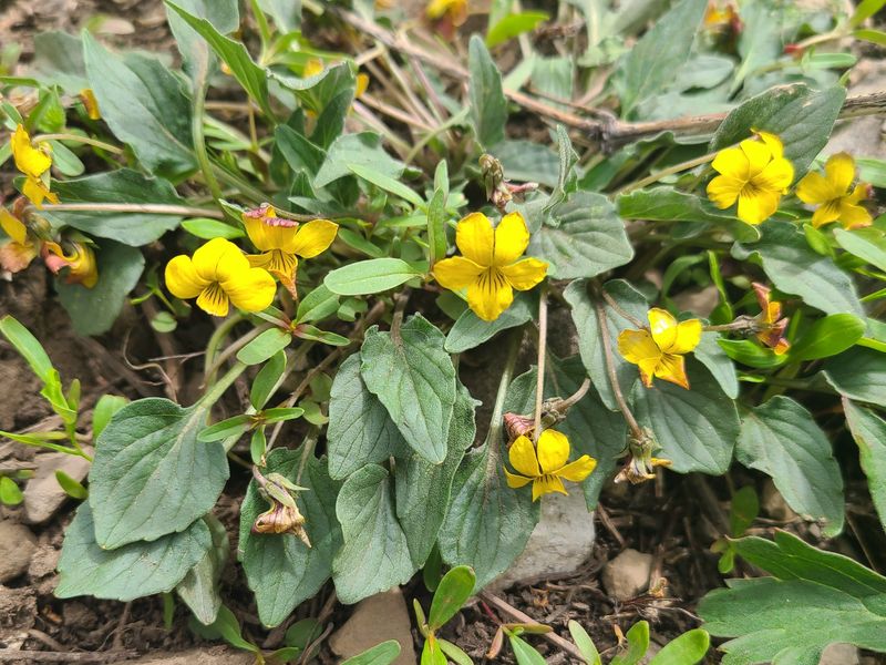
| Spotted Fritillary, Leopard Lily, Fritillaria atropurpurea | Goose-foot violet, Viola
purpurea |
|
 |
||
|
Our GPS track shows about 5 miles
with 1900
feet of ascent.
You can look at our route using Google Earth or download our GPS file. |
||