Home
Pig Hole Loop Hike, 6 November 2020
The weather forecast for Saturday called for a stormy end to our mild fall weather so several hikers decided to explore a loop hike on the "Pig Trails" on Friday. We do not know why these areas were named Hog Hole, Pig Hole, Boar Hole and Sow Hole it surely must be an interesting story. We have not actually hiked there, but the areas feature Forest Service "system" trails, springs, livestock grazing, and motor vehicle access to upper portions.
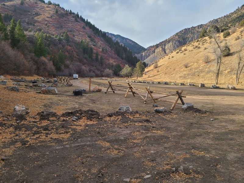
Six hikers drove 22 miles to the mouth of Sow Hole in the Left Hand Fork of Blacksmith Fork Canyon (the last 5 miles were on a rough gravel road). This was the first time we had been on this road since when Forest Service closed the Left Hand Fork in September for "improvements", and we were surprised to see the extent of the work that had been done. The area had been overrun with dispersed camping in the past but obviously the Forest Service is trying to change that. Now, individual campsites are numbered and large areas have been blocked with boulders, fences or berms to stop vehicles. Our Sow Hollow access was affected, too. The parking area had been greatly reduced in size and we had barely enough space to park our four vehicles (COVID precautions required a separate car for each household group).
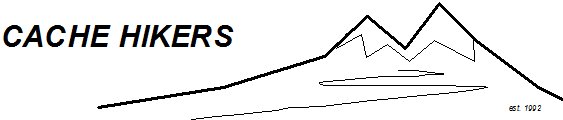
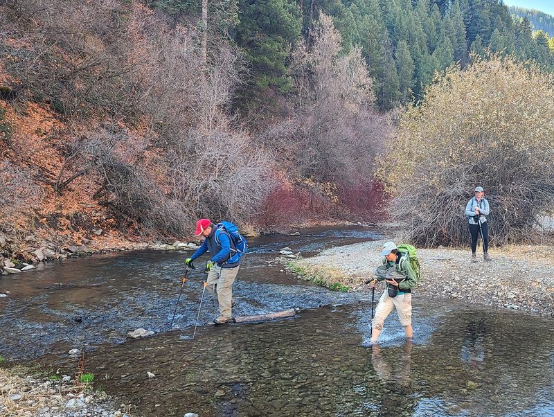
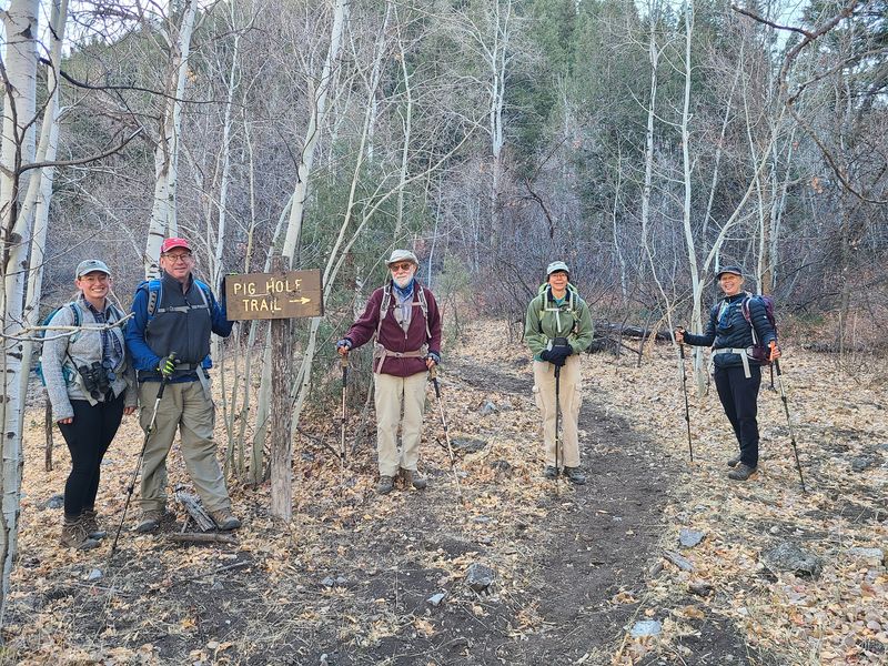
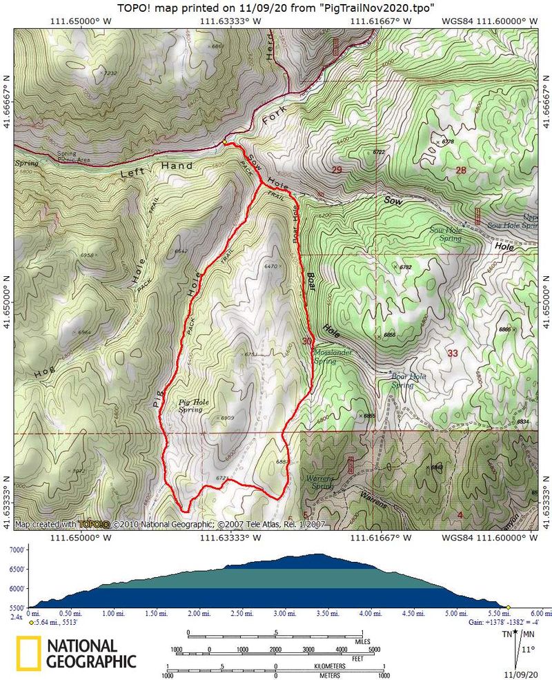
Our hike started with a watery crossing of the Left Hand Fork. One hiker donned wading shoes and strode across while the others carefully stepped from stone-to-stone while using hiking poles for balance. Soon after starting up the Sow Hole Trail (021) we encountered a livestock gate. After 1/3 mile we turned right onto the Pig Hole Trail (022) and followed it another 1.5 miles to Pig Hole Spring, where water was piped to a series of troughs. From here the Pig Hole Trail turned west toward Hog Hole, but instead we continued south up Pig Hole on a closed section of the Pig Hole Spring Road (FR254). After 1.3 miles on the road we turned north toward Boar Hole. The Boar Hole Trail (602) started near this point, but we chose an easier path via the designated "Walk-In Access" area before joining the Boar Hole Trail in another 1/4 mile.
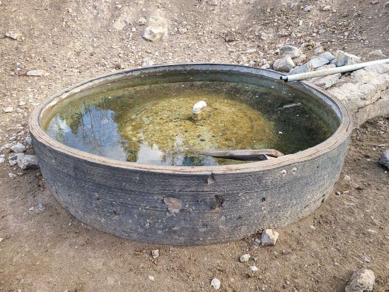
The wind had picked up since we left Pig Hole Spring so we were glad to take shelter among trees in upper Boar Hole for lunch. After eating we followed the trail as it descended to Mosslander Spring, 4.2 miles from the beginning of our hike. Here we found a couple of large water troughs (built from salvaged "haul truck" tires) with a game camera strategically placed nearby. The rest of the way down Boar Hole was not good hiking. Beyond the spring the trail was clogged with debris from juniper control work and after that we had to push through trail-encroaching brush. After a mile of unpleasant hiking we rejoined the Sow Hole Trail and a half-mile later we arrived at the Left Hand Fork and our vehicles.
This was an interesting hike. We do not want hike the miserable Boar Hole Trail section again, but the Pig Hole and Sow Hole trails were fine. A future loop hike could connect Pig Hole and Hog Hole, but it would require a half-mile walk along the Left Hand Fork road. It would be best to avoid these trails during cattle grazing season (the last week in June to the last week in September).
Trip Summary:
- Participants:
Dave P, Jane, Laurel, Dick, Sarah and Dave W (leader)
- Drove 22
miles to the Sow Hole trailhead in the Left Hand Fork
of Blacksmith Fork Canyon
- Started
hiking about 10:00, lunch from 12:30 to 1:00 and back
a the trailhead by 2:30
- Partly
cloudy skies changing to overcast, windy with
comfortable temperatures
- 5.7 miles
with 1350 feet up-and-down
Thanks to Dave W. for the narrative, photos and GPS data and Dave P. for photos.
 |
|
| Crossing the
Left Hand Fork |
|
 |
|
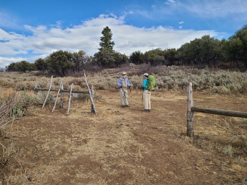
| At the Sow
Hole Trail - Pig Hole Trail junction |
|
 |
|
| Pig Hole Spring | |
 |
 |
 |
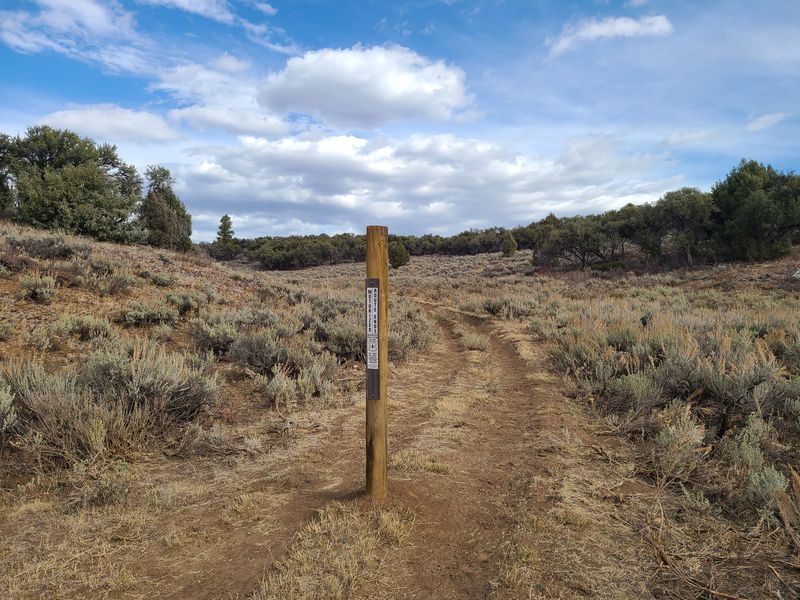 |
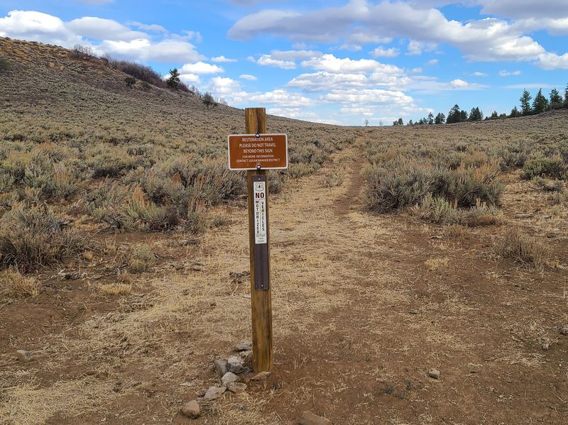
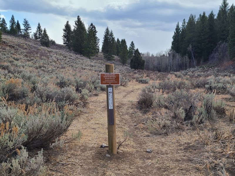
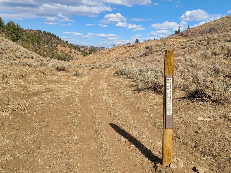
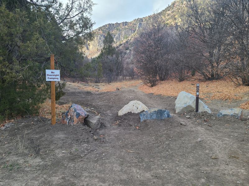
| "Motorized Route Ends", "Restoration
Area" and "No Motorized Vehicles" signs
emphasize the Forest Service's intent to control
unauthorized vehicle use in the area |
|
 |
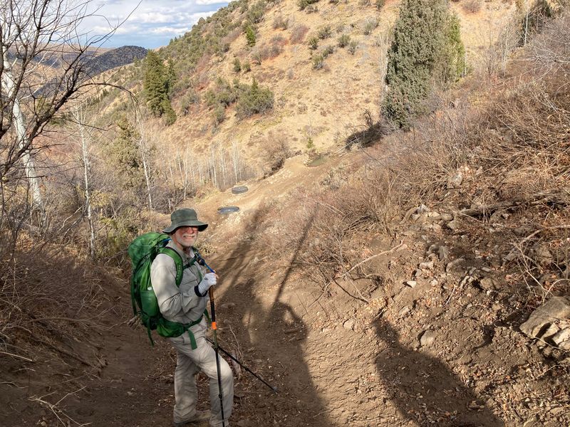 |
| "Walk-In
Access" at the top of Boar Hole |
Approaching Mosslander Spring in Boar Hole |
 |
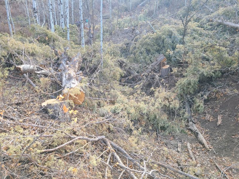 |
| A water trough made from a salvaged haul truck tire | Juniper tree debris clogged the Boar Hole Trail |
 |
 |
| We stopped at Leatham Hollow camping
area (left) and trailhead (right) to see the
recent work by the Forest Service (refer to our
June
Leatham Hollow Hike report for comparison) |
|
 |
|
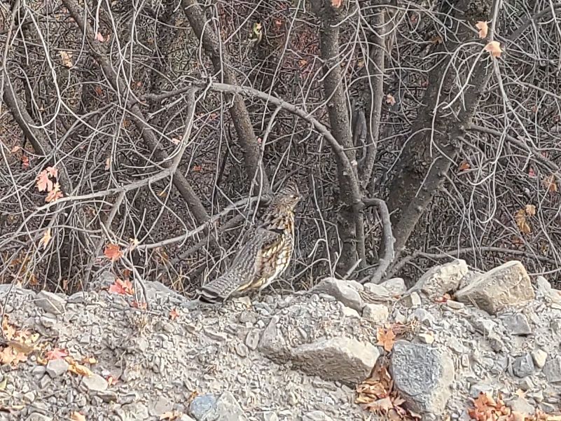
| A dusky grouse posed for a photo as
we drove down the Left Hand Fork |
|
 |
|
|
Our GPS track shows about 5.7 miles
with 1350 feet of ascent and descent.
You can look at our route using Google Earth or download our GPS file. |
|